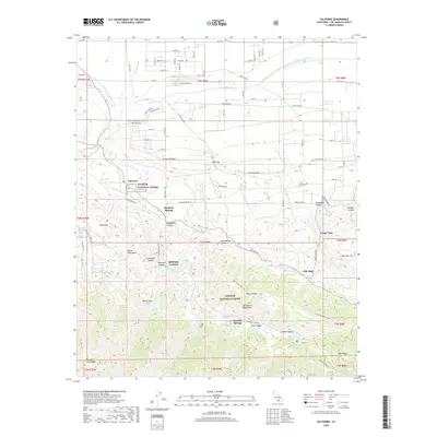
2018 Map of Valyermo
USGS Topo · Published 2018About this map
The San Andreas Fault cuts a visible line through this high-desert landscape on the northern edge of the San Gabriel Mountains. This transition from the Antelope Valley floor to the steep ridges of the Angeles National Forest is defined by drainage patterns like Big Rock Creek and the Governor Edmund G Brown East Branch California Aqueduct, which skirts the northern foothills. Near the small settlement of Valyermo, the terrain breaks into dramatic geological formations including the Devils Punchbowl and the Devils Chair.
Find a feature on this map
75 named features on this map. Tap any name to fly to it.
Don’t see what you’re looking for? This feature index may not catch every label — zoom into the map to look around manually.
Map Details
Editions of this 2018 Valyermo Map
This is the sole edition of this map. No revisions or reprints were ever made.
Other maps of this area

1901 · Southern California Sheet No. 1
USGS Topo · 1:250,000

1903 · Rock Creek
USGS Topo · 1:62,500

1903 · San Antonio
USGS Topo · 1:62,500

1904 · Southern California Sheet No. 1
USGS Topo · 1:250,000

1930 · Black Butte
USGS Topo · 1:24,000

1930 · Llano
USGS Topo · 1:24,000

1933 · Black Butte
USGS Topo · 1:24,000

1934 · Mescal Creek
USGS Topo · 1:24,000
1934 · Llano
USGS Topo · 1:24,000
1934 · Valyermo
USGS Topo · 1:24,000