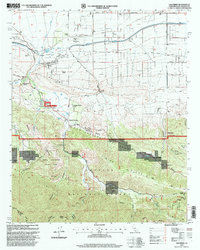
1995 Map of Valyermo
USGS Topo · Published 1999About this map
The San Andreas Fault Zone carves a striking path through this high-desert landscape, creating the geological conditions for the dramatic formations of Devils Punchbowl County Park. Along the northern edge, the California Aqueduct and Aqueduct Cutoff represent massive water infrastructure projects vital to the region's development. Settlement is clustered around the Big Rock Creek drainage, where family-named properties like Mountain Brook Ranch, McFarland Ranch, and Valyermo Ranch are situated near the community of Valyermo.
Find a feature on this map
58 named features on this map. Tap any name to fly to it.
Don’t see what you’re looking for? This feature index may not catch every label — zoom into the map to look around manually.
Map Details
Editions of this 1995 Valyermo Map
This is the sole edition of this map. No revisions or reprints were ever made.
Other maps of this area

1901 · Southern California Sheet No. 1
USGS Topo · 1:250,000

1903 · Rock Creek
USGS Topo · 1:62,500

1903 · San Antonio
USGS Topo · 1:62,500

1904 · Southern California Sheet No. 1
USGS Topo · 1:250,000

1930 · Black Butte
USGS Topo · 1:24,000

1930 · Llano
USGS Topo · 1:24,000

1933 · Black Butte
USGS Topo · 1:24,000

1934 · Mescal Creek
USGS Topo · 1:24,000
1934 · Llano
USGS Topo · 1:24,000
1934 · Valyermo
USGS Topo · 1:24,000