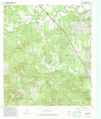
1991 Map of Van Raub
USGS Topo · Published 1991About this map
Fair Oaks Ranch and Leon Springs anchor this 1991 survey of the Texas Hill Country north of San Antonio, showing a landscape defined by dramatic limestone ridges and narrow creek valleys. The area transitions from the suburban growth at Fair Oaks Ranch to the rugged terrain surrounding Cross Mountain and the deep incisions of Cibolo Creek and Leon Creek. Historic transportation routes like the Boerne Stage Road follow the natural topography, winding through settlements such as Van Raub and Grey Forest. Local genealogy and land use are evident in features like Robles Cem and the Veterans Hall, while the eastern edge is dominated by the Camp Stanley Military Reservation. The map captures a moment of modern development, including Interstate 10, superimposed over an older network of gravel pits, springs like Morales Spring, and family-named landmarks like Mc Farland Hill.
Find a feature on this map
48 named features on this map. Tap any name to fly to it.
Don’t see what you’re looking for? This feature index may not catch every label — zoom into the map to look around manually.
Map Details
Editions of this 1991 Van Raub Map
This is the sole edition of this map. No revisions or reprints were ever made.
Other maps of this area

1953 · Otis Ridge
USGS Topo · 1:24,000

1953 · Helotes
USGS Topo · 1:24,000

1953 · Castle Hills
USGS Topo · 1:24,000

1953 · Van Raub
USGS Topo · 1:24,000

1954 · San Antonio
USGS Topo · 1:250,000

1956 · Comfort
USGS Topo · 1:62,500

1956 · Medina Lake
USGS Topo · 1:62,500

1957 · Boerne
USGS Topo · 1:62,500

1957 · San Antonio
USGS Topo · 1:250,000

1964 · Boerne
USGS Topo · 1:24,000