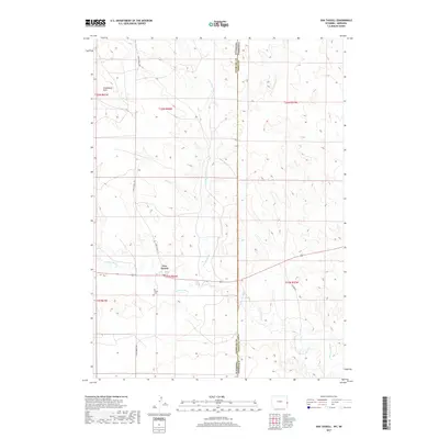
2017 Map of Van Tassell
USGS Topo · Published 2017About this map
Van Tassell sits at a geographic crossroads where the high plains of eastern Wyoming meet the Nebraska panhandle. This 2017 survey shows the village positioned just north of the Niobrara River, a vital water source in this semi-arid landscape. The topography is defined by drainage patterns like Van Tassell Cr, which flows southward toward the river, and distinctive landforms such as Steamboat Rock in the northwest. Local history and genealogy are anchored at the Van Tassell Cem, located just south of the primary settlement. The map also delineates the precise state boundary separating Wyoming and Nebraska, alongside the county line for Niobrara and Sioux counties. The road network, including N Van Tassell Rd and S Van Tassell Rd, reflects the area's rural character and its reliance on these arteries for connectivity across the state line.
Find a feature on this map
16 named features on this map. Tap any name to fly to it.
Don’t see what you’re looking for? This feature index may not catch every label — zoom into the map to look around manually.
Map Details
Editions of this 2017 Van Tassell Map
This is the sole edition of this map. No revisions or reprints were ever made.
Other maps of this area

1954 · Torrington
USGS Topo · 1:250,000

1955 · Alliance
USGS Topo · 1:250,000

1957 · Alliance
USGS Topo · 1:250,000

1958 · Torrington
USGS Topo · 1:250,000

1958 · Alliance
USGS Topo · 1:250,000

1974 · Mc Master Reservoir
USGS Topo · 1:24,000

1977 · Van Tassell
USGS Topo · 1:24,000

1977 · Van Tassell SE
USGS Topo · 1:24,000

1977 · Prairie Center
USGS Topo · 1:24,000

1978 · Kirtley SW
USGS Topo · 1:24,000