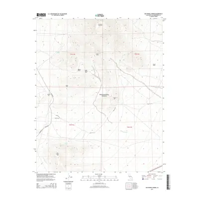
2015 Map of Van Winkle Spring
USGS Topo · Published 2015About this map
The Providence Mountains anchor the northern landscape of this desert terrain, where the expansive Lanfair Valley meets the high elevations of the Mojave National Preserve. This 2015 survey reveals a wilderness defined by its critical water sources, including Arrowhead Spring and Van Winkle Spring, which have historically served as vital stops for travelers through this arid environment. The map shows the convergence of several distinct desert valleys, with Clipper Valley to the east and the Quail Spring Basin tucked between the peaks. Key transportation corridors like Kelbaker Rd and the more remote Hidden Hill Rd provide access through the complex topography of Granite Pass and around the slopes of Van Winkle Mtn. This modern topographic study details the drainage patterns of Quail Spring Wash and Van Winkle Wash, reflecting the seasonal hydrology of the Mojave.
Find a feature on this map
22 named features on this map. Tap any name to fly to it.
Don’t see what you’re looking for? This feature index may not catch every label — zoom into the map to look around manually.
Map Details
Editions of this 2015 Van Winkle Spring Map
This is the sole edition of this map. No revisions or reprints were ever made.
Other maps of this area

1942 · Amboy
USGS Topo · 1:250,000

1943 · Amboy
USGS Topo · 1:250,000

1943 · Danby
USGS Topo · 1:62,500

1954 · Needles
USGS Topo · 1:250,000

1956 · Needles
USGS Topo · 1:250,000

1956 · Colton Well
USGS Topo · 1:62,500

1956 · Cadiz
USGS Topo · 1:62,500

1956 · Danby
USGS Topo · 1:62,500

1956 · Flynn
USGS Topo · 1:62,500

1981 · Needles
USGS Topo · 1:250,000