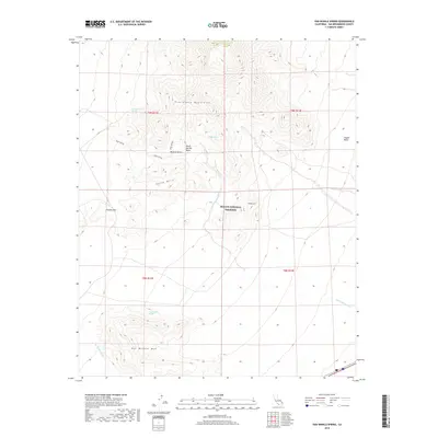
2018 Map of Van Winkle Spring
USGS Topo · Published 2018About this map
Van Winkle Spring and several other vital desert water sources define this high-desert landscape within the Mojave National Preserve. The topography is dominated by the southern reaches of the Providence Mountains and the distinct peak of Van Winkle Mtn, which rises above the surrounding alluvial fans. These desert hydrologic features, including Arrowhead Spring and Quail Spring, were essential waypoints for travelers and cattle in this arid environment.
Find a feature on this map
18 named features on this map. Tap any name to fly to it.
Don’t see what you’re looking for? This feature index may not catch every label — zoom into the map to look around manually.
Map Details
Editions of this 2018 Van Winkle Spring Map
This is the sole edition of this map. No revisions or reprints were ever made.
Other maps of this area

1942 · Amboy
USGS Topo · 1:250,000

1943 · Amboy
USGS Topo · 1:250,000

1943 · Danby
USGS Topo · 1:62,500

1954 · Needles
USGS Topo · 1:250,000

1956 · Needles
USGS Topo · 1:250,000

1956 · Colton Well
USGS Topo · 1:62,500

1956 · Cadiz
USGS Topo · 1:62,500

1956 · Danby
USGS Topo · 1:62,500

1956 · Flynn
USGS Topo · 1:62,500

1981 · Needles
USGS Topo · 1:250,000