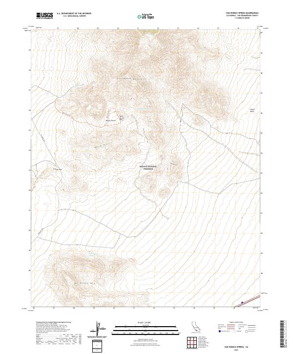
2021 Map of Van Winkle Spring
USGS Topo · Published 2021About this map
The Mojave National Preserve covers the vast majority of this landscape, protecting a series of desert summits and watering holes vital to local history. The southern portion of the Providence Mountains dominates the northern reaches, while Van Winkle Mtn stands as a prominent landmark to the south. Between these peaks, the high desert terrain reveals a network of natural water sources, including Arrowhead Spring, Quail Spring, and Van Winkle Spring, which have long served as essential stops for travelers and wildlife alike.
Find a feature on this map
18 named features on this map. Tap any name to fly to it.
Don’t see what you’re looking for? This feature index may not catch every label — zoom into the map to look around manually.
Map Details
Editions of this 2021 Van Winkle Spring Map
This is the sole edition of this map. No revisions or reprints were ever made.
Other maps of this area

1942 · Amboy
USGS Topo · 1:250,000

1943 · Amboy
USGS Topo · 1:250,000

1943 · Danby
USGS Topo · 1:62,500

1954 · Needles
USGS Topo · 1:250,000

1956 · Needles
USGS Topo · 1:250,000

1956 · Colton Well
USGS Topo · 1:62,500

1956 · Cadiz
USGS Topo · 1:62,500

1956 · Danby
USGS Topo · 1:62,500

1956 · Flynn
USGS Topo · 1:62,500

1981 · Needles
USGS Topo · 1:250,000