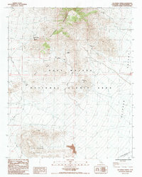
1985 Map of Van Winkle Spring
USGS Topo · Published 1985About this map
Providence Mountains and Van Winkle Mountain dominate this desert landscape, where water sources dictated the patterns of human activity. The map identifies several vital watering points, including Van Winkle Spring, Quail Spring, and Arroweed Spring, which served as essential stops for travelers and miners in this arid environment. The area's extraction history is evidenced by the Providence Mine and Bighorn Mine, tucked into the high elevations. Transportation through the region relies on the crossing at Granite Pass, while the Pine Tree Ranch (Site) suggests earlier settlement along the northwestern slopes. Much of this terrain falls within the East Mojave National Scenic Area, illustrating a transition toward conservation in the late 20th century. The intricate contour lines around Hidden Hill and the Horse Hills provide a detailed study of the drainage patterns feeding into Clipper Valley.
Find a feature on this map
16 named features on this map. Tap any name to fly to it.
Don’t see what you’re looking for? This feature index may not catch every label — zoom into the map to look around manually.
Map Details
Editions of this 1985 Van Winkle Spring Map
This is the sole edition of this map. No revisions or reprints were ever made.
Other maps of this area

1942 · Amboy
USGS Topo · 1:250,000

1943 · Amboy
USGS Topo · 1:250,000

1943 · Danby
USGS Topo · 1:62,500

1954 · Needles
USGS Topo · 1:250,000

1956 · Needles
USGS Topo · 1:250,000

1956 · Colton Well
USGS Topo · 1:62,500

1956 · Cadiz
USGS Topo · 1:62,500

1956 · Danby
USGS Topo · 1:62,500

1956 · Flynn
USGS Topo · 1:62,500

1981 · Needles
USGS Topo · 1:250,000