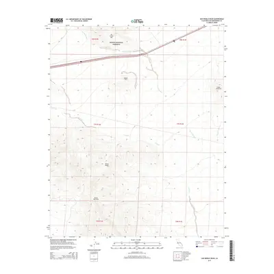
2015 Map of Van Winkle Wash
USGS Topo · Published 2015About this map
The Mojave National Preserve covers the northern reaches of this territory, where the arid landscape is defined by massive drainage systems like Van Winkle Wash and Cut Wash. These intermittent watercourses trace the alluvial slopes between distinct desert ranges, including the Van Winkle Mtn and the northern tip of the Marble Mountains. The map illustrates the specialized infrastructure required to traverse this portion of the Mojave Desert, centered on the path of Interstate 40. This corridor cuts across the desert floor, passing between the Middle Hills and the southern edge of the Clipper Mountains. The layout of township and range lines reveals the vast, undeveloped sections of San Bernardino County as they were managed in the early 21st century, showing how modern transportation routes follow the natural gaps between the region's prominent volcanic and sedimentary peaks.
Find a feature on this map
16 named features on this map. Tap any name to fly to it.
Don’t see what you’re looking for? This feature index may not catch every label — zoom into the map to look around manually.
Map Details
Editions of this 2015 Van Winkle Wash Map
This is the sole edition of this map. No revisions or reprints were ever made.
Other maps of this area

1942 · Amboy
USGS Topo · 1:250,000

1943 · Amboy
USGS Topo · 1:250,000

1943 · Danby
USGS Topo · 1:62,500

1954 · Needles
USGS Topo · 1:250,000

1956 · Needles
USGS Topo · 1:250,000

1956 · Colton Well
USGS Topo · 1:62,500

1956 · Cadiz
USGS Topo · 1:62,500

1956 · Danby
USGS Topo · 1:62,500

1956 · Flynn
USGS Topo · 1:62,500

1981 · Needles
USGS Topo · 1:250,000