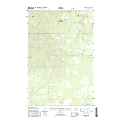
2017 Map of Vance Creek
USGS Topo · Published 2017About this map
Olympic National Forest dominates this landscape in the eastern foothills of the Olympic Mountains. The map highlights a complex network of forest development roads, including Natl Forest Development Road 23, which weave through the timberlands and steep drainage basins. Significant water systems like Vance Creek and the South Fork Skokomish River carve through the terrain, with the High Steel Bridge providing a notable point of passage over the river canyon.
Find a feature on this map
52 named features on this map. Tap any name to fly to it.
Don’t see what you’re looking for? This feature index may not catch every label — zoom into the map to look around manually.
Map Details
Editions of this 2017 Vance Creek Map
This is the sole edition of this map. No revisions or reprints were ever made.
Other maps of this area

1939 · Shelton
USGS Topo · 1:62,500

1943 · Potlatch
USGS Topo · 1:62,500

1943 · Nahwatzel Lake
USGS Topo · 1:62,500

1952 · Potlatch
USGS Topo · 1:62,500

1953 · Mt Tebo
USGS Topo · 1:62,500

1953 · Shelton
USGS Topo · 1:62,500

1953 · Elma
USGS Topo · 1:62,500

1958 · Seattle
USGS Topo · 1:250,000

1962 · Seattle
USGS Topo · 1:250,000
1981 · Nahwatzel Lake
USGS Topo · 1:24,000