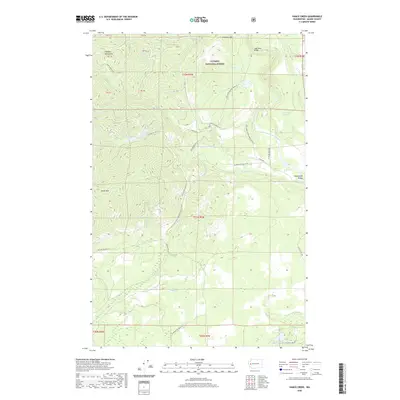
2020 Map of Vance Creek
USGS Topo · Published 2020About this map
The High Steel Bridge spans a deep gorge in the northeast, serving as a prominent landmark within the Olympic National Forest. This modern topographic study reveals a landscape defined by industrial forestry and rugged relief, where the Olympic Mountains meet the fertile Skokomish Valley. A dense network of timber access routes, including the Natl Forest Development Road 23 and Trestle Rd, crisscrosses the drainages of the South Fork Skokomish River and Vance Cr. Small upland water bodies such as Jackpot Lake, Hanks Lake, and Lake West are scattered across the timberlands, providing specific points of reference for recreationists and land managers. The map also delineates several land parcels marked as PB 53 through PB 58, indicating specific public land blocks or historical survey divisions near Grisdale Hill.
Find a feature on this map
48 named features on this map. Tap any name to fly to it.
Don’t see what you’re looking for? This feature index may not catch every label — zoom into the map to look around manually.
Map Details
Editions of this 2020 Vance Creek Map
This is the sole edition of this map. No revisions or reprints were ever made.
Other maps of this area

1939 · Shelton
USGS Topo · 1:62,500

1943 · Potlatch
USGS Topo · 1:62,500

1943 · Nahwatzel Lake
USGS Topo · 1:62,500

1952 · Potlatch
USGS Topo · 1:62,500

1953 · Mt Tebo
USGS Topo · 1:62,500

1953 · Shelton
USGS Topo · 1:62,500

1953 · Elma
USGS Topo · 1:62,500

1958 · Seattle
USGS Topo · 1:250,000

1962 · Seattle
USGS Topo · 1:250,000
1981 · Nahwatzel Lake
USGS Topo · 1:24,000