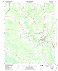
1983 Map of Vanceboro
USGS Topo · Published 1983About this map
The town of Vanceboro serves as the hub of this coastal plain landscape, situated along the Norfolk Southern rail line and the winding banks of Swift Creek. The survey reveals a community deeply rooted in the wetlands and watercourses of eastern North Carolina, where Neuse River and its tributaries like Turkey Quarter Creek shape the southern boundary. The proximity of the Farm Life Sch and numerous rural houses of worship, such as Juniper Chapel and Tabernacle Ch, reflects the social fabric of the era. The terrain is characterized by extensive lowlands, including Baybush Swamp and Palmetto Swamp, which hem in the agricultural clearings. Pockets of local industry are visible at the Sandpit and the Anderson Landing Strip, while the Celestial Memorial Gardens and numerous small family cemeteries provide valuable points of reference for genealogical research.
Find a feature on this map
29 named features on this map. Tap any name to fly to it.
Don’t see what you’re looking for? This feature index may not catch every label — zoom into the map to look around manually.
Map Details
Editions of this 1983 Vanceboro Map
This is the sole edition of this map. No revisions or reprints were ever made.
Other maps of this area

1901 · New Bern
USGS Topo · 1:62,500

1902 · Ayden
USGS Topo · 1:62,500

1902 · Vanceboro
USGS Topo · 1:62,500

1903 · New Bern
USGS Topo · 1:62,500

1903 · Trent River
USGS Topo · 1:62,500

1904 · Ayden
USGS Topo · 1:62,500

1904 · Trent River
USGS Topo · 1:62,500

1904 · Vanceboro
USGS Topo · 1:62,500

1905 · Vanceboro
USGS Topo · 1:62,500

1951 · Hackney
USGS Topo · 1:24,000