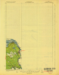
1933 Map of Vanceboro
USGS Topo · Published 1933About this map
Vanceboro stands as a vital international rail gateway at the edge of Washington County, where the Maine Central railroad tracks cross the border from the United States into New Brunswick. This 1930s topographic study by Olinus Smith captures the town's orientation toward the St. Croix River and the sprawling Chiputneticook Lakes system. The geography is defined by the river's descent through a series of rapids, notably Elbow Rips, Mile Rips, and Joe Georges Rips, which dictated the early movement of timber and river navigation in this borderland.
Find a feature on this map
36 named features on this map. Tap any name to fly to it.
Don’t see what you’re looking for? This feature index may not catch every label — zoom into the map to look around manually.
Map Details
Editions of this 1933 Vanceboro Map
4 editions found
Other maps of this area

1930 · Vanceboro
USGS Topo · 1:48,000

1933 · Vanceboro
USGS Topo · 1:62,500

1940 · Waite
USGS Topo · 1:62,500

1940 · Forest
USGS Topo · 1:62,500

1940 · Kellyland
USGS Topo · 1:62,500

1942 · Kellyland
USGS Topo · 1:62,500

1942 · Waite
USGS Topo · 1:62,500

1942 · Forest
USGS Topo · 1:62,500

1957 · Fredericton
USGS Topo · 1:250,000

1963 · Fredericton
USGS Topo · 1:250,000