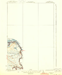
1933 Map of Vanceboro
USGS Topo · Published 1944About this map
The international boundary between Maine and New Brunswick follows the winding course of the St Croix River, defining the eastern edge of this 1930s landscape. At the center of the local economy and geography is Vanceboro, a critical border crossing point where the Maine Central railroad passes over the water. The survey captures a world shaped by timber and water, showing the intricate shoreline of Chiputneticook Lake and the numerous named river rapids or "rips" like Elbow Rips and Tunnel Rips that once challenged river drivers.
Find a feature on this map
30 named features on this map. Tap any name to fly to it.
Don’t see what you’re looking for? This feature index may not catch every label — zoom into the map to look around manually.
Map Details
Editions of this 1933 Vanceboro Map
4 editions found
Other maps of this area

1930 · Vanceboro
USGS Topo · 1:48,000

1933 · Vanceboro
USGS Topo · 1:62,500

1940 · Waite
USGS Topo · 1:62,500

1940 · Forest
USGS Topo · 1:62,500

1940 · Kellyland
USGS Topo · 1:62,500

1942 · Kellyland
USGS Topo · 1:62,500

1942 · Waite
USGS Topo · 1:62,500

1942 · Forest
USGS Topo · 1:62,500

1957 · Fredericton
USGS Topo · 1:250,000

1963 · Fredericton
USGS Topo · 1:250,000