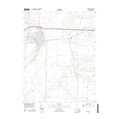
2015 Map of Vandalia
USGS Topo · Published 2015About this map
The Kaskaskia River winds through this region of central Illinois, defining a landscape of complex waterways and fertile bottomlands. In the city of Vandalia, a detailed street grid reveals the community's core along W Main St and N Kennedy Blvd, while the southern outskirts are marked by a significant concentration of burial sites including Vandalia City Cem, South Hill Cem, and Fairlawn Cem. This high density of cemeteries suggests a deeply established settlement history and provides a clear spatial record for genealogical research.
Find a feature on this map
119 named features on this map. Tap any name to fly to it.
Don’t see what you’re looking for? This feature index may not catch every label — zoom into the map to look around manually.
Map Details
Editions of this 2015 Vandalia Map
This is the sole edition of this map. No revisions or reprints were ever made.
Other maps of this area

1941 · St. Elmo
USGS Topo · 1:62,500

1944 · Ramsey
USGS Topo · 1:62,500

1945 · St. Elmo
USGS Topo · 1:62,500

1945 · Kinmundy
USGS Topo · 1:62,500

1945 · Vandalia
USGS Topo · 1:62,500

1946 · Ramsey
USGS Topo · 1:62,500

1947 · Vandalia
USGS Topo · 1:62,500

1947 · Kinmundy
USGS Topo · 1:62,500

1958 · Decatur
USGS Topo · 1:250,000

1958 · Belleville
USGS Topo · 1:250,000