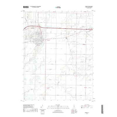
2018 Map of Vandalia
USGS Topo · Published 2018About this map
The Kaskaskia River winds south through this portion of Fayette County, serving as the historical and geographical axis for the city of Vandalia. As a former state capital, the area's rich history is reflected in the high density of burial sites surrounding the town, including the Old State Burial Ground, Mother of Dolors Cem, and Fairlawn Cem. The landscape transitions from the urban grid of Vandalia to the agricultural bottomlands and low-lying wetlands of the Vandalia Ditch and Inman Slough. To the east, the settlement of Bluff City sits perched above the river's floodplain. The surrounding countryside is dotted with family and community landmarks such as the Mitchell Family Cem and Haley Chapel Cem, while the southern reaches of the map are defined by the winding Richland Cr and the oxbows of Horseshoe Lake.
Find a feature on this map
81 named features on this map. Tap any name to fly to it.
Don’t see what you’re looking for? This feature index may not catch every label — zoom into the map to look around manually.
Map Details
Editions of this 2018 Vandalia Map
This is the sole edition of this map. No revisions or reprints were ever made.
Other maps of this area

1941 · St. Elmo
USGS Topo · 1:62,500

1944 · Ramsey
USGS Topo · 1:62,500

1945 · St. Elmo
USGS Topo · 1:62,500

1945 · Kinmundy
USGS Topo · 1:62,500

1945 · Vandalia
USGS Topo · 1:62,500

1946 · Ramsey
USGS Topo · 1:62,500

1947 · Vandalia
USGS Topo · 1:62,500

1947 · Kinmundy
USGS Topo · 1:62,500

1958 · Decatur
USGS Topo · 1:250,000

1958 · Belleville
USGS Topo · 1:250,000