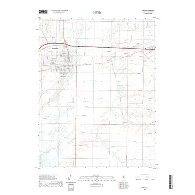
2021 Map of Vandalia
USGS Topo · Published 2021About this map
The Vandalia street grid and its surrounding Fayette County landscape are defined by the winding course of the Kaskaskia River. This survey documents a high concentration of burial grounds, providing significant genealogical value with sites like Old State Cem, Fairlawn Cem, and the Mitchell Family Cem. The river floodplain to the south is marked by numerous natural features including Horseshoe Lake, Inman Slough, and Pecan Island, illustrating the complex hydrology of the Kaskaskia valley. To the east, the settlement of Bluff City sits near the intersection of several county roads and Sandy Run. The map detail captures the intersection of major transportation routes like Veterans Pkwy with the established residential streets of the city, such as W Main St and W Gallatin St.
Find a feature on this map
64 named features on this map. Tap any name to fly to it.
Don’t see what you’re looking for? This feature index may not catch every label — zoom into the map to look around manually.
Map Details
Editions of this 2021 Vandalia Map
This is the sole edition of this map. No revisions or reprints were ever made.
Other maps of this area

1941 · St. Elmo
USGS Topo · 1:62,500

1944 · Ramsey
USGS Topo · 1:62,500

1945 · St. Elmo
USGS Topo · 1:62,500

1945 · Kinmundy
USGS Topo · 1:62,500

1945 · Vandalia
USGS Topo · 1:62,500

1946 · Ramsey
USGS Topo · 1:62,500

1947 · Vandalia
USGS Topo · 1:62,500

1947 · Kinmundy
USGS Topo · 1:62,500

1958 · Decatur
USGS Topo · 1:250,000

1958 · Belleville
USGS Topo · 1:250,000