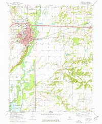
1974 Map of Vandalia
USGS Topo · Published 1977About this map
The historic Illinois state capital of Vandalia serves as the focal point of this mid-1970s survey, illustrating its position as a hub of transport and administration along the Kaskaskia River. The map meticulously details the town's civic infrastructure, including the Vandalia Correctional Center, the local Courthouse, and the State House. Evidence of early settlement patterns remains visible through a high density of burial grounds like the Old State Cem and South Hill Cem, while the industrial and agricultural landscape is shaped by the Penn Central railroad and the extensive Vandalia Ditch drainage system.
Find a feature on this map
60 named features on this map. Tap any name to fly to it.
Don’t see what you’re looking for? This feature index may not catch every label — zoom into the map to look around manually.
Map Details
Editions of this 1974 Vandalia Map
This is the sole edition of this map. No revisions or reprints were ever made.
Other maps of this area

1941 · St. Elmo
USGS Topo · 1:62,500

1944 · Ramsey
USGS Topo · 1:62,500

1945 · St. Elmo
USGS Topo · 1:62,500

1945 · Kinmundy
USGS Topo · 1:62,500

1945 · Vandalia
USGS Topo · 1:62,500

1946 · Ramsey
USGS Topo · 1:62,500

1947 · Vandalia
USGS Topo · 1:62,500

1947 · Kinmundy
USGS Topo · 1:62,500

1958 · Decatur
USGS Topo · 1:250,000

1958 · Belleville
USGS Topo · 1:250,000