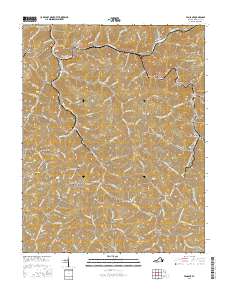
2016 Map of Vansant
USGS Topo · Published 2016About this map
Vansant and the surrounding Buchanan County coalfields appear in this topographical study, where the Levisa Fork winds through a landscape marked by deep hollows and high ridges. The map illustrates a community defined by its proximity to extraction and education, featuring the Appalachian Coll of Pharmacy in Oakwood alongside industrial features like the Edge of Strip Mine near Boyd Ridge. The settlement pattern follows the narrow valley floors, with towns like Mavisdale, Deskins, and Rowe connected by routes such as Riverside Dr and State Rte 662. Numerous family burial grounds, including Cook Cem, Jackson Cem, and Keen Cem, are scattered across the hillsides, providing a detailed record of local genealogy. In the northwest, the Grundy Municipal Airport sits atop Turkey Pen Ridge, demonstrating how the terrain has been modified for modern infrastructure in this pocket of the Appalachian Plateau.
Find a feature on this map
132 named features on this map. Tap any name to fly to it.
Don’t see what you’re looking for? This feature index may not catch every label — zoom into the map to look around manually.
Map Details
Editions of this 2016 Vansant Map
This is the sole edition of this map. No revisions or reprints were ever made.
Other maps of this area

1886 · Grundy
USGS Topo · 1:125,000

1890 · Grundy
USGS Topo · 1:125,000

1891 · Tazewell
USGS Topo · 1:125,000

1892 · Grundy
USGS Topo · 1:125,000

1895 · Tazewell
USGS Topo · 1:125,000

1897 · Tazewell
USGS Topo · 1:125,000

1910 · Iaeger
USGS Topo · 1:48,000

1912 · Iaeger
USGS Topo · 1:62,500

1914 · Bucu
USGS Topo · 1:48,000

1914 · Iaeger
USGS Topo · 1:48,000