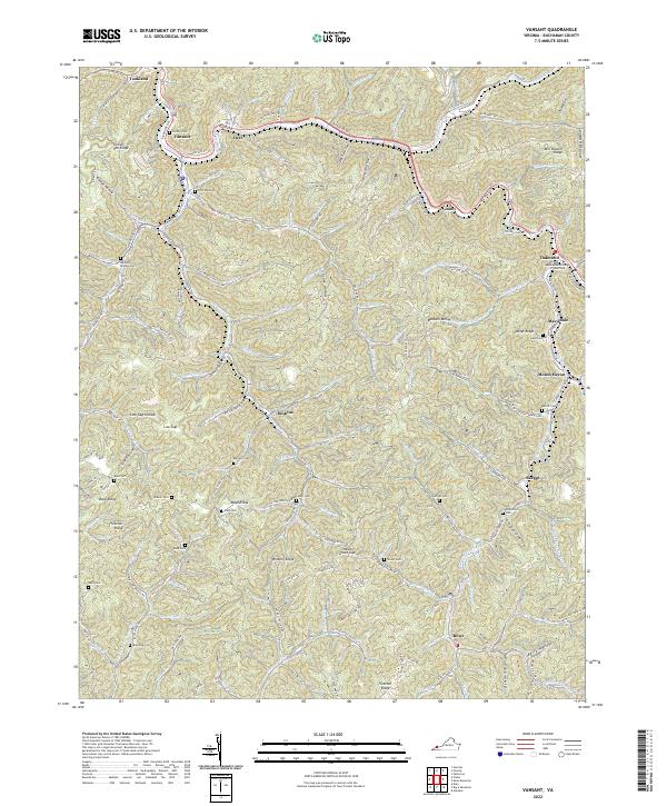
2022 Map of Vansant
USGS Topo · Published 2022About this map
Vansant and the winding course of the Louisa Fork define the northern corridor of this 2022 survey in Buchanan County. The landscape is a dense network of hollows and ridges, such as Turkey Pen Ridge and Mill Branch Ridge, where small communities and family-named landmarks are concentrated along narrow valley floors. To the east, the Appalachian College of Pharmacy stands near Oakwood, while the southern reaches of the map around Rowe and Skeggs show a terrain dictated by steep elevation changes and the numerous tributaries of Dismal Creek. This contemporary study is particularly valuable for genealogists, as it meticulously labels dozens of small family burial grounds, including the Burdine Looney Cem, McGlothlin Cem, and Jackson Cem, providing a detailed look at the ancestral footprint throughout the Appalachian coalfields.
Find a feature on this map
143 named features on this map. Tap any name to fly to it.
Don’t see what you’re looking for? This feature index may not catch every label — zoom into the map to look around manually.
Map Details
Editions of this 2022 Vansant Map
This is the sole edition of this map. No revisions or reprints were ever made.
Other maps of this area

1886 · Grundy
USGS Topo · 1:125,000

1890 · Grundy
USGS Topo · 1:125,000

1891 · Tazewell
USGS Topo · 1:125,000

1892 · Grundy
USGS Topo · 1:125,000

1895 · Tazewell
USGS Topo · 1:125,000

1897 · Tazewell
USGS Topo · 1:125,000

1910 · Iaeger
USGS Topo · 1:48,000

1912 · Iaeger
USGS Topo · 1:62,500

1914 · Bucu
USGS Topo · 1:48,000

1914 · Iaeger
USGS Topo · 1:48,000