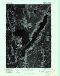
1975 Map of Vassalboro NE
USGS Topo · Published 1980About this map
China Lake dominates this mid-1970s orthophotoquad, its sprawling, multi-lobed basin defining the geography of eastern Kennebec County. The photographic detail, captured by the Geological Survey in October 1975, reveals the dense timberlands and agricultural clearings surrounding the water. Settlements are clustered primarily at the lake's southern tip near South China and along its northwestern reaches, where North Vassalboro and East Vassalboro are situated. Unlike a traditional line-drawn topographic map, this aerial perspective provides an unfiltered look at the landscape's texture, showing the exact boundaries of woodlots and fields as they existed during the era. Small rural junctions like Dirigo Corner and the village of South Vassalboro appear as distinct clearings in the forest, connected by a network of local roads that trace the undulating terrain of central Maine.
Find a feature on this map
7 named features on this map. Tap any name to fly to it.
Don’t see what you’re looking for? This feature index may not catch every label — zoom into the map to look around manually.
Map Details
Editions of this 1975 Vassalboro NE Map
This is the sole edition of this map. No revisions or reprints were ever made.
Other maps of this area

1892 · Waterville
USGS Topo · 1:62,500

1893 · Vassalboro
USGS Topo · 1:62,500

1898 · Vassalboro
USGS Topo · 1:62,500

1916 · Liberty
USGS Topo · 1:62,500

1926 · Burnham
USGS Topo · 1:62,500

1941 · Vassalboro
USGS Topo · 1:62,500

1942 · Liberty
USGS Topo · 1:62,500

1943 · Vassalboro
USGS Topo · 1:62,500

1943 · Waterville
USGS Topo · 1:62,500

1948 · Bangor
USGS Topo · 1:250,000