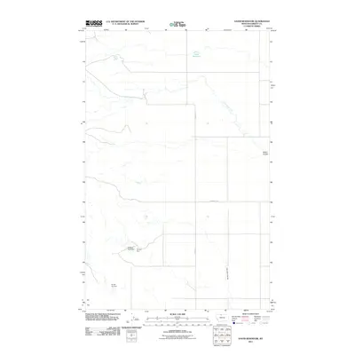
2011 Map of Vaver Reservoir
USGS Topo · Published 2011About this map
Vaver Reservoir and a series of water management structures characterize this corner of Liberty County, Montana. The landscape is defined by the ephemeral flow of Little Sage Creek and the intricate drainage patterns of Desert Coulee and Fourmile Coulee. The presence of several small-scale dams, including the uniquely named Dragons Head Dam, Procyon Dam, and Tex Oh Leo Dam, reflects the vital role of water storage in this high plains region. This network of rural roads, such as Laird Rd and McDowell Rd, provides the essential infrastructure for ranching operations and land management across the wide, open terrain. The map offers a precise look at the section lines and topography that dictate the movement and settlement of this agricultural frontier.
Find a feature on this map
9 named features on this map. Tap any name to fly to it.
Don’t see what you’re looking for? This feature index may not catch every label — zoom into the map to look around manually.
Map Details
Editions of this 2011 Vaver Reservoir Map
This is the sole edition of this map. No revisions or reprints were ever made.
Other maps of this area

1919 · Alma
USGS Topo · 1:125,000

1954 · Shelby
USGS Topo · 1:250,000

1958 · Shelby
USGS Topo · 1:250,000
1962 · Bingham Lake
USGS Topo · 1:24,000

1962 · Lakey Ranch
USGS Topo · 1:24,000

1962 · Mount Lebanon
USGS Topo · 1:24,000

1963 · Bobcat Coulee SE
USGS Topo · 1:24,000

1963 · Vaver Reservoir
USGS Topo · 1:24,000

1963 · Chester NW
USGS Topo · 1:24,000

1963 · Chester NE
USGS Topo · 1:24,000