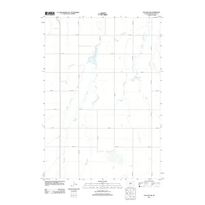
2012 Map of Vayland NW
USGS Topo · Published 2012About this map
Turtle Cr and its meandering tributaries dominate this section of Hand County, illustrating the intricate drainage patterns of the South Dakota prairie. The landscape is defined by the hydrologic relationship between Jones Lake and Pearl Lake, connected by the various branches of Pearl Cr, including W Pearl Cr and E Pearl Cr. This 2012 survey by the U.S. Geological Survey shows a meticulously organized grid of section-line roads, such as 361st Ave and 200th St, which trace the agricultural development of the region. A notable break in the standard numbering occurs at Cow Camp Pl, suggesting localized land use or historical ranching footprints. This map provides a clear record of the rural infrastructure and natural watercourses that have shaped this portion of the Great Plains into the 21st century.
Find a feature on this map
19 named features on this map. Tap any name to fly to it.
Don’t see what you’re looking for? This feature index may not catch every label — zoom into the map to look around manually.
Map Details
Editions of this 2012 Vayland NW Map
This is the sole edition of this map. No revisions or reprints were ever made.
Other maps of this area

1899 · Redfield
USGS Topo · 1:125,000

1949 · Vayland SE
USGS Topo · 1:24,000

1949 · Vayland SW
USGS Topo · 1:24,000

1950 · Ree Heights SE
USGS Topo · 1:24,000

1950 · Vayland
USGS Topo · 1:24,000

1950 · Vayland NW
USGS Topo · 1:24,000

1951 · Vayland SW
USGS Topo · 1:24,000

1951 · Vayland SE
USGS Topo · 1:24,000

1953 · Huron
USGS Topo · 1:250,000

1954 · Huron
USGS Topo · 1:250,000