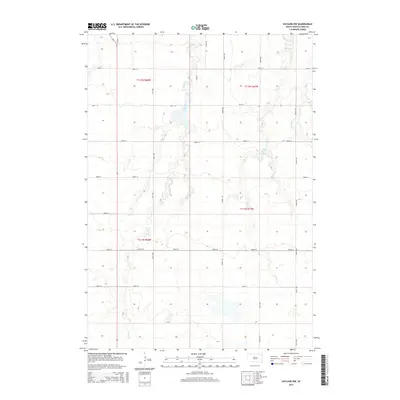
2015 Map of Vayland NW
USGS Topo · Published 2015About this map
Turtle Creek winds through the heart of Hand County, defining the drainage patterns of this central South Dakota landscape. This 2015 survey reveals a terrain defined by its water features, where small basins like Jones Lake and Pearl Lake collect amidst a grid of rural section roads. The landscape is a classic example of the Great Plains' rectangular survey system, with roads like 364th Ave and 200th St carving the prairie into neat agricultural blocks. In the eastern portion, the headwaters of West Pearl Creek and East Pearl Creek create subtle topographical variations. This map is particularly useful for those tracing family land holdings or the evolution of rural infrastructure, as it documents the exact placement of prairie roads and local waterways within the Townships of t112n r68w, t112n r67w, t111n r68w, and t111n r67w.
Find a feature on this map
22 named features on this map. Tap any name to fly to it.
Don’t see what you’re looking for? This feature index may not catch every label — zoom into the map to look around manually.
Map Details
Editions of this 2015 Vayland NW Map
This is the sole edition of this map. No revisions or reprints were ever made.
Other maps of this area

1899 · Redfield
USGS Topo · 1:125,000

1949 · Vayland SE
USGS Topo · 1:24,000

1949 · Vayland SW
USGS Topo · 1:24,000

1950 · Ree Heights SE
USGS Topo · 1:24,000

1950 · Vayland
USGS Topo · 1:24,000

1950 · Vayland NW
USGS Topo · 1:24,000

1951 · Vayland SW
USGS Topo · 1:24,000

1951 · Vayland SE
USGS Topo · 1:24,000

1953 · Huron
USGS Topo · 1:250,000

1954 · Huron
USGS Topo · 1:250,000