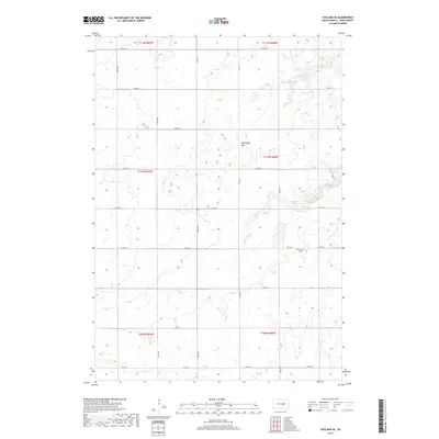
2017 Map of Vayland SE
USGS Topo · Published 2017About this map
The eastern slopes of the Wessington Hills define the character of this rural Hand County landscape, where the prairie begins its descent toward the James River Valley. Unlike the flat plains found elsewhere in the region, this area is marked by numerous small wetlands and depressions that collect seasonal water. Sand Cr winds through the central portion of the map, draining the elevation change near Rose Hill Lake. This small body of water serves as a focal point for the surrounding section lines, which are formally laid out in the Public Land Survey System. Genealogists and local historians will find the location of Rosehill Cem along Co Rd 31, providing a specific point of reference for the families who settled this portion of Township 110 North.
Find a feature on this map
25 named features on this map. Tap any name to fly to it.
Don’t see what you’re looking for? This feature index may not catch every label — zoom into the map to look around manually.
Map Details
Editions of this 2017 Vayland SE Map
This is the sole edition of this map. No revisions or reprints were ever made.
Other maps of this area

1949 · Vayland SE
USGS Topo · 1:24,000

1949 · Vayland SW
USGS Topo · 1:24,000

1950 · Vayland
USGS Topo · 1:24,000

1950 · Wessington
USGS Topo · 1:24,000

1950 · Vayland NW
USGS Topo · 1:24,000

1951 · Vayland SW
USGS Topo · 1:24,000

1951 · Wessington SW
USGS Topo · 1:24,000

1951 · Vayland SE
USGS Topo · 1:24,000

1953 · Huron
USGS Topo · 1:250,000

1954 · Huron
USGS Topo · 1:250,000