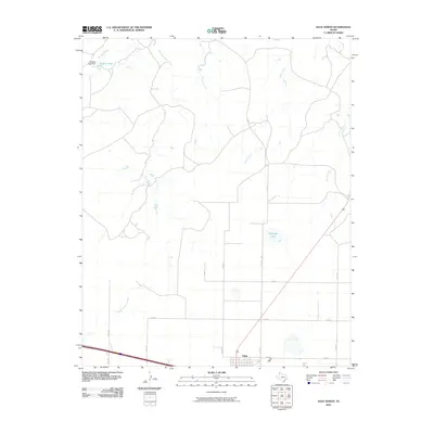
2010 Map of Vega North
USGS Topo · Published 2010About this map
Vega anchors the southern edge of this High Plains landscape, situated along a busy transportation corridor where local routes like Co RD 34 and Co RD D meet. The terrain is defined by a dendritic drainage pattern typical of the Texas Panhandle, with Middle Alamosa Creek winding through the western half and Billys Creek cutting through the center. These ephemeral watercourses are vital landmarks in an arid ranching environment, often punctuated by man-made infrastructure such as the Bradley Tank Dam and the associated Bradley Tank in the northwest corner. To the east, Milkweed Lake sits as a solitary basin among the grid of county roads, including Co RD 37 and Co RD 39. The map illustrates the structured intersection of industrial-scale agriculture and natural hydrology, where the vast open spaces are organized by a rigid network of secondary roads supporting the regional economy.
Find a feature on this map
18 named features on this map. Tap any name to fly to it.
Don’t see what you’re looking for? This feature index may not catch every label — zoom into the map to look around manually.
Map Details
Editions of this 2010 Vega North Map
This is the sole edition of this map. No revisions or reprints were ever made.
Other maps of this area

1954 · Tucumcari
USGS Topo · 1:250,000

1958 · Tucumcari
USGS Topo · 1:250,000

1965 · Everett
USGS Topo · 1:24,000

1966 · Alamocitos Camp
USGS Topo · 1:24,000

1966 · Simms NE
USGS Topo · 1:24,000

1966 · Jay Taylor Ranch
USGS Topo · 1:24,000

1966 · Halfway Creek
USGS Topo · 1:24,000

1966 · Landergin
USGS Topo · 1:24,000

1966 · Vega South
USGS Topo · 1:24,000

1966 · Torrea Peak
USGS Topo · 1:24,000