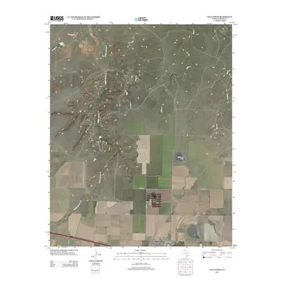
2012 Map of Vega North
USGS Topo · Published 2012About this map
The town of Vega serves as the focal point for this Oldham County landscape, situated at a junction where local roads like Lubbock St and 4th St meet regional thoroughfares. The terrain north of the settlement is defined by an extensive drainage network, including the meandering paths of Middle Alamosa Creek and Billys Creek. This map illustrates the transition from the organized grid of county roads, such as Co Road D and Co Road F, to the more irregular paths of the northern creeks and draws. Small landmarks like Bradley Tank and the seasonal waters of Milkweed Lake reveal the essential water management features of this high plains ranching and agricultural region. The inclusion of FM-3319 and several rural county roads provides a detailed look at the infrastructure supporting this section of the Texas Panhandle in the early 21st century.
Find a feature on this map
20 named features on this map. Tap any name to fly to it.
Don’t see what you’re looking for? This feature index may not catch every label — zoom into the map to look around manually.
Map Details
Editions of this 2012 Vega North Map
This is the sole edition of this map. No revisions or reprints were ever made.
Other maps of this area

1954 · Tucumcari
USGS Topo · 1:250,000

1958 · Tucumcari
USGS Topo · 1:250,000

1965 · Everett
USGS Topo · 1:24,000

1966 · Alamocitos Camp
USGS Topo · 1:24,000

1966 · Simms NE
USGS Topo · 1:24,000

1966 · Jay Taylor Ranch
USGS Topo · 1:24,000

1966 · Halfway Creek
USGS Topo · 1:24,000

1966 · Landergin
USGS Topo · 1:24,000

1966 · Vega South
USGS Topo · 1:24,000

1966 · Torrea Peak
USGS Topo · 1:24,000