
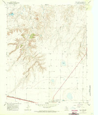
1966 Map of Vega South
USGS Topo · Published 1969About this map
The High Plains of the Texas Panhandle are defined here by the transport corridor of the Chicago Rock Island and Pacific railroad and the neighboring town of Vega. Situated along the Oldham Co Deaf Smith Co boundary, the landscape is dotted with numerous water wells and several large basins, including Dodson Lake, reflecting the region's reliance on groundwater for ranching and agriculture. The settlement of Faber sits just west of the main town, connected by a network of developing roads and a major pipeline that traverses the northern sections.
Find a feature on this map
12 named features on this map. Tap any name to fly to it.
Don’t see what you’re looking for? This feature index may not catch every label — zoom into the map to look around manually.
Map Details
Editions of this 1966 Vega South Map
This is the sole edition of this map. No revisions or reprints were ever made.
Other maps of this area

1954 · Tucumcari
USGS Topo · 1:250,000

1958 · Tucumcari
USGS Topo · 1:250,000

1965 · Everett
USGS Topo · 1:24,000

1965 · Allison Ranch
USGS Topo · 1:24,000

1966 · Overstreet Lake
USGS Topo · 1:24,000

1966 · Simms NE
USGS Topo · 1:24,000

1966 · Jay Taylor Ranch
USGS Topo · 1:24,000

1966 · Landergin
USGS Topo · 1:24,000

1966 · Ford
USGS Topo · 1:24,000
1966 · Vega North
USGS Topo · 1:24,000