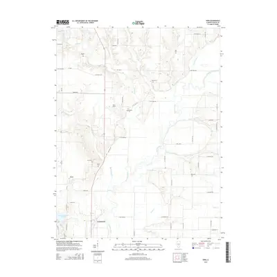
2015 Map of Vera
USGS Topo · Published 2015About this map
The settlement of Vera sits west of a winding river valley in this 2015 Fayette County survey. The landscape is defined by the braided path of the Kaskaskia River, which is fed by numerous tributaries including Ramsey Cr, Ash Cr, and Forbis Cr. Local family names and community history are preserved through several documented burial grounds scattered across the township, such as Bolyard Cem in the north and Sharon Cem near the town site. Civil engineering and water management are evident in features like the Vandalia Municipal Reservoir and the Peppermill Ditch, while Harris Airport provides a small aviation hub for the rural district. The transition from the more elevated terrain near Vera down into the river bottomlands highlights the agricultural and hydrological character of this part of central Illinois.
Find a feature on this map
57 named features on this map. Tap any name to fly to it.
Don’t see what you’re looking for? This feature index may not catch every label — zoom into the map to look around manually.
Map Details
Editions of this 2015 Vera Map
This is the sole edition of this map. No revisions or reprints were ever made.
Other maps of this area

1941 · St. Elmo
USGS Topo · 1:62,500

1944 · Ramsey
USGS Topo · 1:62,500

1945 · St. Elmo
USGS Topo · 1:62,500

1945 · Kinmundy
USGS Topo · 1:62,500

1945 · Vandalia
USGS Topo · 1:62,500

1946 · Ramsey
USGS Topo · 1:62,500

1947 · Vandalia
USGS Topo · 1:62,500

1947 · Kinmundy
USGS Topo · 1:62,500

1958 · Decatur
USGS Topo · 1:250,000

1958 · Belleville
USGS Topo · 1:250,000