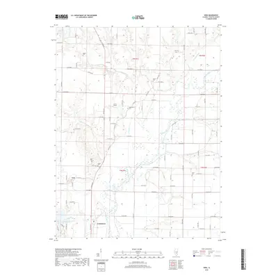
2018 Map of Vera
USGS Topo · Published 2018About this map
The Kaskaskia River snakes through the center of this Fayette County landscape, carving a wide valley floor marked by seasonal wetlands and interconnected drainage systems like Suck Cr and Linn Cr. To the south, the northern reaches of Vandalia appear near the Vandalia Municipal Reservoir, which is fed by Bear Cr. The small community of Vera sits west of the river, serving as a focal point for the surrounding agricultural grid.
Find a feature on this map
49 named features on this map. Tap any name to fly to it.
Don’t see what you’re looking for? This feature index may not catch every label — zoom into the map to look around manually.
Map Details
Editions of this 2018 Vera Map
This is the sole edition of this map. No revisions or reprints were ever made.
Other maps of this area

1941 · St. Elmo
USGS Topo · 1:62,500

1944 · Ramsey
USGS Topo · 1:62,500

1945 · St. Elmo
USGS Topo · 1:62,500

1945 · Kinmundy
USGS Topo · 1:62,500

1945 · Vandalia
USGS Topo · 1:62,500

1946 · Ramsey
USGS Topo · 1:62,500

1947 · Vandalia
USGS Topo · 1:62,500

1947 · Kinmundy
USGS Topo · 1:62,500

1958 · Decatur
USGS Topo · 1:250,000

1958 · Belleville
USGS Topo · 1:250,000