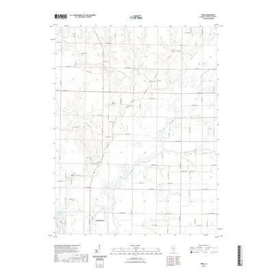
2021 Map of Vera
USGS Topo · Published 2021About this map
The Kaskaskia River valley defines this part of Fayette County, winding southward through a landscape marked by numerous small tributaries such as Ramsey Cr, Hoffman Cr, and Forbis Cr. In the early 21st century, the area surrounding the village of Vera remains primarily rural, organized by a persistent grid of county roads that serve several family-named landmarks. The northern outskirts of Vandalia appear at the bottom of the map, situated near the Vandalia Municipal Reservoir and the Harris Airport. Genealogists will find this particular survey especially useful for its clear documentation of several burial grounds scattered across the townships, including Sharon Cem, Union Cem, and Independence Cem, as well as the Mathias Cem located near a sharp bend in the river. This collection of cemeteries and named creeks provides a clear view of the ancestral settlement patterns along the river bottomlands and adjacent bluffs.
Find a feature on this map
45 named features on this map. Tap any name to fly to it.
Don’t see what you’re looking for? This feature index may not catch every label — zoom into the map to look around manually.
Map Details
Editions of this 2021 Vera Map
This is the sole edition of this map. No revisions or reprints were ever made.
Other maps of this area

1941 · St. Elmo
USGS Topo · 1:62,500

1944 · Ramsey
USGS Topo · 1:62,500

1945 · St. Elmo
USGS Topo · 1:62,500

1945 · Kinmundy
USGS Topo · 1:62,500

1945 · Vandalia
USGS Topo · 1:62,500

1946 · Ramsey
USGS Topo · 1:62,500

1947 · Vandalia
USGS Topo · 1:62,500

1947 · Kinmundy
USGS Topo · 1:62,500

1958 · Decatur
USGS Topo · 1:250,000

1958 · Belleville
USGS Topo · 1:250,000