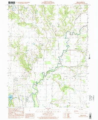
1998 Map of Vera
USGS Topo · Published 2002About this map
The Kaskaskia River winds extensively through this portion of Fayette County, defining a landscape of low-lying wetlands and flood-management structures like the Peppermill Ditch. The small settlement of Vera sits in the western section of the map, surrounded by numerous rural landmarks that speak to the area's genealogical depth. Scattered across the townships of Sharon, Ramsey, and Sefton are several small family and community burial grounds, including Bolyard Cem and Sharon Cem.
Find a feature on this map
25 named features on this map. Tap any name to fly to it.
Don’t see what you’re looking for? This feature index may not catch every label — zoom into the map to look around manually.
Map Details
Editions of this 1998 Vera Map
This is the sole edition of this map. No revisions or reprints were ever made.
Other maps of this area

1941 · St. Elmo
USGS Topo · 1:62,500

1944 · Ramsey
USGS Topo · 1:62,500

1945 · St. Elmo
USGS Topo · 1:62,500

1945 · Kinmundy
USGS Topo · 1:62,500

1945 · Vandalia
USGS Topo · 1:62,500

1946 · Ramsey
USGS Topo · 1:62,500

1947 · Vandalia
USGS Topo · 1:62,500

1947 · Kinmundy
USGS Topo · 1:62,500

1958 · Decatur
USGS Topo · 1:250,000

1958 · Belleville
USGS Topo · 1:250,000