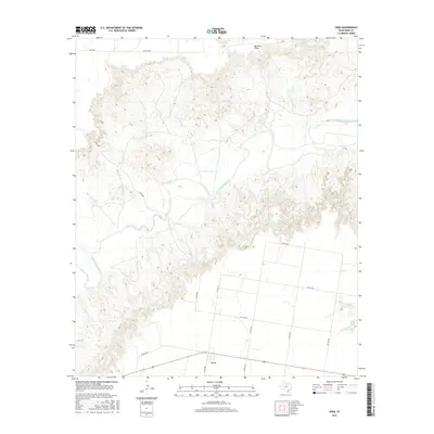
2016 Map of Vera
USGS Topo · Published 2016About this map
South Wichita River meanders across this West Texas landscape, cutting through the high ground of Ignorant Ridge in the northern portion of the quadrangle. The settlement of Vera serves as the primary local hub, situated at the intersection of several county roads and highways that reflect the region's agricultural and ranching infrastructure. This 2016 survey illustrates how modern transportation routes, such as FM 267n and Co RD 3150, follow the section lines and natural contours of the terrain. The presence of Boyd Lake and Mustang Cr highlights the drainage patterns critical to this semi-arid environment, while the dense network of county roads like Co RD 7001 and Co RD 3065 indicates the distributed nature of land ownership and rural residences in Knox County.
Find a feature on this map
18 named features on this map. Tap any name to fly to it.
Don’t see what you’re looking for? This feature index may not catch every label — zoom into the map to look around manually.
Map Details
Editions of this 2016 Vera Map
This is the sole edition of this map. No revisions or reprints were ever made.
Other maps of this area

1954 · Wichita Falls
USGS Topo · 1:250,000

1958 · Wichita Falls
USGS Topo · 1:250,000

1966 · Santa Rosa Lake SW
USGS Topo · 1:24,000

1966 · Soap Creek
USGS Topo · 1:24,000

1966 · Colwell Creek
USGS Topo · 1:24,000

1966 · Halsell Ranch
USGS Topo · 1:24,000

1966 · Gilliland
USGS Topo · 1:24,000

1966 · Bomarton
USGS Topo · 1:24,000

1966 · Vera
USGS Topo · 1:24,000

1967 · Hefner
USGS Topo · 1:24,000