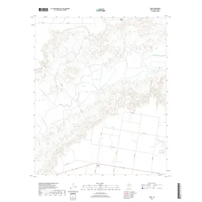
2019 Map of Vera
USGS Topo · Published 2019About this map
The settlement of Vera sits along the southern edge of this Knox County landscape, where the flat agricultural plains of the Texas Rolling Plains meet the broken breaks of the South Wichita River. The river carves a winding course through the center of the quadrangle, flanked by complex drainage systems including Mustang Cr and Soap Cr. This transition from the structured grid of rural roads like Co RD 3171 to the erratic topography of Ignorant Ridge highlights the tension between land cultivation and the natural erosion of the Red River Basin. To the southeast, Boyd Lake provides a rare contained water feature amidst the deep draws and ridges. The map captures the isolation of this ranching and farming country, where life is oriented around the seasonal flow of the river and the long stretches of highway connecting remote homesteads.
Find a feature on this map
19 named features on this map. Tap any name to fly to it.
Don’t see what you’re looking for? This feature index may not catch every label — zoom into the map to look around manually.
Map Details
Editions of this 2019 Vera Map
This is the sole edition of this map. No revisions or reprints were ever made.
Other maps of this area

1954 · Wichita Falls
USGS Topo · 1:250,000

1958 · Wichita Falls
USGS Topo · 1:250,000

1966 · Santa Rosa Lake SW
USGS Topo · 1:24,000

1966 · Soap Creek
USGS Topo · 1:24,000

1966 · Colwell Creek
USGS Topo · 1:24,000

1966 · Halsell Ranch
USGS Topo · 1:24,000

1966 · Gilliland
USGS Topo · 1:24,000

1966 · Bomarton
USGS Topo · 1:24,000

1966 · Vera
USGS Topo · 1:24,000

1967 · Hefner
USGS Topo · 1:24,000