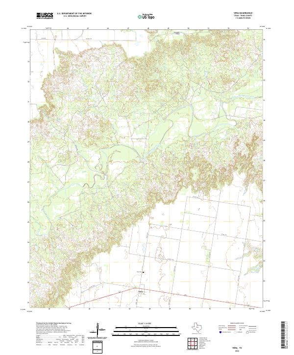
2022 Map of Vera
USGS Topo · Published 2022About this map
The community of Vera serves as the primary focal point of this North Texas landscape, situated along a network of county roads south of the South Wichita River. This 2022 survey illustrates the intersection of rural infrastructure and the distinct topography of Knox County, where the river carves a winding path through the northern half of the quadrangle. Significant elevation changes are marked by Ignorant Ridge, which overlooks the river valley. Local history and genealogy interests are centered at the Vera Cem, located just north of the town center. The hydrology of the area is defined by seasonal waterways and drainage patterns, including Mustang Cr and Soap Cr, which feed into the larger river system, and Boyd Lake situated in the southeastern reaches of the map.
Find a feature on this map
20 named features on this map. Tap any name to fly to it.
Don’t see what you’re looking for? This feature index may not catch every label — zoom into the map to look around manually.
Map Details
Editions of this 2022 Vera Map
This is the sole edition of this map. No revisions or reprints were ever made.
Other maps of this area

1954 · Wichita Falls
USGS Topo · 1:250,000

1958 · Wichita Falls
USGS Topo · 1:250,000

1966 · Santa Rosa Lake SW
USGS Topo · 1:24,000

1966 · Soap Creek
USGS Topo · 1:24,000

1966 · Colwell Creek
USGS Topo · 1:24,000

1966 · Halsell Ranch
USGS Topo · 1:24,000

1966 · Gilliland
USGS Topo · 1:24,000

1966 · Bomarton
USGS Topo · 1:24,000

1966 · Vera
USGS Topo · 1:24,000

1967 · Hefner
USGS Topo · 1:24,000