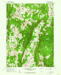
1960 Map of Verbank
USGS Topo · Published 1962About this map
Verbank Village and the smaller settlement of Verbank sit along the upper reaches of Sprout Creek in this 1960 study of central Dutchess County. The landscape is defined by the deep north-south trough of Clove Valley, flanked by East Mountain and West Mountain. This topographic detail captures the area during a period of transition, where small agricultural hamlets like Camby and North Clove remained connected by a web of local routes such as Waterbury Hill Road and Whortleberry Hill Road.
Find a feature on this map
64 named features on this map. Tap any name to fly to it.
Don’t see what you’re looking for? This feature index may not catch every label — zoom into the map to look around manually.
Map Details
Editions of this 1960 Verbank Map
3 editions found
Other maps of this area

1893 · Clove
USGS Topo · 1:62,500

1893 · Poughkeepsie
USGS Topo · 1:62,500

1894 · Clove
USGS Topo · 1:62,500

1894 · Poughkeepsie
USGS Topo · 1:62,500

1898 · Clove
USGS Topo · 1:62,500

1898 · Rhinebeck
USGS Topo · 1:62,500

1899 · Millbrook
USGS Topo · 1:62,500

1901 · Clove
USGS Topo · 1:62,500

1902 · Millbrook
USGS Topo · 1:62,500

1903 · Poughkeepsie
USGS Topo · 1:62,500