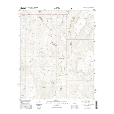
2014 Map of Verde Hot Springs
USGS Topo · Published 2014About this map
Verde Hot Springs and the surrounding wilderness of the Verde River corridor are the focal points of this 2014 survey. The map details a landscape where three national forests meet, showing the intersection of the Prescott National Forest, Coconino National Forest, and Tonto National Forest. Water is the defining resource of this arid region, from the Childs Powerplant Tank and the turbulence of Childs Rapid to the remote livestock tanks such as Coldwater Tank Number One and Squaw Cr Tank.
Find a feature on this map
59 named features on this map. Tap any name to fly to it.
Don’t see what you’re looking for? This feature index may not catch every label — zoom into the map to look around manually.
Map Details
Editions of this 2014 Verde Hot Springs Map
This is the sole edition of this map. No revisions or reprints were ever made.
Other maps of this area

1887 · Verde
USGS Topo · 1:250,000

1892 · Verde
USGS Topo · 1:250,000

1929 · Turret Peak
USGS Topo · 1:125,000

1933 · Turret Peak
USGS Topo · 1:125,000

1954 · Holbrook
USGS Topo · 1:250,000

1957 · Holbrook
USGS Topo · 1:250,000

1958 · Holbrook
USGS Topo · 1:250,000

1960 · Holbrook
USGS Topo · 1:250,000
1967 · Tule Mesa
USGS Topo · 1:24,000
1967 · Hackberry Mtn.
USGS Topo · 1:24,000