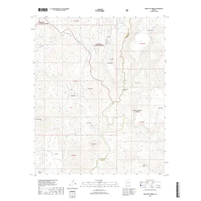
2018 Map of Verde Hot Springs
USGS Topo · Published 2018About this map
Verde Hot Springs sits along the winding course of the Verde River, marking a point of convergence for three national forests. The terrain is defined by dramatic elevation changes across Black Ridge, Skeleton Ridge, and the prominent Squaw Butte. A network of water sources, including Tanko Caliente and Warm Spring, highlights the hydrologic importance of this arid landscape.
Find a feature on this map
63 named features on this map. Tap any name to fly to it.
Don’t see what you’re looking for? This feature index may not catch every label — zoom into the map to look around manually.
Map Details
Editions of this 2018 Verde Hot Springs Map
This is the sole edition of this map. No revisions or reprints were ever made.
Other maps of this area

1887 · Verde
USGS Topo · 1:250,000

1892 · Verde
USGS Topo · 1:250,000

1929 · Turret Peak
USGS Topo · 1:125,000

1933 · Turret Peak
USGS Topo · 1:125,000

1954 · Holbrook
USGS Topo · 1:250,000

1957 · Holbrook
USGS Topo · 1:250,000

1958 · Holbrook
USGS Topo · 1:250,000

1960 · Holbrook
USGS Topo · 1:250,000
1967 · Tule Mesa
USGS Topo · 1:24,000
1967 · Hackberry Mtn.
USGS Topo · 1:24,000