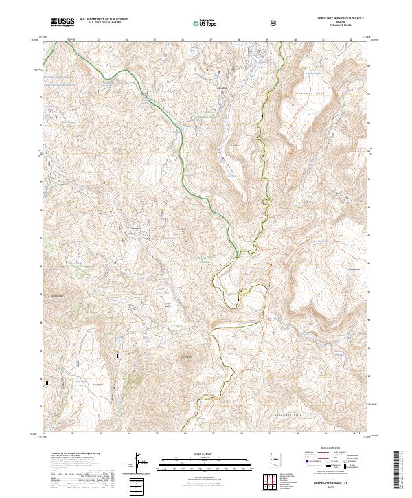
2023 Map of Verde Hot Springs
USGS Topo · Published 2023About this map
Verde Hot Springs and the confluence of several major drainage systems anchor this map of the Central Arizona highlands. The rugged intersection of the Verde Wild and Scenic River and the Fossil Creek Wild and Scenic River creates a landscape dominated by dramatic elevation changes, notably at Deadman Mesa and Ikes Backbone. Settlement is nearly absent in this protected corridor, represented only by the site of Lancaster amidst the vast reaches of the Mazatzal Wilderness and Pine Mountain Wilderness. The map details an intricate network of water management features, including Coldwater Tank Number One and Headquarter Tank, which support the high-desert environment. This area serves as a critical boundary zone, where the borders of Gila and Yavapai counties meet along the winding path of the East Verde River.
Find a feature on this map
60 named features on this map. Tap any name to fly to it.
Don’t see what you’re looking for? This feature index may not catch every label — zoom into the map to look around manually.
Map Details
Editions of this 2023 Verde Hot Springs Map
This is the sole edition of this map. No revisions or reprints were ever made.
Other maps of this area

1887 · Verde
USGS Topo · 1:250,000

1892 · Verde
USGS Topo · 1:250,000

1929 · Turret Peak
USGS Topo · 1:125,000

1933 · Turret Peak
USGS Topo · 1:125,000

1954 · Holbrook
USGS Topo · 1:250,000

1957 · Holbrook
USGS Topo · 1:250,000

1958 · Holbrook
USGS Topo · 1:250,000

1960 · Holbrook
USGS Topo · 1:250,000
1967 · Tule Mesa
USGS Topo · 1:24,000
1967 · Hackberry Mtn.
USGS Topo · 1:24,000