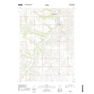
2017 Map of Verdigre
USGS Topo · Published 2017About this map
Verdigre serves as the central hub of this Knox County landscape, situated at the confluence of several vital waterways in the late 2010s. The village is flanked by the Riverside Cem and Saint Wenceslaus Cem, providing significant points of interest for genealogists tracing local families. The terrain is defined by the winding course of Verdigre Creek, which is fed by the North Branch Verdigre Creek and Middle Branch Verdigre Creek. These water systems cut through the agricultural sections, where Sukup Reservoir and a network of section-line roads like 881 Rd and 875 Rd connect dispersed homesteads. To the northeast, the Missouri National Recreation River represents a protected corridor of the Nebraska-South Dakota borderlands, emphasizing the transition from township farming to preserved riverine environments.
Find a feature on this map
28 named features on this map. Tap any name to fly to it.
Don’t see what you’re looking for? This feature index may not catch every label — zoom into the map to look around manually.
Map Details
Editions of this 2017 Verdigre Map
This is the sole edition of this map. No revisions or reprints were ever made.
Other maps of this area

1950 · Verdigre NE
USGS Topo · 1:24,000

1950 · Pishelville
USGS Topo · 1:24,000

1954 · Walnut
USGS Topo · 1:24,000

1954 · Verdigre
USGS Topo · 1:24,000

1955 · Sioux City
USGS Topo · 1:250,000

1955 · O'Neill
USGS Topo · 1:250,000

1958 · Sioux City
USGS Topo · 1:250,000

1959 · O'Neill
USGS Topo · 1:250,000

1959 · Sioux City
USGS Topo · 1:250,000

1963 · Orchard NE
USGS Topo · 1:24,000