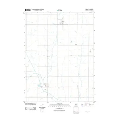
2011 Map of Verdon
USGS Topo · Published 2011About this map
Verdon and Shubert anchor this Richardson County landscape, where the agricultural grid is defined by a network of local roads such as Verdon Rd and 37th St. The area is notably rich in genealogical sites, preserved through the presence of several distinct burial grounds including New Saint Anns Cemetery, Cupola Cemetery, Cornell Cemetery, and Verdon Cemetery. These landmarks, along with the Shubert Post Office and Verdon Post Office, trace the distribution of small-town civic life across the eastern Nebraska plains.
Find a feature on this map
24 named features on this map. Tap any name to fly to it.
Don’t see what you’re looking for? This feature index may not catch every label — zoom into the map to look around manually.
Map Details
Editions of this 2011 Verdon Map
This is the sole edition of this map. No revisions or reprints were ever made.
Other maps of this area

1915 · Falls City
USGS Topo · 1:62,500

1915 · Nemaha
USGS Topo · 1:62,500

1915 · Howe
USGS Topo · 1:62,500

1916 · Humboldt
USGS Topo · 1:62,500

1939 · Nemaha
USGS Topo · 1:62,500

1949 · Nemaha
USGS Topo · 1:62,500

1955 · Nebraska City
USGS Topo · 1:250,000

1957 · Nebraska City
USGS Topo · 1:250,000

1958 · Nebraska City
USGS Topo · 1:250,000
1965 · Salem
USGS Topo · 1:24,000