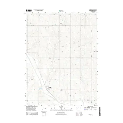
2014 Map of Verdon
USGS Topo · Published 2014About this map
Shubert and Verdon anchor this Richardson County landscape, where the agricultural grid is deeply etched by a complex drainage network. Water is a defining element of the terrain, from Verdon Lake in the south to the meandering courses of Muddy Cr, Mackelroy Cr, and Sardine Cr. These waterways create natural breaks in the systematic road layout of numbered avenues and roads, such as 647 Ave and 715 Rd.
Find a feature on this map
43 named features on this map. Tap any name to fly to it.
Don’t see what you’re looking for? This feature index may not catch every label — zoom into the map to look around manually.
Map Details
Editions of this 2014 Verdon Map
This is the sole edition of this map. No revisions or reprints were ever made.
Other maps of this area

1915 · Falls City
USGS Topo · 1:62,500

1915 · Nemaha
USGS Topo · 1:62,500

1915 · Howe
USGS Topo · 1:62,500

1916 · Humboldt
USGS Topo · 1:62,500

1939 · Nemaha
USGS Topo · 1:62,500

1949 · Nemaha
USGS Topo · 1:62,500

1955 · Nebraska City
USGS Topo · 1:250,000

1957 · Nebraska City
USGS Topo · 1:250,000

1958 · Nebraska City
USGS Topo · 1:250,000
1965 · Salem
USGS Topo · 1:24,000