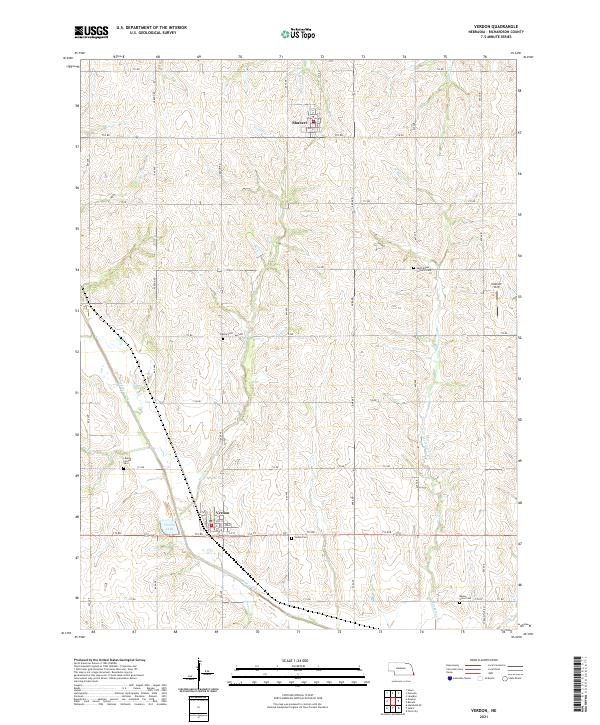
2021 Map of Verdon
USGS Topo · Published 2021About this map
The village of Verdon and its neighboring settlement Shubert anchor this study of the rural landscape in Richardson County. The terrain is defined by a dense network of drainage, where Muddy Creek and its many tributaries, including Sardine Cr and Whisky Run, carve out the rolling topography of southeast Nebraska. The land division follows a rigid section grid of rural roads like Verdon Rd and 648 Ave, yet the placement of numerous cemeteries—such as Maple Grove Cem, Cupola Cem, and Liberty - Cornell Cem—speaks to the deep generational ties of the farming community. Local landmarks like Verdon Lake and the Eickhoff Strip provide specific points of reference within the agricultural sections of t2n r15e and t3n r15e.
Find a feature on this map
49 named features on this map. Tap any name to fly to it.
Don’t see what you’re looking for? This feature index may not catch every label — zoom into the map to look around manually.
Map Details
Editions of this 2021 Verdon Map
This is the sole edition of this map. No revisions or reprints were ever made.
Other maps of this area

1915 · Falls City
USGS Topo · 1:62,500

1915 · Nemaha
USGS Topo · 1:62,500

1915 · Howe
USGS Topo · 1:62,500

1916 · Humboldt
USGS Topo · 1:62,500

1939 · Nemaha
USGS Topo · 1:62,500

1949 · Nemaha
USGS Topo · 1:62,500

1955 · Nebraska City
USGS Topo · 1:250,000

1957 · Nebraska City
USGS Topo · 1:250,000

1958 · Nebraska City
USGS Topo · 1:250,000
1965 · Salem
USGS Topo · 1:24,000