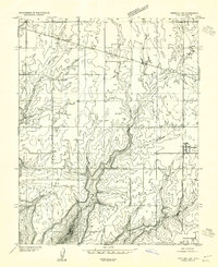
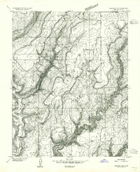
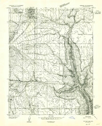
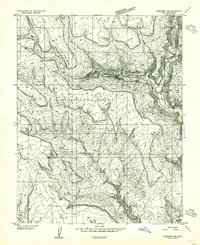
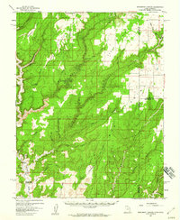
1955 Map of Verdure 1 SW
USGS Topo · Published 1955About this map
The small settlement of Eastland sits at a crossroads in the high desert landscape of San Juan County, recorded here during a mid-1950s survey. This era shows a network of water management features, including several unnamed Ponds and a Reservoir, supporting the high-altitude agricultural efforts of the region. The landscape is defined by its dramatic topography, featuring prominent landmarks such as Boulder Point, Ginger Hill, and Pearson Point, which drop away into the deeply incised drainage of Boulder Creek.
Find a feature on this map
18 named features on this map. Tap any name to fly to it.
Don’t see what you’re looking for? This feature index may not catch every label — zoom into the map to look around manually.
Map Details
Editions of this 1955 Verdure 1 SW Map
This is the sole edition of this map. No revisions or reprints were ever made.
Other maps of this area

1886 · Abajo
USGS Topo · 1:250,000

1892 · Abajo
USGS Topo · 1:250,000

1893 · Abajo
USGS Topo · 1:250,000
1955 · Verdure 4 NW
USGS Topo · 1:24,000
1955 · Verdure 2 SE
USGS Topo · 1:24,000
1955 · Verdure 3 NE
USGS Topo · 1:24,000

1956 · Cortez
USGS Topo · 1:250,000
1957 · Monument Canyon
USGS Topo · 1:62,500
1957 · Blanding
USGS Topo · 1:62,500
1957 · Eastland
USGS Topo · 1:62,500