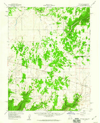
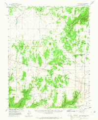
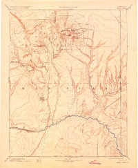
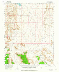
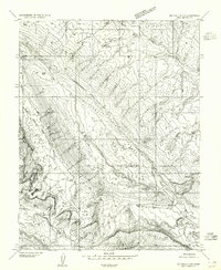
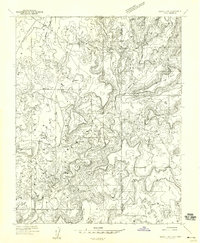
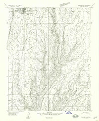
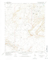
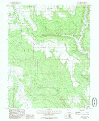
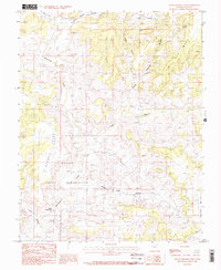
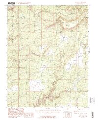
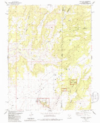
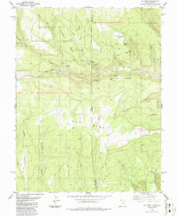
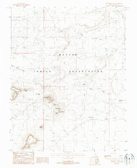
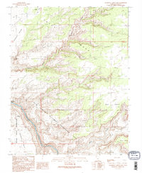
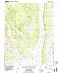
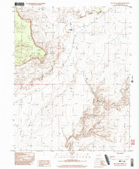
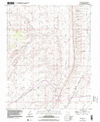
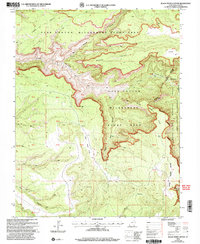
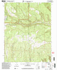
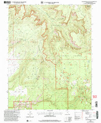
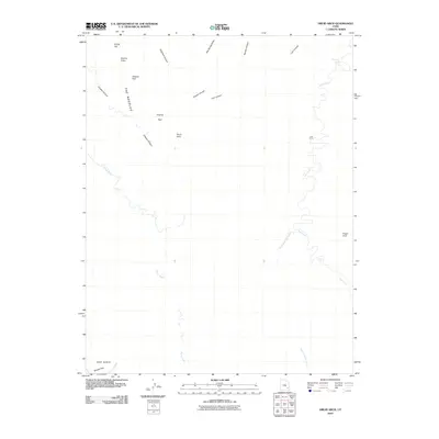
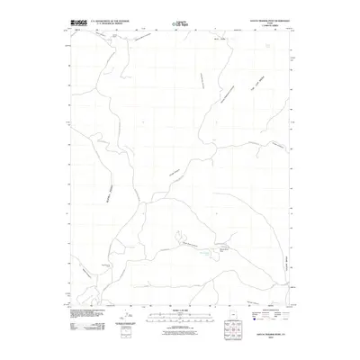
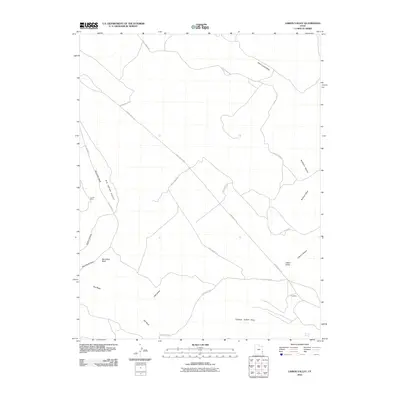
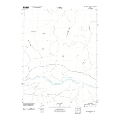
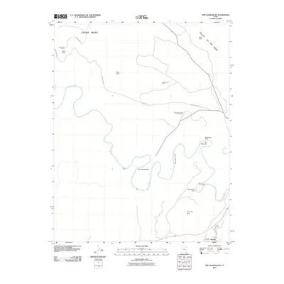
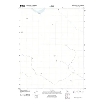
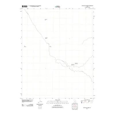
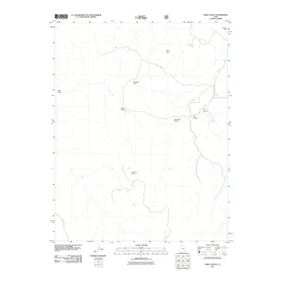
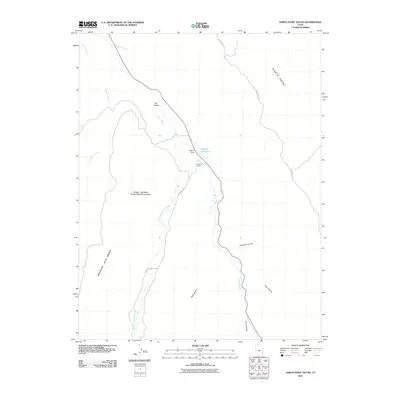
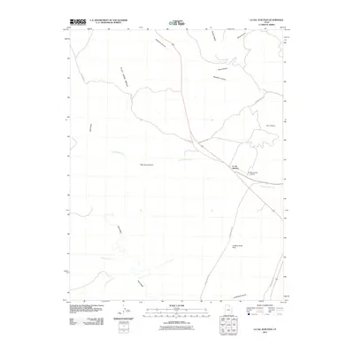
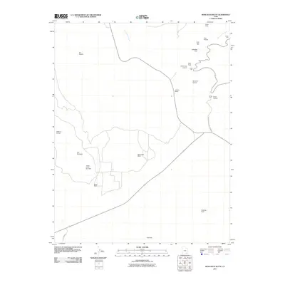
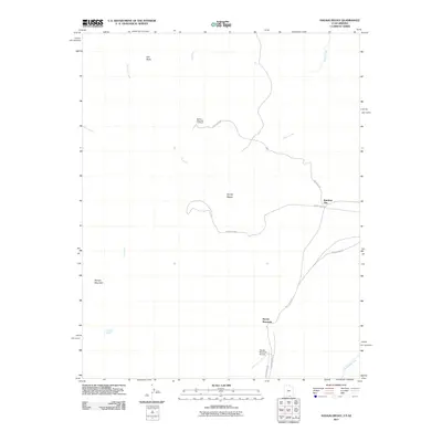
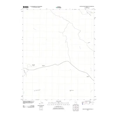
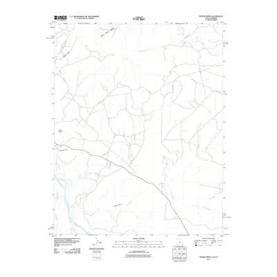
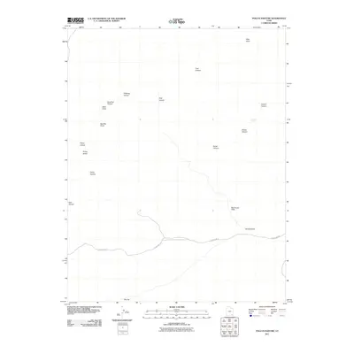
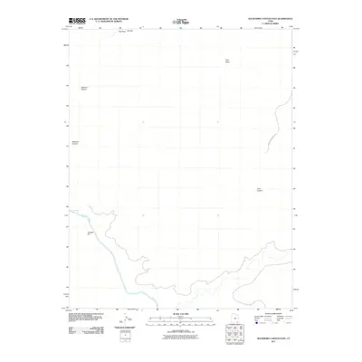
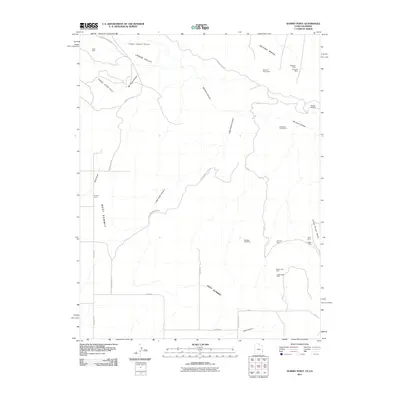
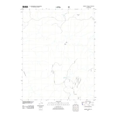
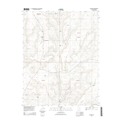
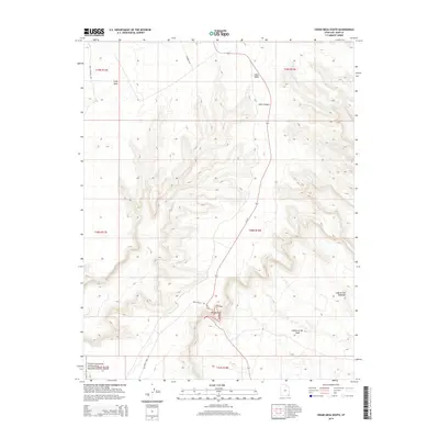
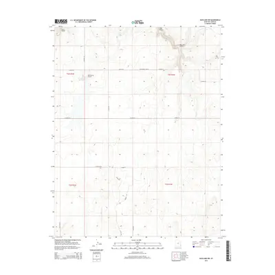
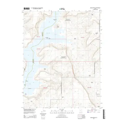
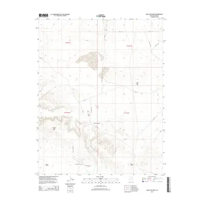
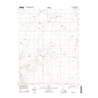
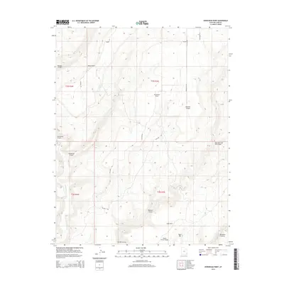
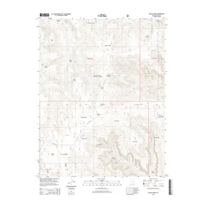
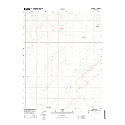
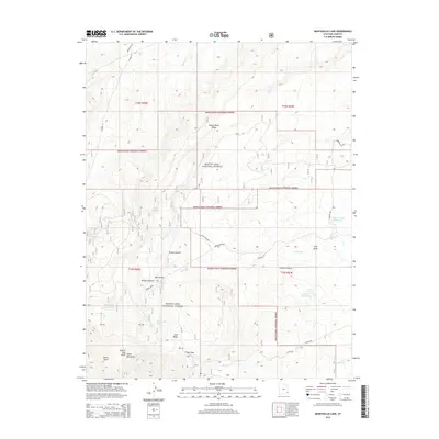
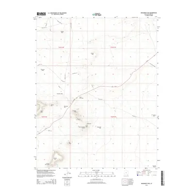
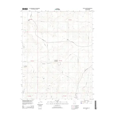
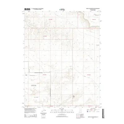
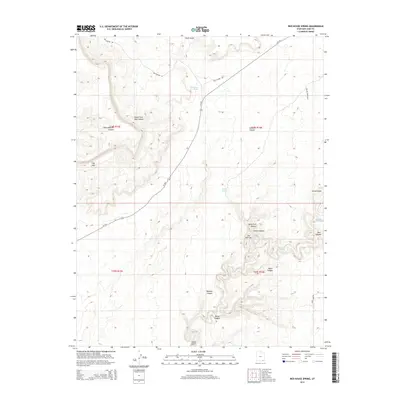
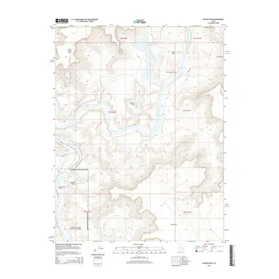
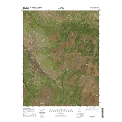
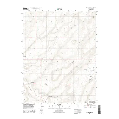
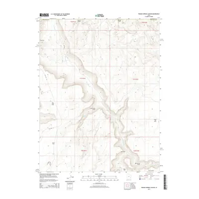
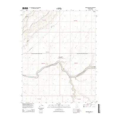
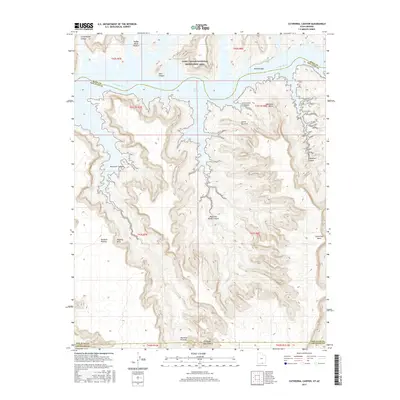
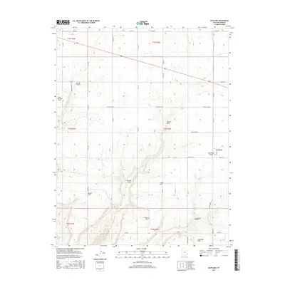
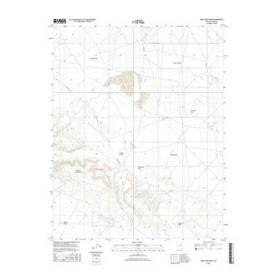
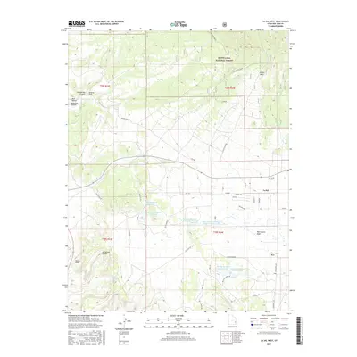
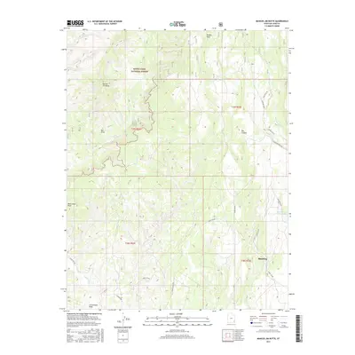
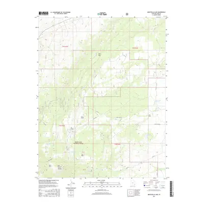
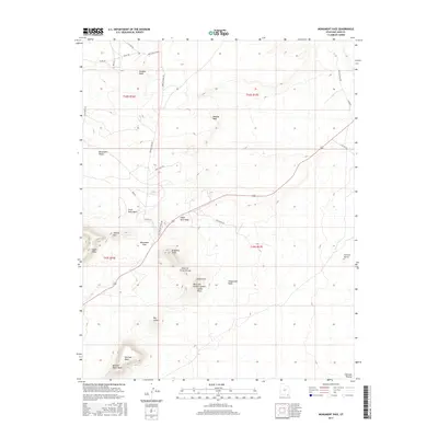
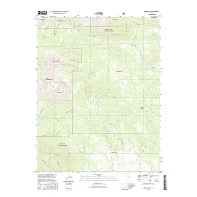
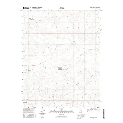
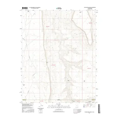
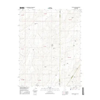
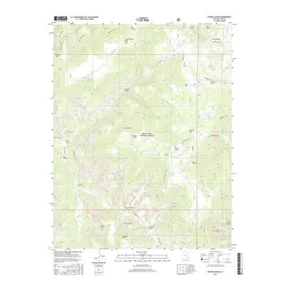
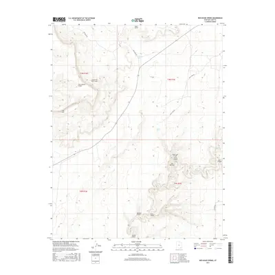
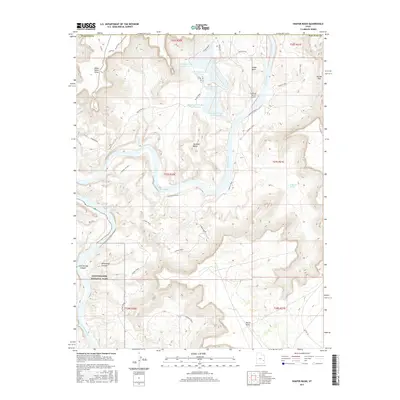
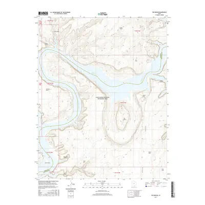
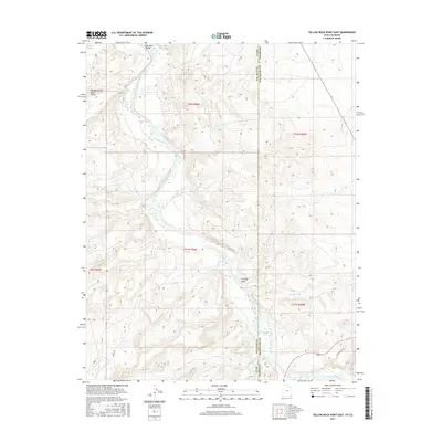
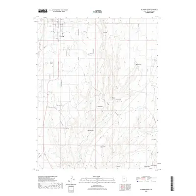
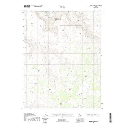
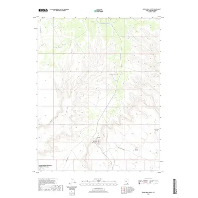
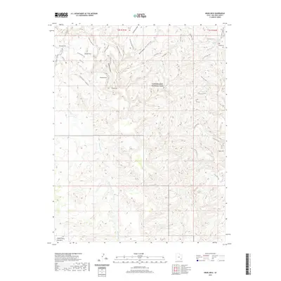
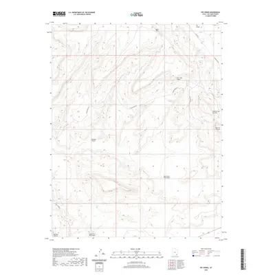
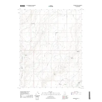
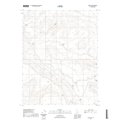
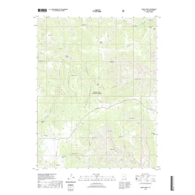
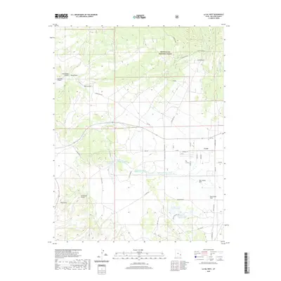
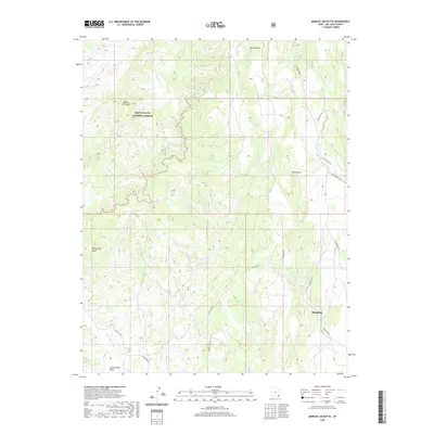
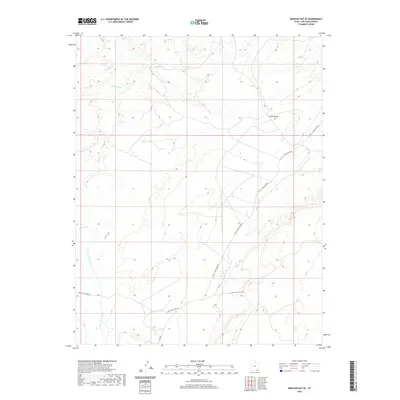
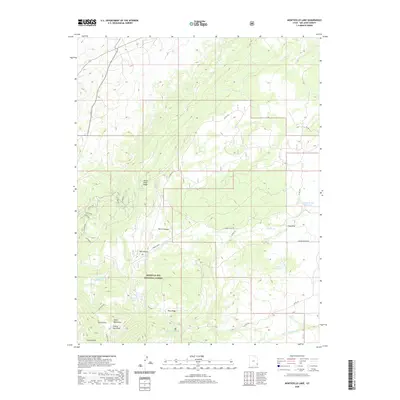
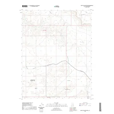
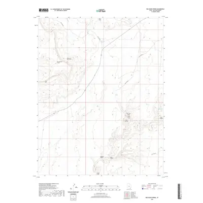
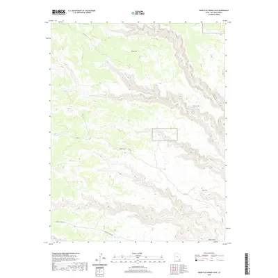
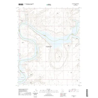
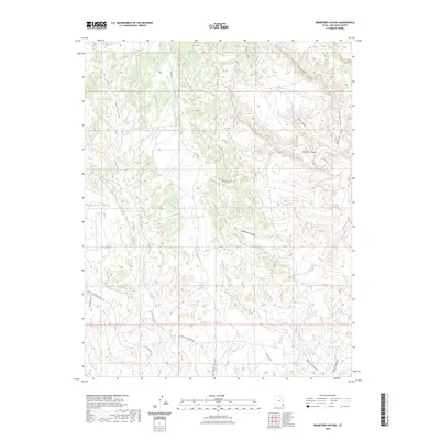
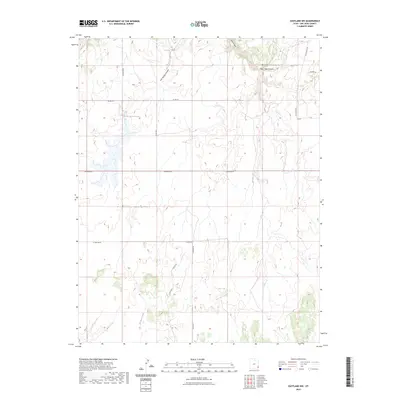
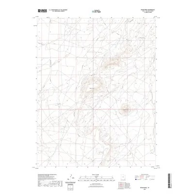
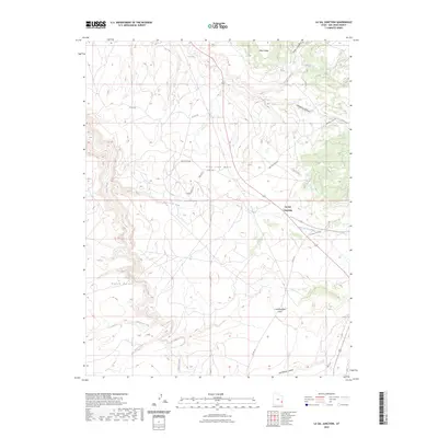
1957 Map of Eastland
USGS Topo · Published 1960About this map
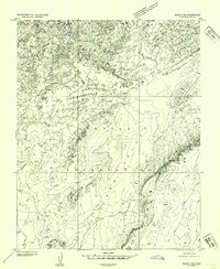
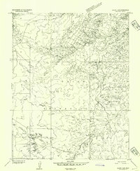
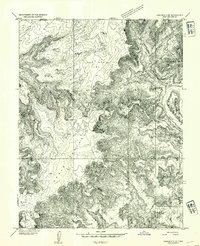
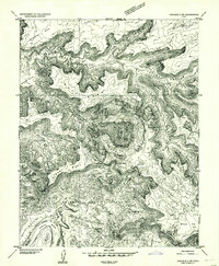
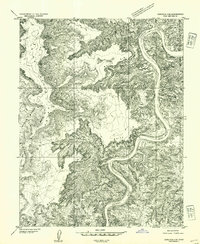
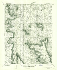
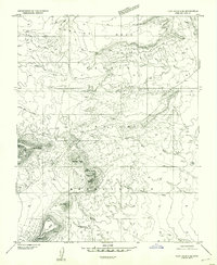
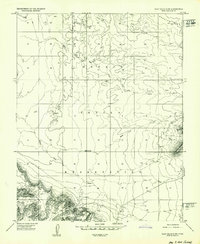
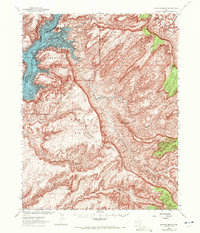
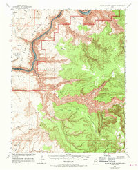
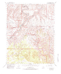
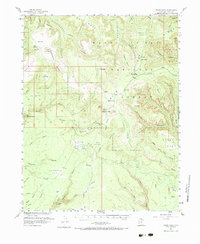
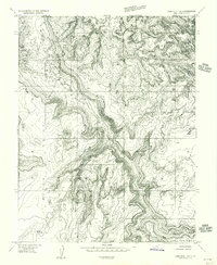
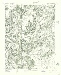
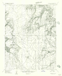
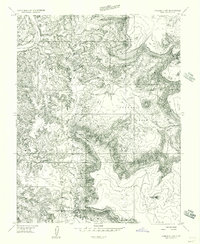
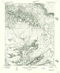
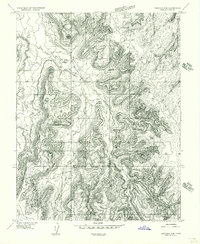
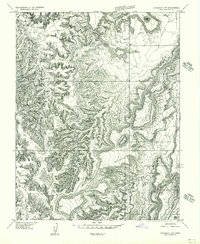
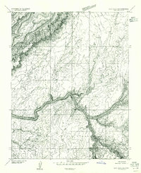
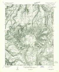
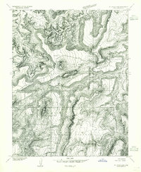
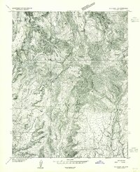
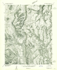
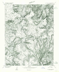
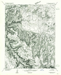
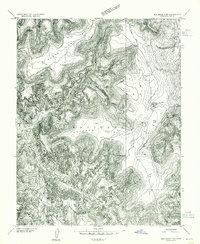
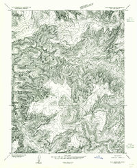
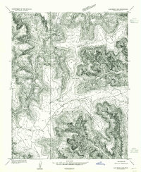
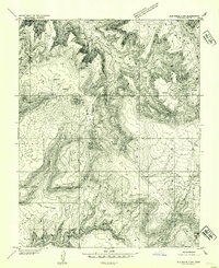
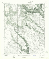
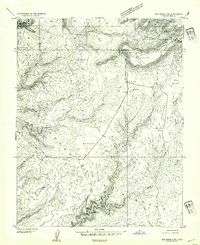
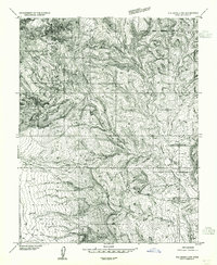
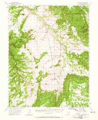
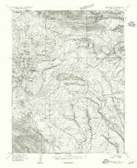
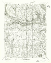
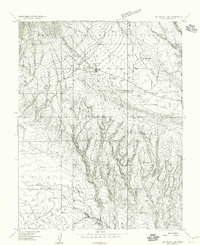
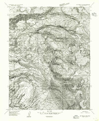
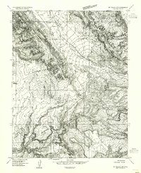
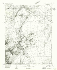
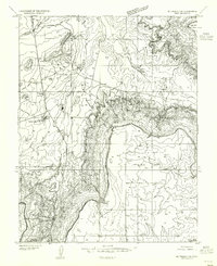
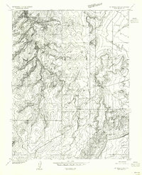
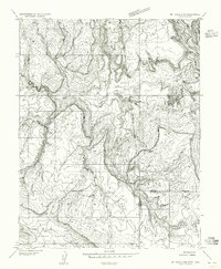
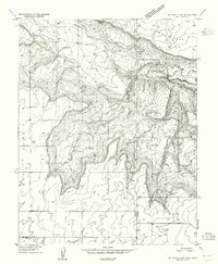
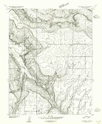
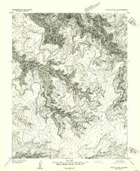
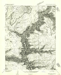
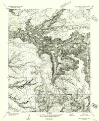
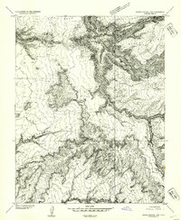
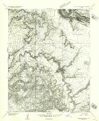
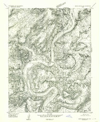
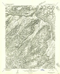
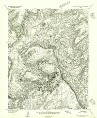
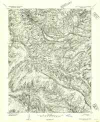
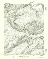
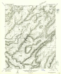
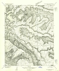
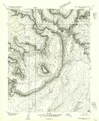
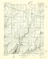
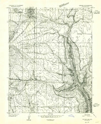
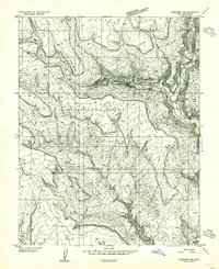
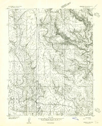
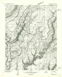
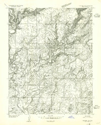
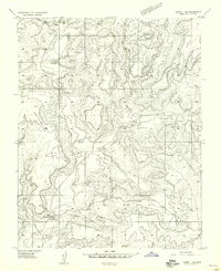
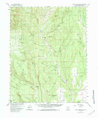
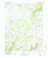
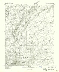
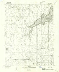
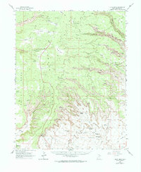
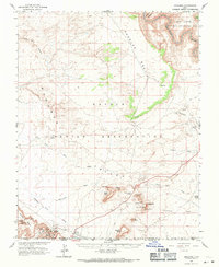
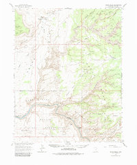
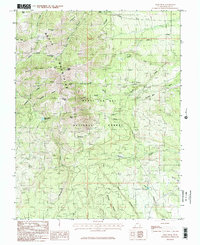
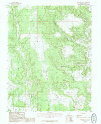
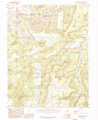
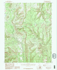
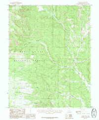
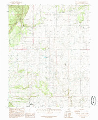
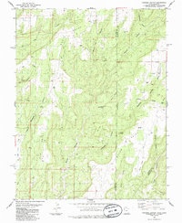
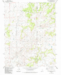
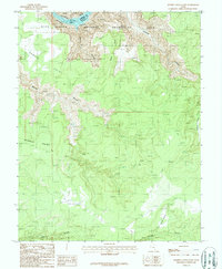
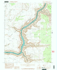
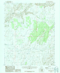
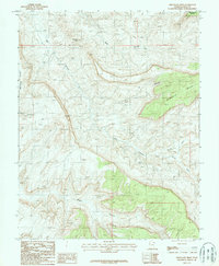
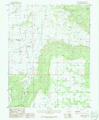
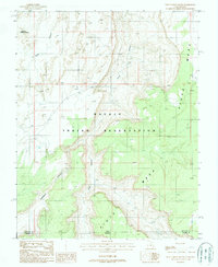
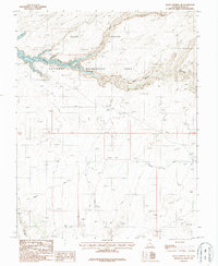
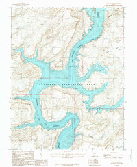
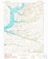
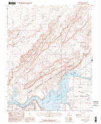
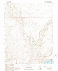
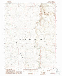
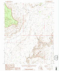
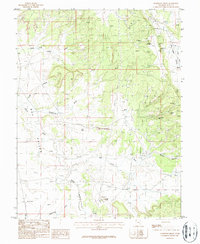
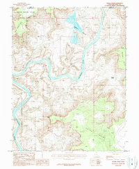
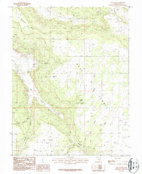
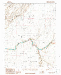
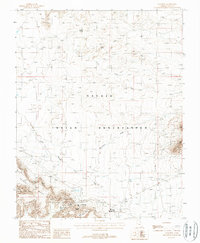
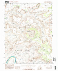
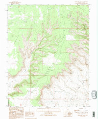
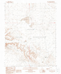
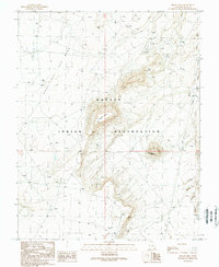
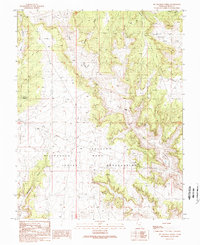
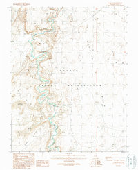
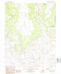
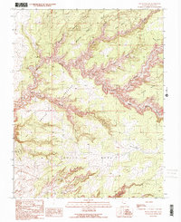
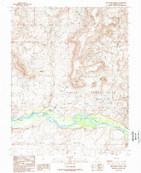
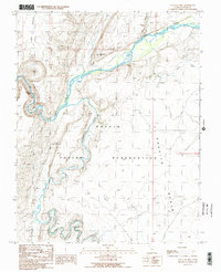
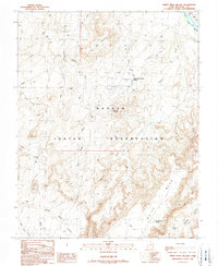
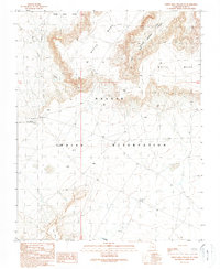
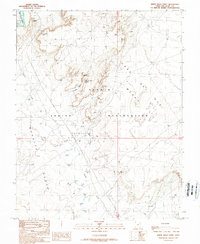
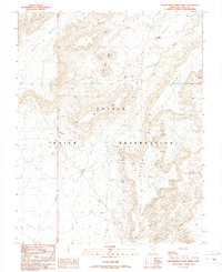
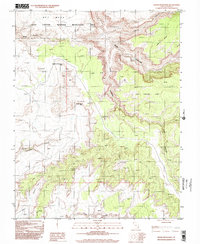
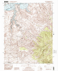
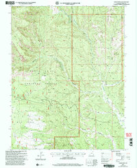
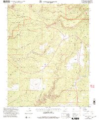
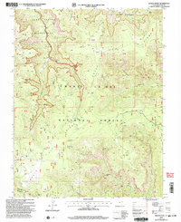
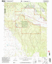
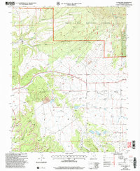
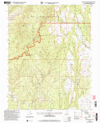
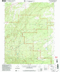
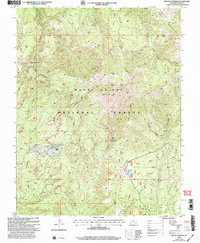
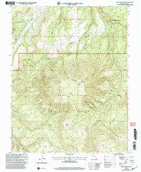
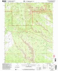
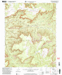
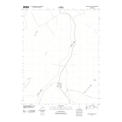
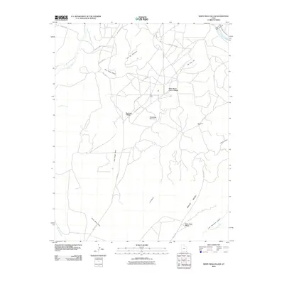
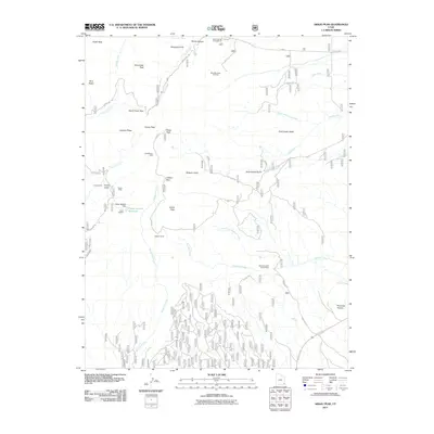
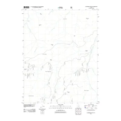
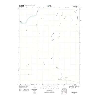
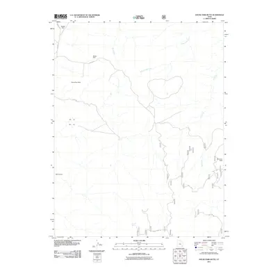
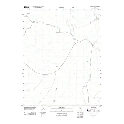
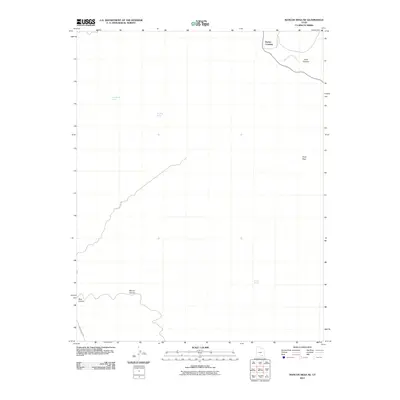
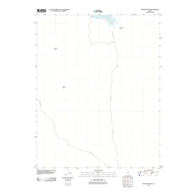
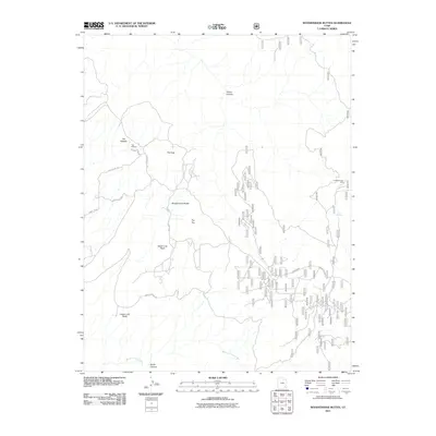
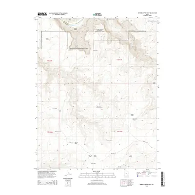
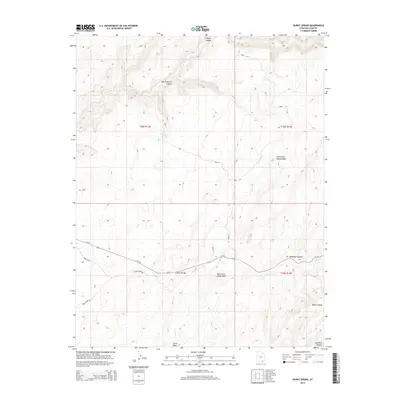
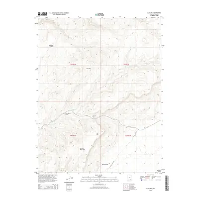
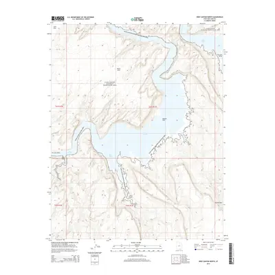
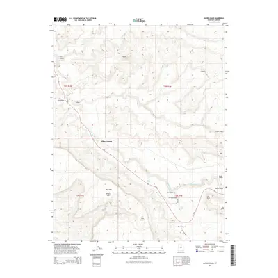
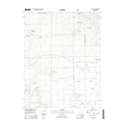
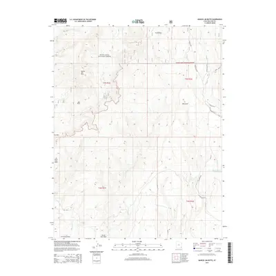
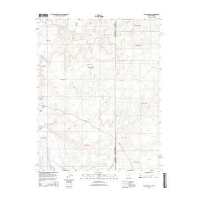
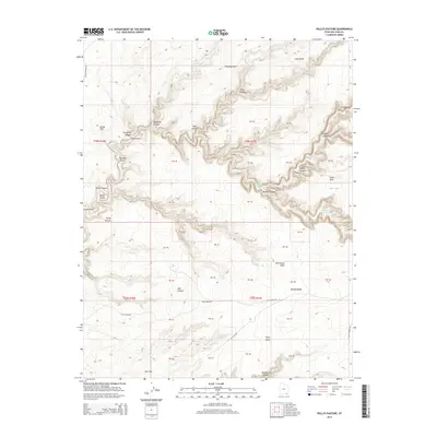
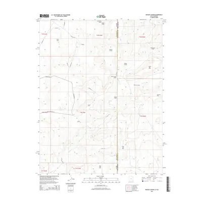
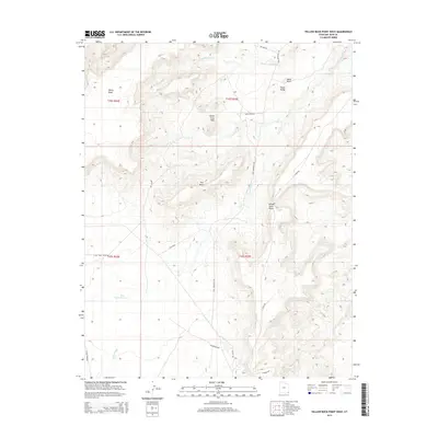
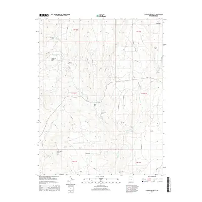
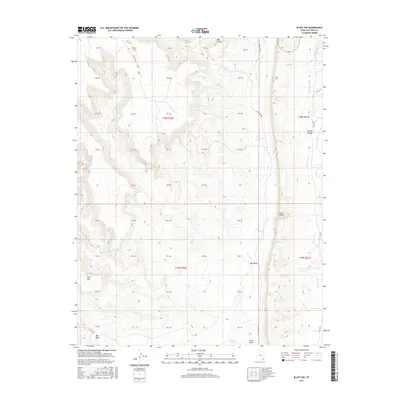
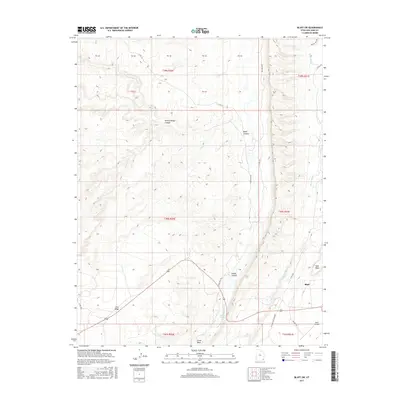
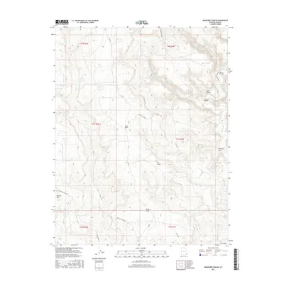
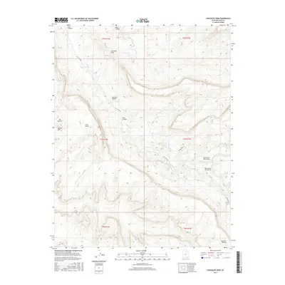
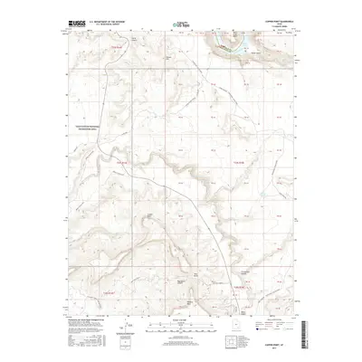
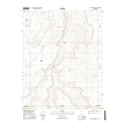
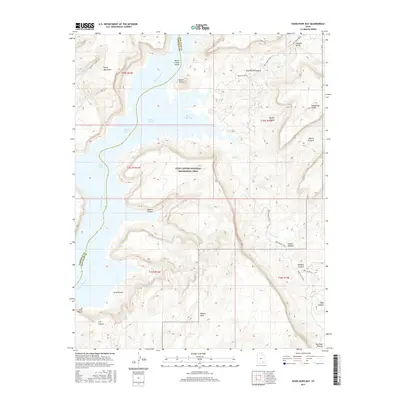
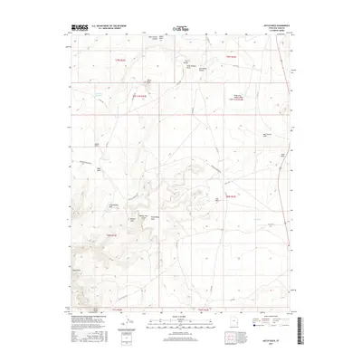
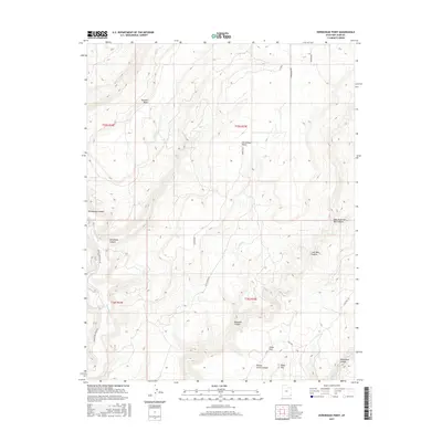
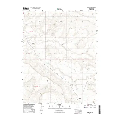
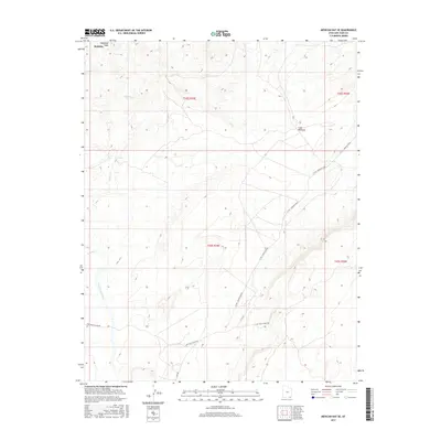
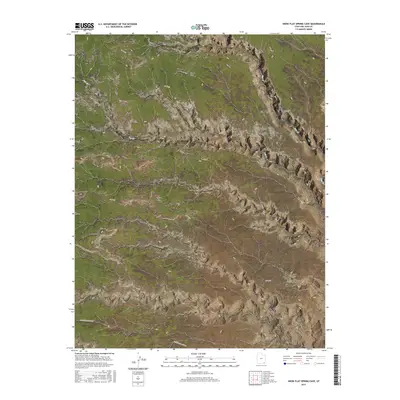
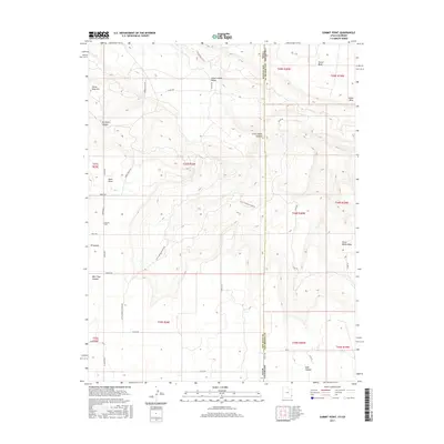
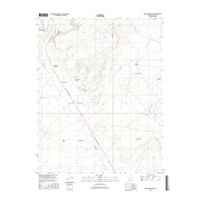
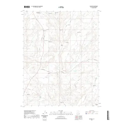
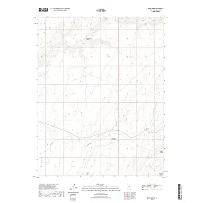
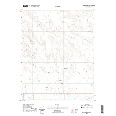
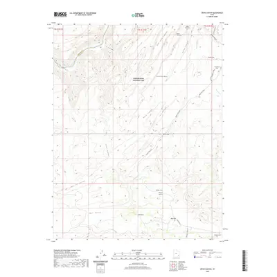
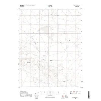
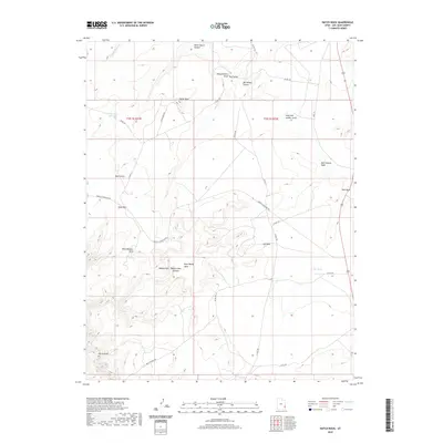
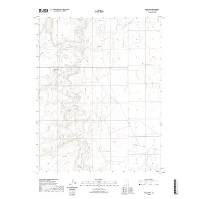
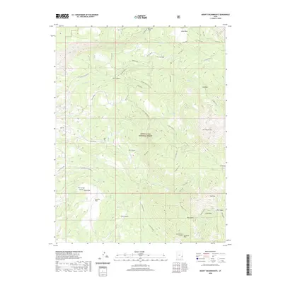
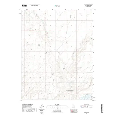
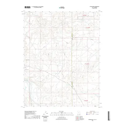
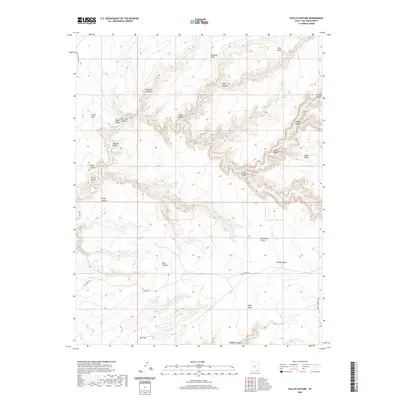
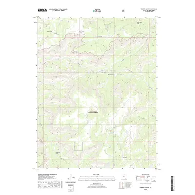
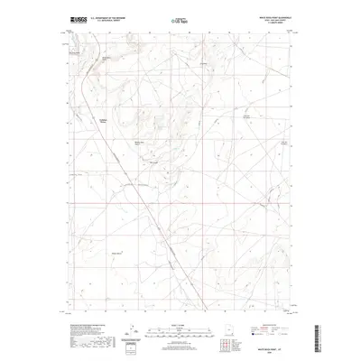
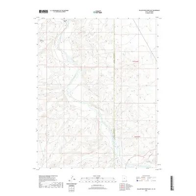
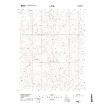
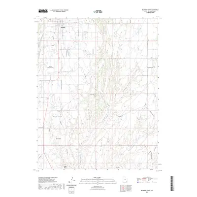
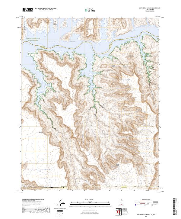
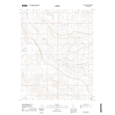
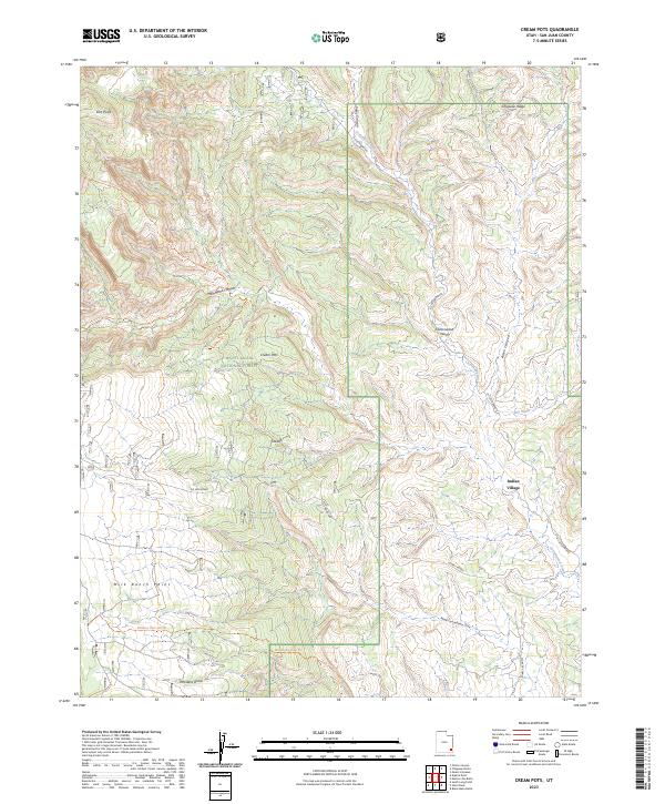
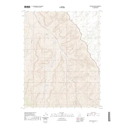
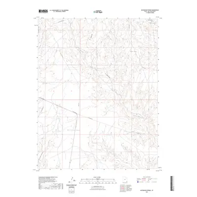
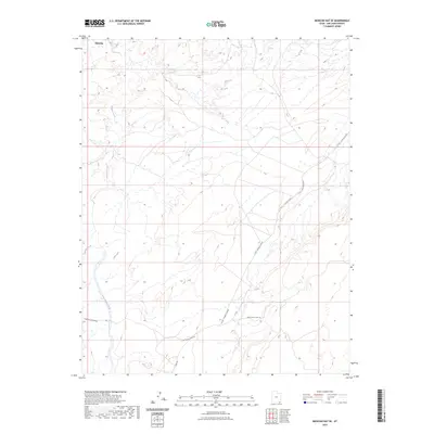
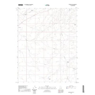
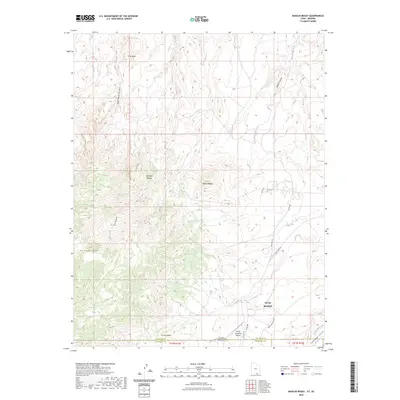
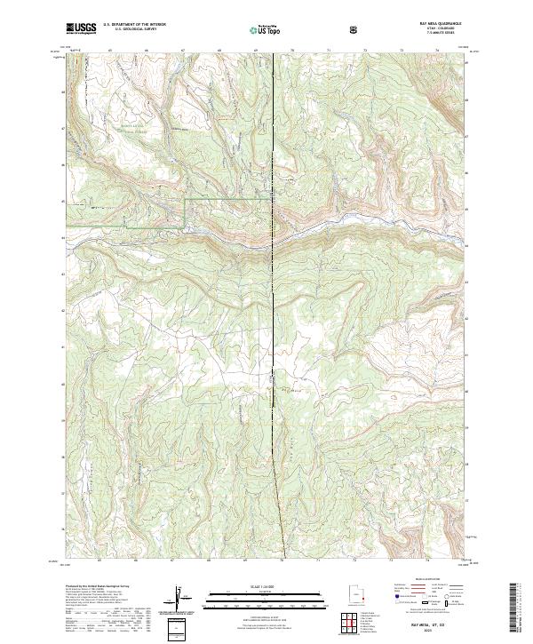
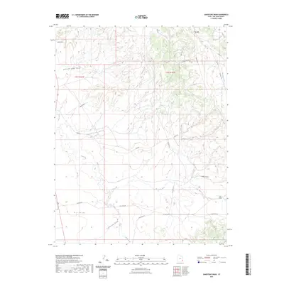
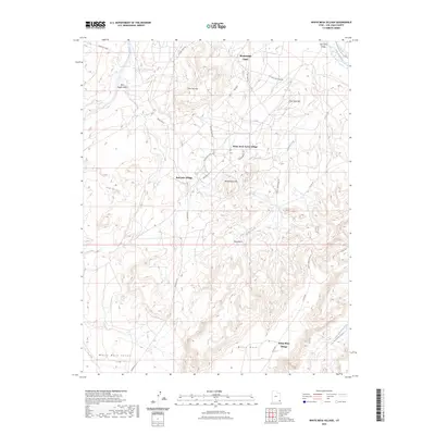
Eastland and the nearby communities of Lockerby and Northdale anchor this high-plateau landscape on the border of Utah and Colorado. The map reflects a mid-century period of local infrastructure, showing the Valley View Cemetery and rural education hubs like the East Summit School and Burn School. This survey was conducted in collaboration with the Atomic Energy Commission, hinting at the era's regional interest in mineral resources. The terrain is deeply incised by drainages such as Peterson Wash and Coal Bed Creek, which cut through a series of summits and points. Notable landmarks include the family-named Pearsons Point and Ginger Hill, while the presence of a Shaft and several pipelines indicates an active industrial footprint. From the high elevation of Piute Knoll to the lower reaches of Montezuma Canyon, the map preserves a specific moment of agricultural and industrial settlement in San Juan County.
Find a feature on this map
54 named features on this map. Tap any name to fly to it.
Don’t see what you’re looking for? This feature index may not catch every label — zoom into the map to look around manually.
Map Details
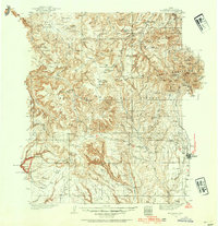
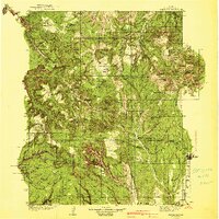
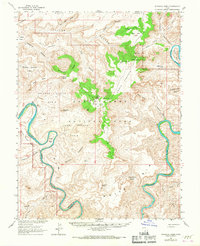
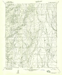
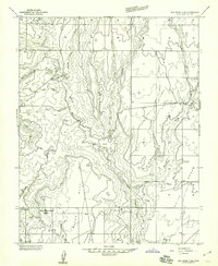
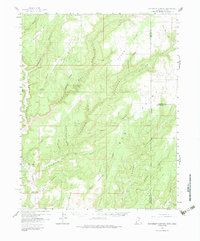
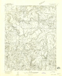
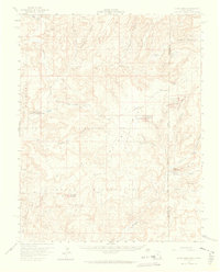
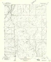
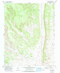
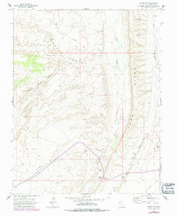
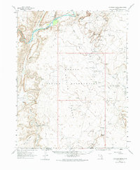
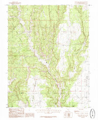
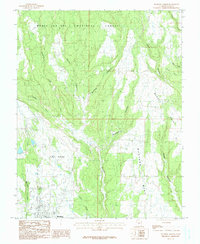
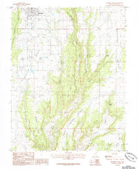
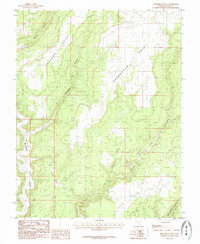
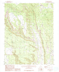
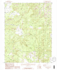
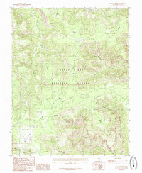
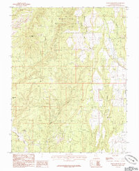
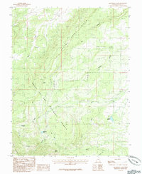
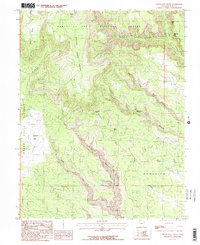
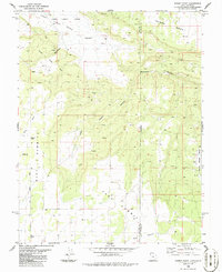
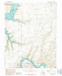
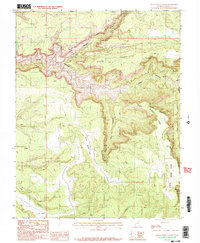
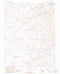
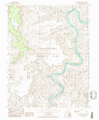
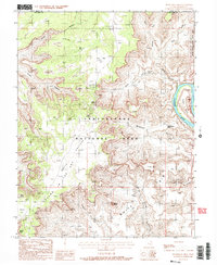
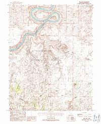
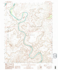
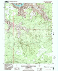
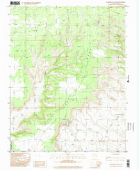
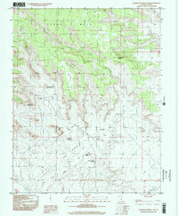
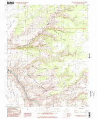
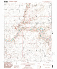
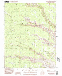
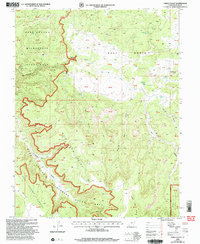
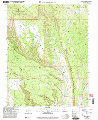
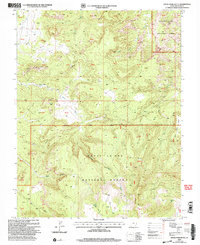
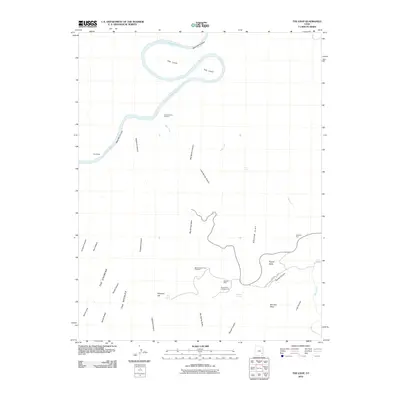
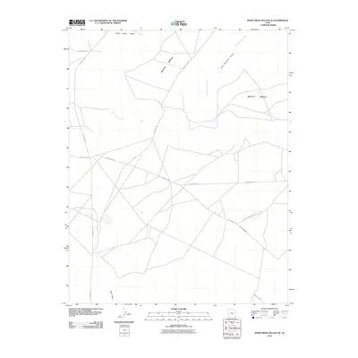
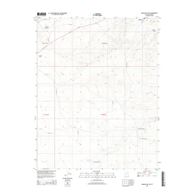
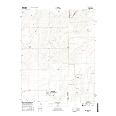
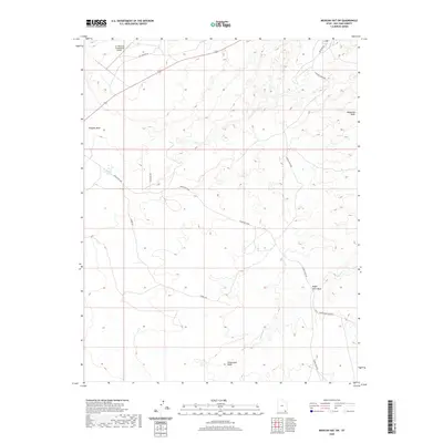
Editions of this 1957 Eastland Map
4 editions found
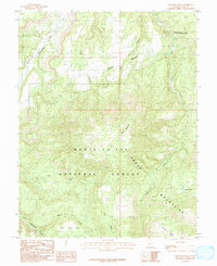
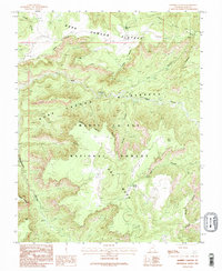
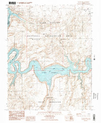
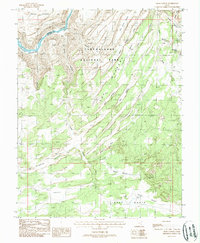
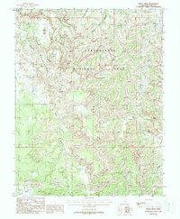
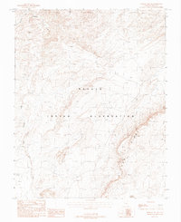
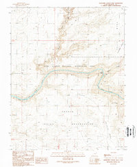
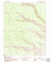
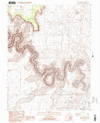
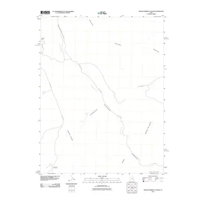
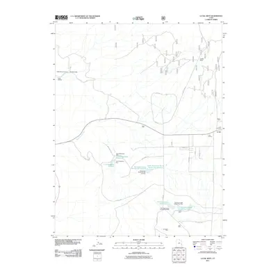
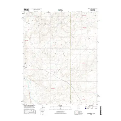
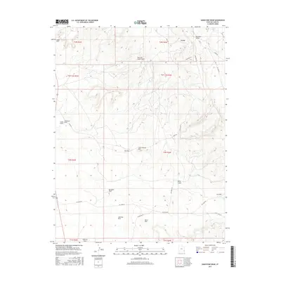
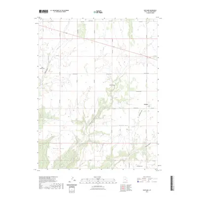
Historical Maps of Northdale Through Time
958 maps found

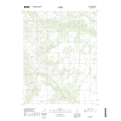
1886 Abajo
San Juan County, UT

1886 Henry Mountains
San Juan County, UT

1892 Abajo
San Juan County, UT
1892 Henry Mountains
San Juan County, UT
1893 Abajo
San Juan County, UT
1935 Elk Ridge
San Juan County, UT
1940 Elk Ridge
San Juan County, UT
1951 Upheaval Dome
San Juan County, UT
1952 Bluff 3 SE
San Juan County, UT
1952 Bluff 3 SW
San Juan County, UT
1952 Carlisle 2 NE
San Juan County, UT
1952 Carlisle 2 NW
San Juan County, UT
1952 Carlisle 2 SE
San Juan County, UT
1952 Carlisle 2 SW
San Juan County, UT
1952 Clay Hills 3 NW
San Juan County, UT
1952 Clay Hills 3 SE
San Juan County, UT
1952 Clay Hills 3 SW
San Juan County, UT
1952 Clay Hills 4 SE
San Juan County, UT
1952 Clay Hills 4 SW
San Juan County, UT
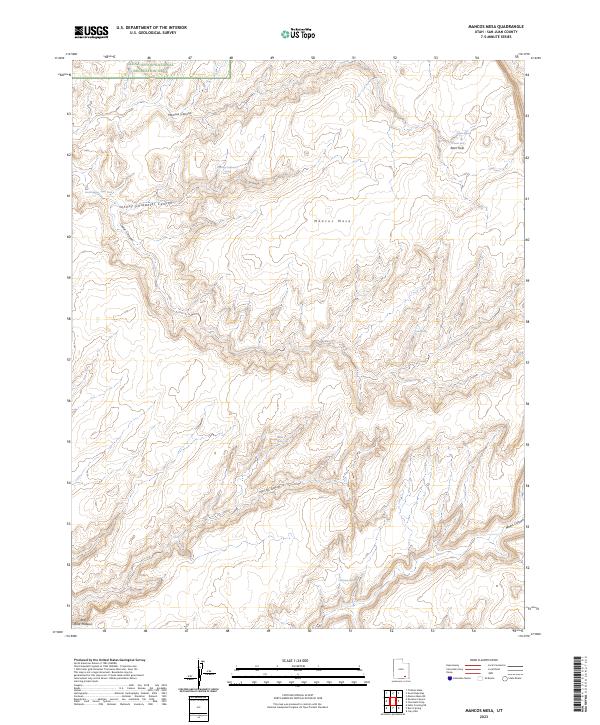
1952 Mancos Mesa
San Juan County, UT
1952 Mouth of Dark Canyon
San Juan County, UT
1952 Natural Bridges
San Juan County, UT
1952 Navajo Mountain 4 NE
San Juan County, UT
1952 Navajo Mtn. 4 SE
San Juan County, UT
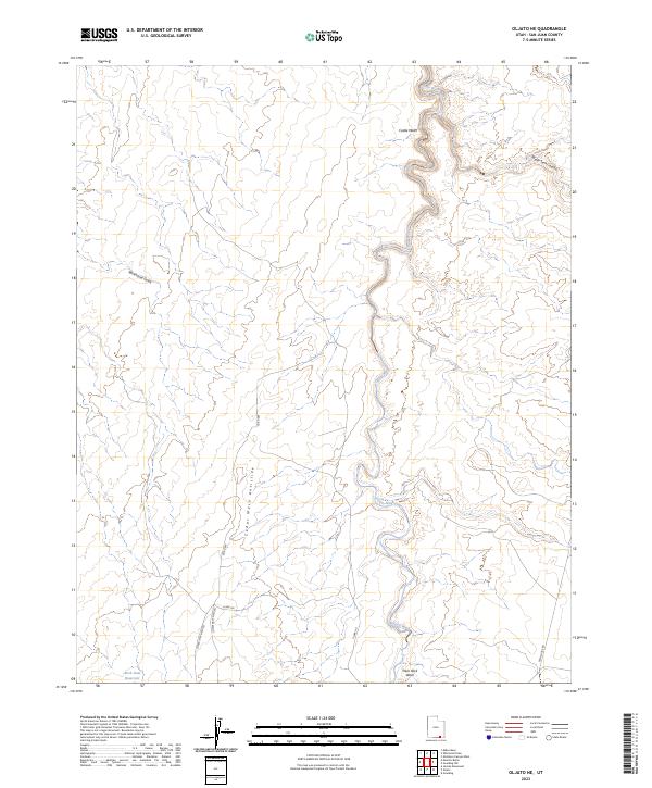
1952 Oljeto
San Juan County, UT
1953 Lake Canyon
San Juan County, UT
1953 Navajo Mountain 4 NW
San Juan County, UT
1953 Navajo Mountain 4 SW
San Juan County, UT
1953 The Needles
San Juan County, UT
1954 Bears Ears
San Juan County, UT
1954 Carlisle 1 NE
San Juan County, UT
1954 Carlisle 1 NW
San Juan County, UT
1954 Carlisle 1 SE
San Juan County, UT
1954 Carlisle 1 SW
San Juan County, UT

1954 Carlisle 4 NE
San Juan County, UT
1954 Carlisle 4 NW
San Juan County, UT
1954 Carlisle 4 SE
San Juan County, UT
1954 Carlisle 4 SW
San Juan County, UT
1954 Clay Hills 1 NW
San Juan County, UT
1954 Clay Hills 2 NE
San Juan County, UT
1954 Clay Hills 2 NW
San Juan County, UT
1954 Clay Hills 2 SE
San Juan County, UT
1954 Clay Hills 2 SW
San Juan County, UT
1954 Clay Hills 3 NE
San Juan County, UT
1954 Clay Hills
San Juan County, UT
1954 Elk Ridge 1 NE
San Juan County, UT
1954 Elk Ridge 1 NW
San Juan County, UT
1954 Elk Ridge 1 SE
San Juan County, UT
1954 Elk Ridge 1 SW
San Juan County, UT
1954 Elk Ridge 2 NE
San Juan County, UT
1954 Elk Ridge 2 NW
San Juan County, UT
1954 Elk Ridge 2 SE
San Juan County, UT
1954 Elk Ridge 2 SW
San Juan County, UT
1954 Elk Ridge 3 NE
San Juan County, UT
1954 Elk Ridge 3 NW
San Juan County, UT
1954 Elk Ridge 3 SE
San Juan County, UT
1954 Elk Ridge 3 SW
San Juan County, UT
1954 Elk Ridge 4 NW
San Juan County, UT
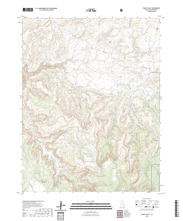
1954 Fable Valley
San Juan County, UT
1954 Harts Point
San Juan County, UT
1954 Hatch Point
San Juan County, UT
1954 Hatch Rock
San Juan County, UT
1954 La Sal Junction
San Juan County, UT
1954 Lisbon Valley
San Juan County, UT
1954 Mount Linnaeus
San Juan County, UT
1954 Mt Peale 1 NW
San Juan County, UT
1954 Mt Peale 1 SE
San Juan County, UT
1954 Mt Peale 1 SW
San Juan County, UT
1954 Mt Peale 2 NE
San Juan County, UT
1954 Mt Peale 2 NW
San Juan County, UT
1954 Mt Peale 2 SE
San Juan County, UT
1954 Mt Peale 2 SW
San Juan County, UT
1954 Mt Peale 3 NE
San Juan County, UT
1954 Mt Peale 3 NW
San Juan County, UT
1954 Mt Peale 3 SE
San Juan County, UT
1954 Mt Peale 3 SW
San Juan County, UT
1954 Mt Peale 4 NE
San Juan County, UT
1954 Mt Peale 4 NW
San Juan County, UT
1954 Mt Peale 4 SE
San Juan County, UT
1954 Mt Peale 4 SW
San Juan County, UT
1954 White Canyon 1 NE
San Juan County, UT
1954 White Canyon 1 NW
San Juan County, UT
1954 White Canyon 1 SE
San Juan County, UT
1954 White Canyon 1 SW
San Juan County, UT
1954 White Canyon 2 SE
San Juan County, UT
1954 White Canyon 2 SW
San Juan County, UT
1954 White Canyon 3 NE
San Juan County, UT
1954 White Canyon 3 NW
San Juan County, UT
1954 White Canyon 3 SE
San Juan County, UT
1954 White Canyon 3 SW
San Juan County, UT
1954 White Canyon 4 NE
San Juan County, UT
1954 White Canyon 4 NW
San Juan County, UT
1954 White Canyon 4 SE
San Juan County, UT
1954 White Canyon 4 SW
San Juan County, UT
1955 Carlisle 3 NE
San Juan County, UT
1955 Carlisle 3 SE
San Juan County, UT
1955 Carlisle 3 SW
San Juan County, UT
1955 Verdure 1 SW
San Juan County, UT
1955 Verdure 2 SE
San Juan County, UT
1955 Verdure 3 NE
San Juan County, UT
1955 Verdure 3 SE
San Juan County, UT
1955 Verdure 4 NW
San Juan County, UT
1955 Verdure 4 SW
San Juan County, UT

1957 Aneth 1 NE
San Juan County, UT
1957 Aneth 1 NW
San Juan County, UT
1957 Brushy Basin Wash
San Juan County, UT
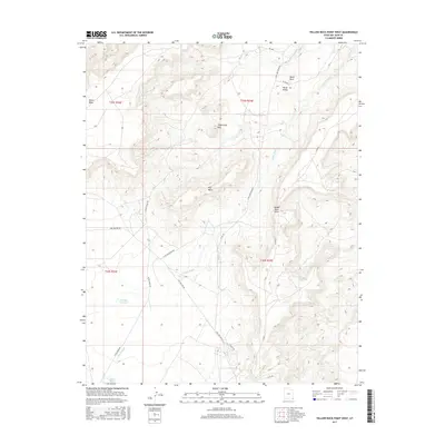
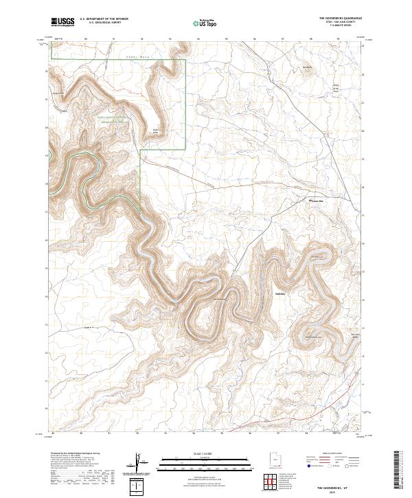
1957 Eastland
San Juan County, UT
1957 Elk Ridge 4 NE
San Juan County, UT
1957 Elk Ridge 4 SE
San Juan County, UT
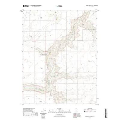
1957 Monument Canyon
San Juan County, UT
1958 Aneth 1 SE
San Juan County, UT
1958 Aneth 1 SW
San Juan County, UT
1958 Cajon Mesa
San Juan County, UT
1958 Verdure 2 NE
San Juan County, UT
1958 Verdure 2 NW
San Juan County, UT
1958 Verdure 2 SW
San Juan County, UT
1958 Verdure 4 NE
San Juan County, UT
1958 Verdure 4 SE
San Juan County, UT
1959 Verdure 1 NE
San Juan County, UT
1959 Verdure 1 NW
San Juan County, UT
1959 Verdure 1 SE
San Juan County, UT
1959 Verdure 3 NW
San Juan County, UT
1959 Verdure 3 SW
San Juan County, UT
1962 Bluff NW
San Juan County, UT
1962 Bluff SW
San Juan County, UT
1962 Boundary Butte
San Juan County, UT
1962 White Mesa Village
San Juan County, UT
1963 Cedar Mesa
San Juan County, UT
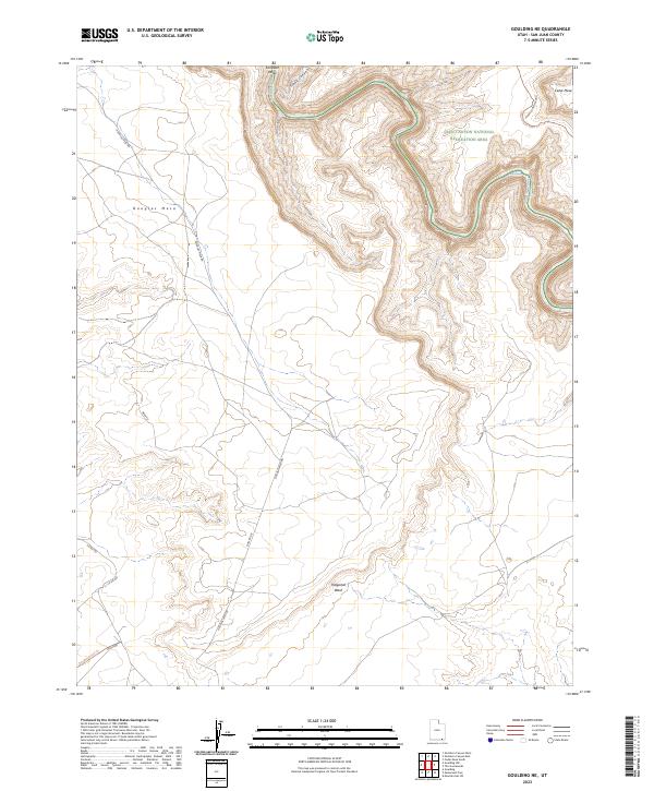
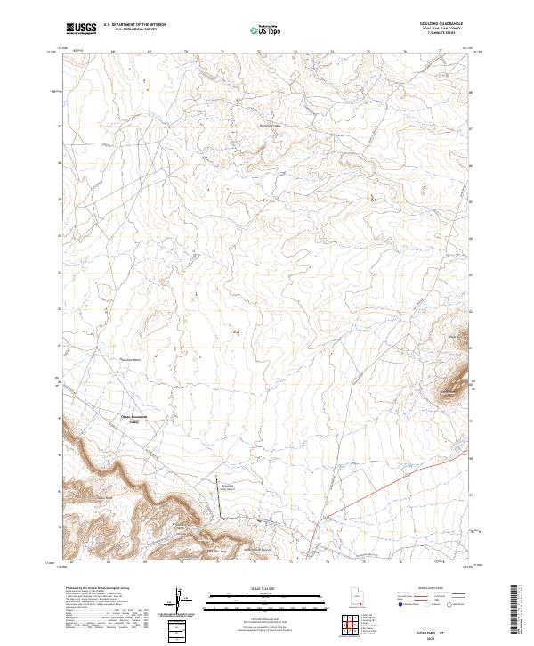
1963 Goulding
San Juan County, UT
1963 Grand Gulch
San Juan County, UT
1985 Abajo Peak
San Juan County, UT
1985 Black Mesa Butte
San Juan County, UT
1985 Blanding North
San Juan County, UT
1985 Blanding South
San Juan County, UT
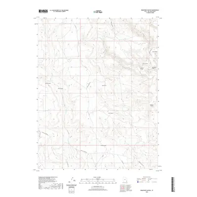
1985 Bradford Canyon
San Juan County, UT
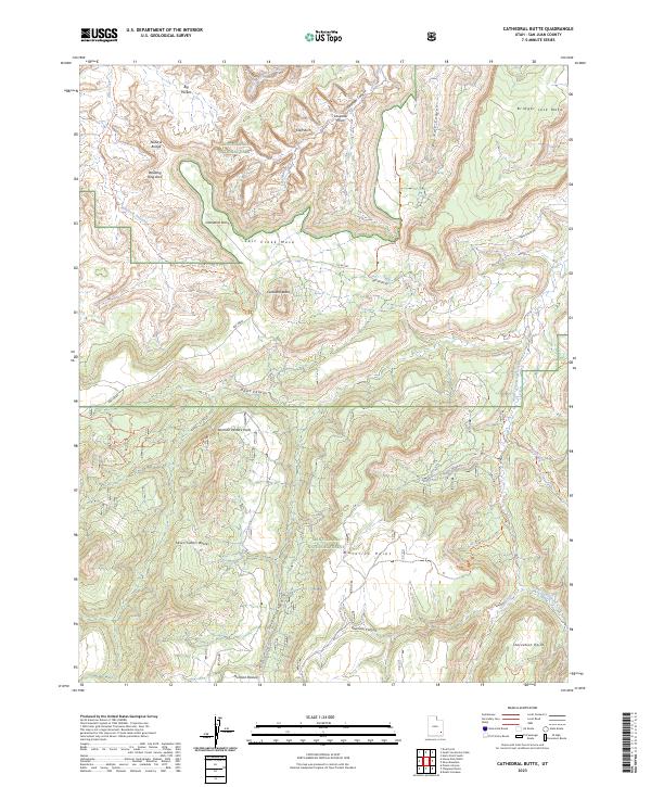
1985 Cathedral Butte
San Juan County, UT

1985 Cathedral Canyon
San Juan County, UT
1985 Chippean Rocks
San Juan County, UT
1985 Cream Pots
San Juan County, UT
1985 Devil Mesa
San Juan County, UT
1985 Eastland NW
San Juan County, UT
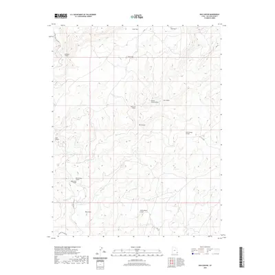
1985 Eastland
San Juan County, UT
1985 Fable Valley
San Juan County, UT
1985 Hatch Trading Post
San Juan County, UT
1985 Horsehead Point
San Juan County, UT
1985 Hotel Rock
San Juan County, UT
1985 House Park Butte
San Juan County, UT
1985 Kane Gulch
San Juan County, UT
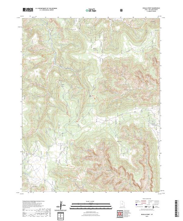
1985 Kigalia Point
San Juan County, UT
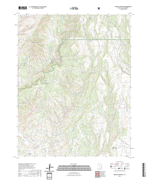
1985 Mancos Jim Butte
San Juan County, UT
1985 Monticello Lake
San Juan County, UT
1985 Monticello North
San Juan County, UT
1985 Monticello South
San Juan County, UT
1985 Mount Linnaeus
San Juan County, UT
1985 Navajo Canyon
San Juan County, UT
1985 Papoose Canyon
San Juan County, UT
1985 Peters Nipple
San Juan County, UT
1985 Piute Knoll
San Juan County, UT
1985 Poison Canyon
San Juan County, UT
1985 Ruin Point
San Juan County, UT
1985 Shay Mountain
San Juan County, UT
1985 South Long Point
San Juan County, UT
1985 Warren Canyon
San Juan County, UT
1985 Wickiup Canyon
San Juan County, UT
1985 Woodenshoe Buttes
San Juan County, UT
1985 Yellow Rock Point East
San Juan County, UT
1986 Lisbon Gap
San Juan County, UT
1986 Ray Mesa
San Juan County, UT
1986 Summit Point
San Juan County, UT
1987 Alcove Canyon
San Juan County, UT
1987 Black Steer Canyon
San Juan County, UT
1987 Bowdie Canyon East
San Juan County, UT
1987 Bowdie Canyon West
San Juan County, UT
1987 Burnt Spring
San Juan County, UT
1987 Chocolate Drop
San Juan County, UT
1987 Church Rock
San Juan County, UT
1987 Clay Hills
San Juan County, UT
1987 Copper Point
San Juan County, UT
1987 Deep Canyon North
San Juan County, UT
1987 Deep Canyon South
San Juan County, UT
1987 Eightmile Rock
San Juan County, UT
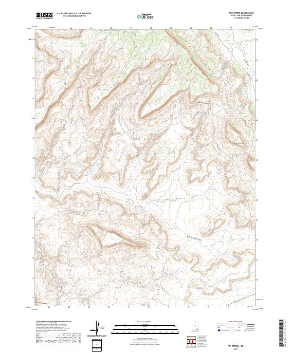
1987 Fry Spring
San Juan County, UT
1987 Good Hope Bay
San Juan County, UT
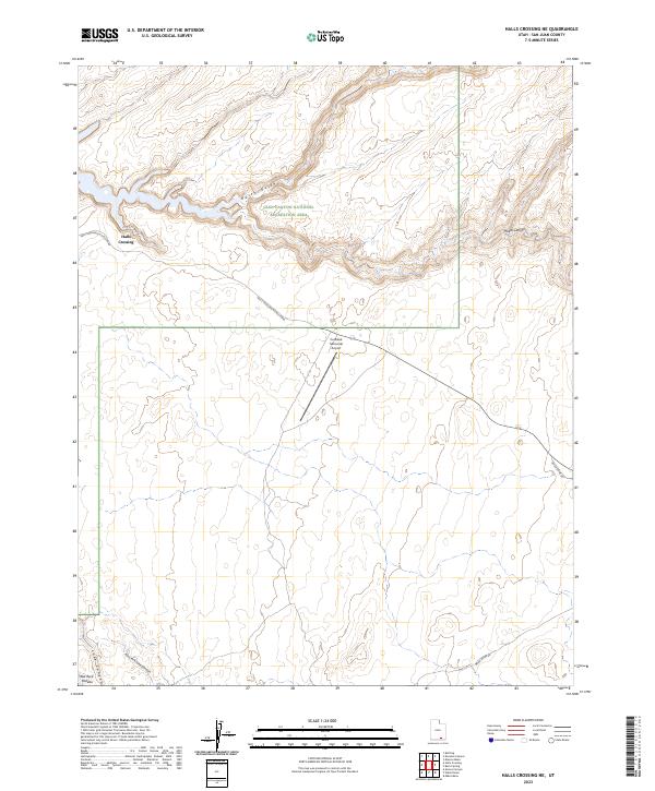
1987 Halls Crossing NE
San Juan County, UT
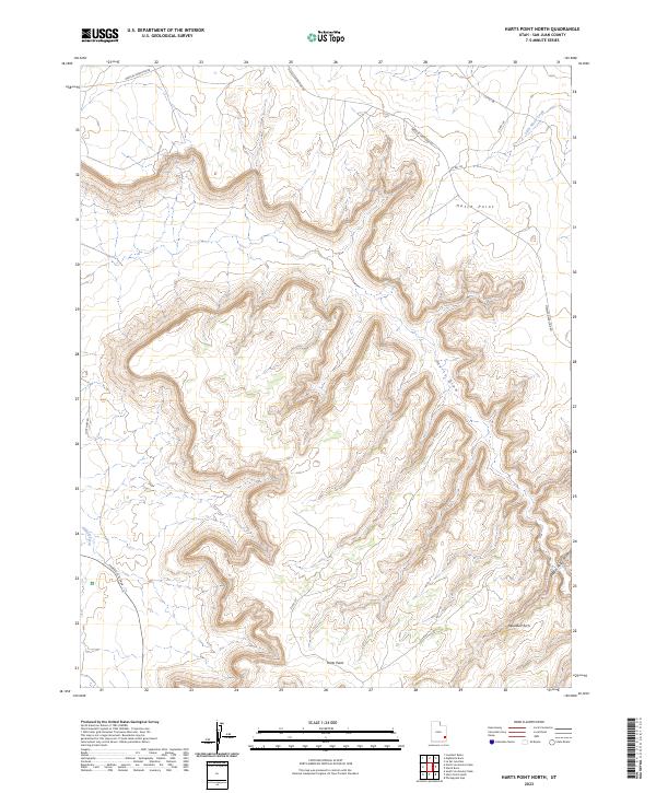
1987 Harts Point North
San Juan County, UT
1987 Harts Point South
San Juan County, UT
1987 Hatch Rock
San Juan County, UT
1987 Hite South
San Juan County, UT
1987 Indian Head Pass
San Juan County, UT

1987 Jacobs Chair
San Juan County, UT
1987 Jacobs Monument
San Juan County, UT
1987 Kane Springs
San Juan County, UT
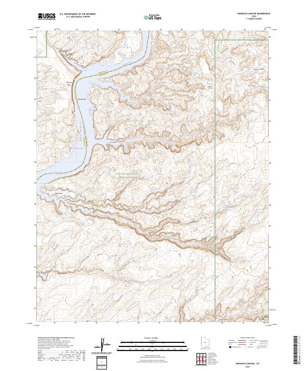
1987 Knowles Canyon
San Juan County, UT
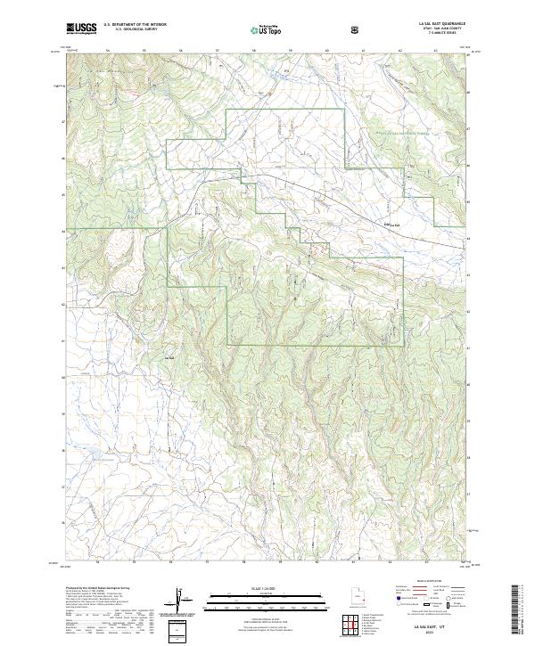
1987 La Sal East
San Juan County, UT
1987 La Sal Junction
San Juan County, UT
1987 La Sal West
San Juan County, UT
1987 Lisbon Valley
San Juan County, UT
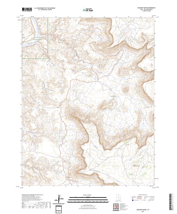
1987 Lockhart Basin
San Juan County, UT
1987 Mancos Mesa NE
San Juan County, UT
1987 Mancos Mesa
San Juan County, UT
1987 Mikes Mesa
San Juan County, UT

1987 Monitor Butte
San Juan County, UT

1987 Moss Back Butte
San Juan County, UT
1987 Mount Peale
San Juan County, UT
1987 Mount Tukuhnikivatz
San Juan County, UT
1987 Navajo Begay
San Juan County, UT
1987 Nokai Dome
San Juan County, UT
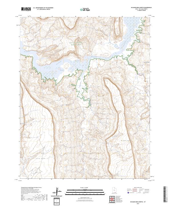
1987 No Mans Mesa North
San Juan County, UT
1987 No Mans Mesa South
San Juan County, UT
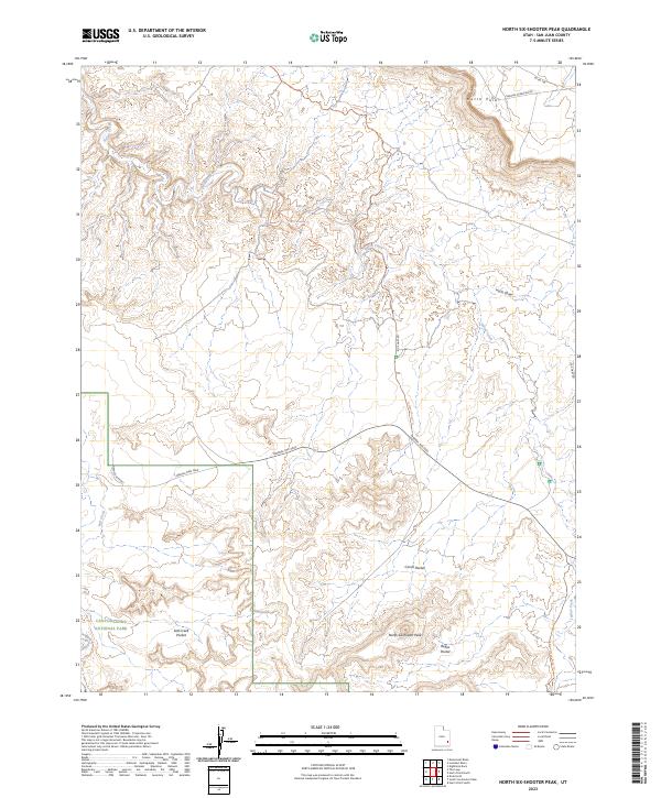
1987 North Six-shooter Peak
San Juan County, UT
1987 Oljeto NE
San Juan County, UT
1987 Oljeto
San Juan County, UT
1987 Photograph Gap
San Juan County, UT
1987 Rainbow Bridge
San Juan County, UT
1987 Red House Spring
San Juan County, UT
1987 Sandstone Draw
San Juan County, UT
1987 Shafer Basin
San Juan County, UT
1987 Sop Canyon
San Juan County, UT
1987 South Six-Shooter Peak
San Juan County, UT
1987 The Cheesebox
San Juan County, UT
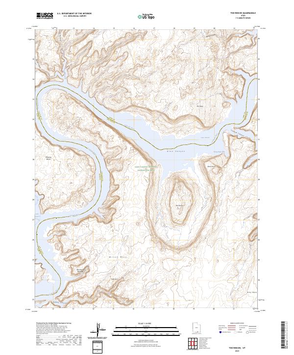
1987 The Rincon
San Juan County, UT
1987 Trough Springs Canyon
San Juan County, UT
1987 Whirlwind Draw
San Juan County, UT
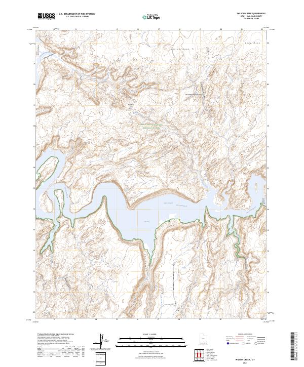
1987 Wilson Creek
San Juan County, UT
1988 Cross Canyon
San Juan County, UT
1988 Druid Arch
San Juan County, UT
1988 Goulding
San Juan County, UT
1988 Mexican Hat SE
San Juan County, UT
1988 Mexican Hat SW
San Juan County, UT
1988 Monument Basin
San Juan County, UT
1988 Monument Pass
San Juan County, UT
1988 Musselman Arch
San Juan County, UT
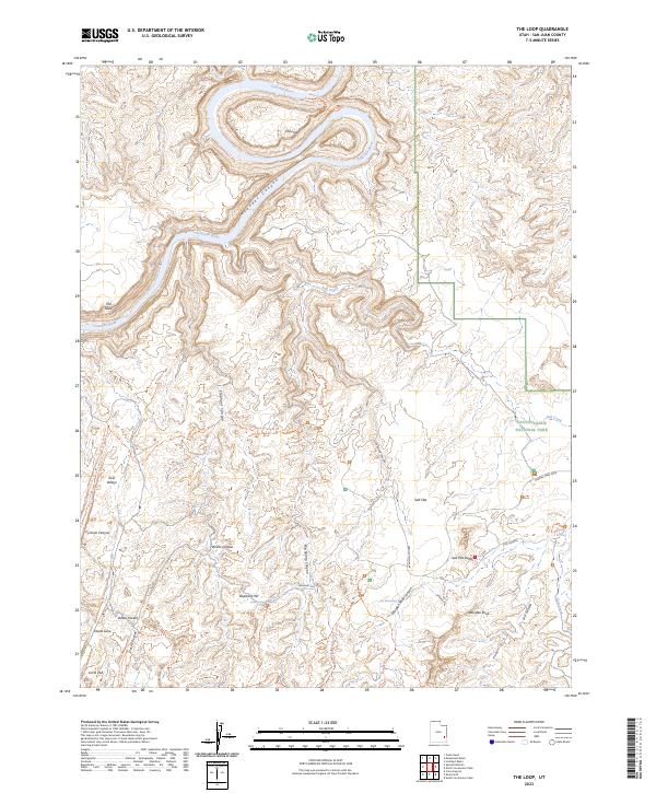
1988 The Loop
San Juan County, UT
1988 Turks Head
San Juan County, UT
1988 Upheaval Dome
San Juan County, UT
1989 Big Bench
San Juan County, UT
1989 Boundary Butte
San Juan County, UT
1989 Cedar Mesa North
San Juan County, UT
1989 Cedar Mesa South
San Juan County, UT
1989 Cigarette Spring Cave
San Juan County, UT
1989 Goulding NE
San Juan County, UT
1989 Goulding NW
San Juan County, UT
1989 Gray Spot Rock
San Juan County, UT
1989 Hogan Mesa
San Juan County, UT
1989 Mc Cracken Spring
San Juan County, UT
1989 Moses Rock
San Juan County, UT
1989 No-mans Island
San Juan County, UT
1989 Pollys Pasture
San Juan County, UT
1989 Recapture Pocket
San Juan County, UT
1989 San Juan Hill
San Juan County, UT
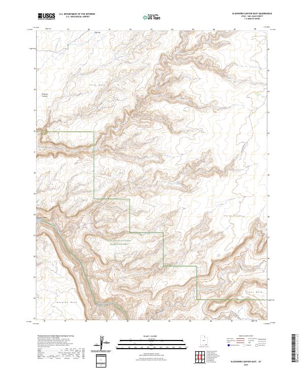
1989 Slickhorn Canyon East
San Juan County, UT
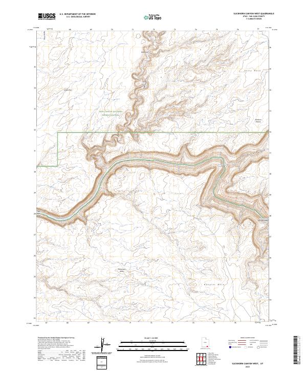
1989 Slickhorn Canyon West
San Juan County, UT
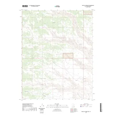
1989 Snow Flat Spring Cave
San Juan County, UT
1989 The Goosenecks
San Juan County, UT
1989 White Mesa Village
San Juan County, UT
1989 White Mesa Village SE
San Juan County, UT
1989 White Rock Point
San Juan County, UT
1989 Yellow Rock Point West
San Juan County, UT
1996 Bluff NW
San Juan County, UT
1996 Bowdie Canyon East
San Juan County, UT
1996 Cedar Mesa South
San Juan County, UT
1996 Cigarette Spring Cave
San Juan County, UT
1996 Indian Head Pass
San Juan County, UT
1996 Jacobs Chair
San Juan County, UT
1996 Kane Springs
San Juan County, UT
1996 Moss Back Butte
San Juan County, UT
1996 Red House Spring
San Juan County, UT
1996 Slickhorn Canyon East
San Juan County, UT
1996 Slickhorn Canyon West
San Juan County, UT
1996 Snow Flat Spring Cave
San Juan County, UT
1997 Bluff SW
San Juan County, UT
1997 Cross Canyon
San Juan County, UT
1997 Druid Arch
San Juan County, UT
1997 North Six-shooter Peak
San Juan County, UT
1997 Rainbow Bridge
San Juan County, UT
1997 South Six-Shooter Peak
San Juan County, UT
1997 The Loop
San Juan County, UT
2001 Abajo Peak
San Juan County, UT
2001 Black Steer Canyon
San Juan County, UT
2001 Blanding North
San Juan County, UT
2001 Cathedral Butte
San Juan County, UT
2001 Chippean Rocks
San Juan County, UT
2001 Cream Pots
San Juan County, UT
2001 Fable Valley
San Juan County, UT
2001 Hotel Rock
San Juan County, UT
2001 House Park Butte
San Juan County, UT
2001 Kane Gulch
San Juan County, UT
2001 Kigalia Point
San Juan County, UT
2001 La Sal East
San Juan County, UT
2001 La Sal West
San Juan County, UT
2001 Mancos Jim Butte
San Juan County, UT
2001 Monticello Lake
San Juan County, UT
2001 Monticello North
San Juan County, UT
2001 Monticello South
San Juan County, UT
2001 Mount Linnaeus
San Juan County, UT
2001 Mount Peale
San Juan County, UT
2001 Mount Tukuhnikivatz
San Juan County, UT
2001 Poison Canyon
San Juan County, UT
2001 Ray Mesa
San Juan County, UT
2001 Shay Mountain
San Juan County, UT
2001 South Long Point
San Juan County, UT
2001 Warren Canyon
San Juan County, UT
2001 Woodenshoe Buttes
San Juan County, UT
2010 Big Bench
San Juan County, UT
2010 Black Mesa Butte
San Juan County, UT
2010 Blanding South
San Juan County, UT
2010 Bluff NW
San Juan County, UT
2010 Bluff SW
San Juan County, UT
2010 Boundary Butte
San Juan County, UT
2010 Bradford Canyon
San Juan County, UT
2010 Cedar Mesa South
San Juan County, UT
2010 Church Rock
San Juan County, UT
2010 Cigarette Spring Cave
San Juan County, UT
2010 Devil Mesa
San Juan County, UT
2010 Druid Arch
San Juan County, UT
2010 Eastland NW
San Juan County, UT
2010 Eightmile Rock
San Juan County, UT
2010 Gray Spot Rock
San Juan County, UT
2010 Hatch Trading Post
San Juan County, UT
2010 Hogan Mesa
San Juan County, UT
2010 Horsehead Point
San Juan County, UT
2010 Kane Springs
San Juan County, UT
2010 Lisbon Valley
San Juan County, UT
2010 Lockhart Basin
San Juan County, UT
2010 McCracken Spring
San Juan County, UT
2010 Mexican Hat SE
San Juan County, UT
2010 Monument Basin
San Juan County, UT
2010 Moses Rock
San Juan County, UT
2010 Navajo Canyon
San Juan County, UT
2010 No-Mans Island
San Juan County, UT
2010 Recapture Pocket
San Juan County, UT
2010 Shafer Basin
San Juan County, UT
2010 Sop Canyon
San Juan County, UT
2010 South Six-shooter Peak
San Juan County, UT
2010 The Goosenecks
San Juan County, UT
2010 The Loop
San Juan County, UT
2010 Trough Springs Canyon
San Juan County, UT
2010 Upheaval Dome
San Juan County, UT
2010 White Mesa Village
San Juan County, UT
2010 White Mesa Village SE
San Juan County, UT
2010 White Rock Point
San Juan County, UT
2010 Yellow Rock Point West
San Juan County, UT
2011 Abajo Peak
San Juan County, UT
2011 Alcove Canyon
San Juan County, UT
2011 Black Steer Canyon
San Juan County, UT
2011 Blanding North
San Juan County, UT
2011 Bowdie Canyon East
San Juan County, UT
2011 Bowdie Canyon West
San Juan County, UT
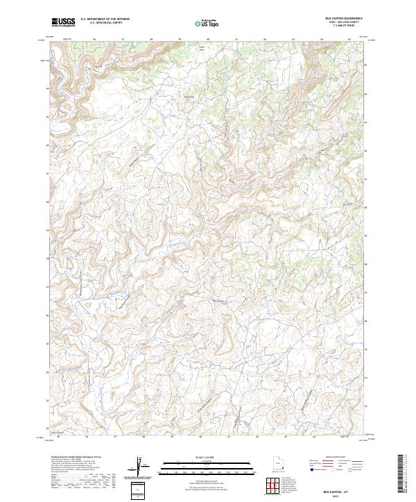
2011 Bug Canyon
San Juan County, UT
2011 Burnt Spring
San Juan County, UT
2011 Cathedral Butte
San Juan County, UT
2011 Cathedral Canyon
San Juan County, UT
2011 Cedar Mesa North
San Juan County, UT
2011 Chippean Rocks
San Juan County, UT
2011 Chocolate Drop
San Juan County, UT
2011 Clay Hills
San Juan County, UT
2011 Copper Point
San Juan County, UT
2011 Cream Pots
San Juan County, UT
2011 Cross Canyon
San Juan County, UT
2011 Deep Canyon North
San Juan County, UT
2011 Deep Canyon South
San Juan County, UT
2011 Eastland
San Juan County, UT
2011 Fable Valley
San Juan County, UT
2011 Fry Spring
San Juan County, UT
2011 Good Hope Bay
San Juan County, UT
2011 Goulding NE
San Juan County, UT
2011 Goulding NW
San Juan County, UT
2011 Goulding
San Juan County, UT
2011 Halls Crossing NE
San Juan County, UT
2011 Harts Point North
San Juan County, UT
2011 Harts Point South
San Juan County, UT
2011 Hatch Rock
San Juan County, UT
2011 Hite South
San Juan County, UT
2011 Hotel Rock
San Juan County, UT
2011 House Park Butte
San Juan County, UT
2011 Indian Head Pass
San Juan County, UT
2011 Jacobs Chair
San Juan County, UT
2011 Jacobs Monument
San Juan County, UT
2011 Kane Gulch
San Juan County, UT
2011 Kigalia Point
San Juan County, UT
2011 Knowles Canyon
San Juan County, UT
2011 La Sal East
San Juan County, UT
2011 La Sal Junction
San Juan County, UT
2011 La Sal West
San Juan County, UT
2011 Lisbon Gap
San Juan County, UT
2011 Mancos Jim Butte
San Juan County, UT
2011 Mancos Mesa NE
San Juan County, UT
2011 Mancos Mesa
San Juan County, UT
2011 Mexican Hat SW
San Juan County, UT
2011 Mikes Mesa
San Juan County, UT
2011 Monitor Butte
San Juan County, UT

2011 Monticello Lake
San Juan County, UT
2011 Monticello North
San Juan County, UT
2011 Monticello South
San Juan County, UT
2011 Monument Pass
San Juan County, UT
2011 Moss Back Butte
San Juan County, UT
2011 Mount Linnaeus
San Juan County, UT
2011 Mount Peale
San Juan County, UT

2011 Mount Tukuhnikivatz
San Juan County, UT
2011 Musselman Arch
San Juan County, UT
2011 Navajo Begay
San Juan County, UT
2011 Nokai Dome
San Juan County, UT
2011 No Mans Mesa North
San Juan County, UT
2011 No Mans Mesa South
San Juan County, UT
2011 North Six-shooter Peak
San Juan County, UT
2011 Oljato NE
San Juan County, UT
2011 Oljato
San Juan County, UT
2011 Papoose Canyon
San Juan County, UT
2011 Peters Nipple
San Juan County, UT
2011 Photograph Gap
San Juan County, UT
2011 Piute Knoll
San Juan County, UT
2011 Poison Canyon
San Juan County, UT
2011 Pollys Pasture
San Juan County, UT
2011 Rainbow Bridge
San Juan County, UT
2011 Ray Mesa
San Juan County, UT
2011 Red House Spring
San Juan County, UT
2011 Ruin Point
San Juan County, UT
2011 Sandstone Draw
San Juan County, UT
2011 San Juan Hill
San Juan County, UT
2011 Shay Mountain
San Juan County, UT
2011 Slickhorn Canyon East
San Juan County, UT
2011 Slickhorn Canyon West
San Juan County, UT
2011 Snow Flat Spring Cave
San Juan County, UT
2011 South Long Point
San Juan County, UT
2011 Summit Point
San Juan County, UT
2011 The Cheesebox
San Juan County, UT
2011 The Rincon
San Juan County, UT
2011 Turks Head
San Juan County, UT
2011 Warren Canyon
San Juan County, UT
2011 Whirlwind Draw
San Juan County, UT
2011 Wickiup Canyon
San Juan County, UT
2011 Wilson Creek
San Juan County, UT
2011 Woodenshoe Buttes
San Juan County, UT
2011 Yellow Rock Point East
San Juan County, UT
2014 Abajo Peak
San Juan County, UT
2014 Alcove Canyon
San Juan County, UT
2014 Big Bench
San Juan County, UT
2014 Black Mesa Butte
San Juan County, UT
2014 Black Steer Canyon
San Juan County, UT
2014 Blanding North
San Juan County, UT
2014 Blanding South
San Juan County, UT
2014 Bluff NW
San Juan County, UT
2014 Bluff SW
San Juan County, UT
2014 Boundary Butte
San Juan County, UT
2014 Bowdie Canyon East
San Juan County, UT
2014 Bowdie Canyon West
San Juan County, UT
2014 Bradford Canyon
San Juan County, UT
2014 Bug Canyon
San Juan County, UT
2014 Burnt Spring
San Juan County, UT
2014 Cathedral Butte
San Juan County, UT
2014 Cathedral Canyon
San Juan County, UT
2014 Cedar Mesa North
San Juan County, UT
2014 Cedar Mesa South
San Juan County, UT
2014 Chippean Rocks
San Juan County, UT
2014 Chocolate Drop
San Juan County, UT

2014 Church Rock
San Juan County, UT
2014 Cigarette Spring Cave
San Juan County, UT
2014 Clay Hills
San Juan County, UT
2014 Copper Point
San Juan County, UT
2014 Cream Pots
San Juan County, UT
2014 Cross Canyon
San Juan County, UT
2014 Deep Canyon North
San Juan County, UT
2014 Deep Canyon South
San Juan County, UT
2014 Devil Mesa
San Juan County, UT
2014 Druid Arch
San Juan County, UT
2014 Eastland NW
San Juan County, UT
2014 Eastland
San Juan County, UT

2014 Eightmile Rock
San Juan County, UT
2014 Fable Valley
San Juan County, UT
2014 Fry Spring
San Juan County, UT
2014 Good Hope Bay
San Juan County, UT
2014 Goulding NE
San Juan County, UT
2014 Goulding NW
San Juan County, UT
2014 Goulding
San Juan County, UT
2014 Gray Spot Rock
San Juan County, UT
2014 Halls Crossing NE
San Juan County, UT
2014 Harts Point North
San Juan County, UT
2014 Harts Point South
San Juan County, UT
2014 Hatch Rock
San Juan County, UT
2014 Hatch Trading Post
San Juan County, UT
2014 Hite South
San Juan County, UT
2014 Hogan Mesa
San Juan County, UT
2014 Horsehead Point
San Juan County, UT
2014 Hotel Rock
San Juan County, UT
2014 House Park Butte
San Juan County, UT
2014 Indian Head Pass
San Juan County, UT
2014 Jacobs Chair
San Juan County, UT
2014 Jacobs Monument
San Juan County, UT
2014 Kane Gulch
San Juan County, UT
2014 Kane Springs
San Juan County, UT
2014 Kigalia Point
San Juan County, UT
2014 Knowles Canyon
San Juan County, UT
2014 La Sal East
San Juan County, UT
2014 La Sal Junction
San Juan County, UT
2014 La Sal West
San Juan County, UT
2014 Lisbon Gap
San Juan County, UT
2014 Lisbon Valley
San Juan County, UT
2014 Lockhart Basin
San Juan County, UT
2014 Mancos Jim Butte
San Juan County, UT
2014 Mancos Mesa NE
San Juan County, UT
2014 Mancos Mesa
San Juan County, UT
2014 McCracken Spring
San Juan County, UT
2014 Mexican Hat SE
San Juan County, UT
2014 Mexican Hat SW
San Juan County, UT
2014 Mikes Mesa
San Juan County, UT
2014 Monitor Butte
San Juan County, UT
2014 Monticello Lake
San Juan County, UT
2014 Monticello North
San Juan County, UT
2014 Monticello South
San Juan County, UT
2014 Monument Basin
San Juan County, UT
2014 Monument Pass
San Juan County, UT
2014 Moses Rock
San Juan County, UT
2014 Moss Back Butte
San Juan County, UT
2014 Mount Linnaeus
San Juan County, UT
2014 Mount Peale
San Juan County, UT
2014 Mount Tukuhnikivatz
San Juan County, UT
2014 Musselman Arch
San Juan County, UT
2014 Navajo Begay
San Juan County, UT
2014 Navajo Canyon
San Juan County, UT
2014 Nokai Dome
San Juan County, UT
2014 No-Mans Island
San Juan County, UT

2014 No Mans Mesa North
San Juan County, UT
2014 No Mans Mesa South
San Juan County, UT
2014 North Six-shooter Peak
San Juan County, UT
2014 Oljato NE
San Juan County, UT
2014 Oljato
San Juan County, UT
2014 Papoose Canyon
San Juan County, UT
2014 Peters Nipple
San Juan County, UT
2014 Photograph Gap
San Juan County, UT
2014 Piute Knoll
San Juan County, UT
2014 Poison Canyon
San Juan County, UT
2014 Pollys Pasture
San Juan County, UT
2014 Rainbow Bridge
San Juan County, UT
2014 Ray Mesa
San Juan County, UT
2014 Recapture Pocket
San Juan County, UT
2014 Red House Spring
San Juan County, UT
2014 Ruin Point
San Juan County, UT
2014 Sandstone Draw
San Juan County, UT
2014 San Juan Hill
San Juan County, UT
2014 Shafer Basin
San Juan County, UT
2014 Shay Mountain
San Juan County, UT
2014 Slickhorn Canyon East
San Juan County, UT

2014 Slickhorn Canyon West
San Juan County, UT
2014 Snow Flat Spring Cave
San Juan County, UT
2014 Sop Canyon
San Juan County, UT
2014 South Long Point
San Juan County, UT
2014 South Six-shooter Peak
San Juan County, UT
2014 Summit Point
San Juan County, UT
2014 The Cheesebox
San Juan County, UT
2014 The Goosenecks
San Juan County, UT
2014 The Loop
San Juan County, UT
2014 The Rincon
San Juan County, UT
2014 Trough Springs Canyon
San Juan County, UT
2014 Turks Head
San Juan County, UT
2014 Upheaval Dome
San Juan County, UT
2014 Warren Canyon
San Juan County, UT
2014 Whirlwind Draw
San Juan County, UT
2014 White Mesa Village
San Juan County, UT
2014 White Mesa Village SE
San Juan County, UT
2014 White Rock Point
San Juan County, UT
2014 Wickiup Canyon
San Juan County, UT
2014 Wilson Creek
San Juan County, UT
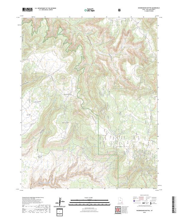
2014 Woodenshoe Buttes
San Juan County, UT
2014 Yellow Rock Point East
San Juan County, UT
2014 Yellow Rock Point West
San Juan County, UT
2017 Abajo Peak
San Juan County, UT
2017 Alcove Canyon
San Juan County, UT
2017 Big Bench
San Juan County, UT
2017 Black Mesa Butte
San Juan County, UT
2017 Black Steer Canyon
San Juan County, UT
2017 Blanding North
San Juan County, UT
2017 Blanding South
San Juan County, UT
2017 Bluff NW
San Juan County, UT
2017 Bluff SW
San Juan County, UT
2017 Boundary Butte
San Juan County, UT
2017 Bowdie Canyon East
San Juan County, UT

2017 Bowdie Canyon West
San Juan County, UT
2017 Bradford Canyon
San Juan County, UT
2017 Bug Canyon
San Juan County, UT
2017 Burnt Spring
San Juan County, UT
2017 Cathedral Butte
San Juan County, UT
2017 Cathedral Canyon
San Juan County, UT
2017 Cedar Mesa North
San Juan County, UT
2017 Cedar Mesa South
San Juan County, UT
2017 Chippean Rocks
San Juan County, UT
2017 Chocolate Drop
San Juan County, UT
2017 Church Rock
San Juan County, UT
2017 Cigarette Spring Cave
San Juan County, UT
2017 Clay Hills
San Juan County, UT
2017 Copper Point
San Juan County, UT
2017 Cream Pots
San Juan County, UT
2017 Cross Canyon
San Juan County, UT
2017 Deep Canyon North
San Juan County, UT
2017 Deep Canyon South
San Juan County, UT
2017 Devil Mesa
San Juan County, UT
2017 Druid Arch
San Juan County, UT
2017 Eastland NW
San Juan County, UT
2017 Eastland
San Juan County, UT
2017 Eightmile Rock
San Juan County, UT
2017 Fable Valley
San Juan County, UT
2017 Fry Spring
San Juan County, UT
2017 Good Hope Bay
San Juan County, UT
2017 Goulding NE
San Juan County, UT
2017 Goulding NW
San Juan County, UT
2017 Goulding
San Juan County, UT
2017 Gray Spot Rock
San Juan County, UT
2017 Halls Crossing NE
San Juan County, UT
2017 Harts Point North
San Juan County, UT
2017 Harts Point South
San Juan County, UT
2017 Hatch Rock
San Juan County, UT
2017 Hatch Trading Post
San Juan County, UT
2017 Hite South
San Juan County, UT
2017 Hogan Mesa
San Juan County, UT
2017 Horsehead Point
San Juan County, UT
2017 Hotel Rock
San Juan County, UT
2017 House Park Butte
San Juan County, UT
2017 Indian Head Pass
San Juan County, UT
2017 Jacobs Chair
San Juan County, UT
2017 Jacobs Monument
San Juan County, UT
2017 Kane Gulch
San Juan County, UT
2017 Kane Springs
San Juan County, UT
2017 Kigalia Point
San Juan County, UT
2017 Knowles Canyon
San Juan County, UT
2017 La Sal East
San Juan County, UT
2017 La Sal Junction
San Juan County, UT
2017 La Sal West
San Juan County, UT
2017 Lisbon Gap
San Juan County, UT
2017 Lisbon Valley
San Juan County, UT
2017 Lockhart Basin
San Juan County, UT
2017 Mancos Jim Butte
San Juan County, UT
2017 Mancos Mesa NE
San Juan County, UT
2017 Mancos Mesa
San Juan County, UT
2017 McCracken Spring
San Juan County, UT
2017 Mexican Hat SE
San Juan County, UT
2017 Mexican Hat SW
San Juan County, UT
2017 Mikes Mesa
San Juan County, UT
2017 Monitor Butte
San Juan County, UT
2017 Monticello Lake
San Juan County, UT
2017 Monticello North
San Juan County, UT
2017 Monticello South
San Juan County, UT
2017 Monument Basin
San Juan County, UT
2017 Monument Pass
San Juan County, UT
2017 Moses Rock
San Juan County, UT
2017 Moss Back Butte
San Juan County, UT
2017 Mount Linnaeus
San Juan County, UT
2017 Mount Peale
San Juan County, UT
2017 Mount Tukuhnikivatz
San Juan County, UT
2017 Musselman Arch
San Juan County, UT
2017 Navajo Begay
San Juan County, UT
2017 Navajo Canyon
San Juan County, UT
2017 Nokai Dome
San Juan County, UT
2017 No-Mans Island
San Juan County, UT
2017 No Mans Mesa North
San Juan County, UT
2017 No Mans Mesa South
San Juan County, UT
2017 North Six-shooter Peak
San Juan County, UT
2017 Oljato NE
San Juan County, UT
2017 Oljato
San Juan County, UT
2017 Papoose Canyon
San Juan County, UT
2017 Peters Nipple
San Juan County, UT
2017 Photograph Gap
San Juan County, UT
2017 Piute Knoll
San Juan County, UT
2017 Poison Canyon
San Juan County, UT

2017 Pollys Pasture
San Juan County, UT
2017 Rainbow Bridge
San Juan County, UT
2017 Ray Mesa
San Juan County, UT
2017 Recapture Pocket
San Juan County, UT
2017 Red House Spring
San Juan County, UT
2017 Ruin Point
San Juan County, UT
2017 Sandstone Draw
San Juan County, UT
2017 San Juan Hill
San Juan County, UT
2017 Shafer Basin
San Juan County, UT
2017 Shay Mountain
San Juan County, UT
2017 Slickhorn Canyon East
San Juan County, UT
2017 Slickhorn Canyon West
San Juan County, UT
2017 Snow Flat Spring Cave
San Juan County, UT
2017 Sop Canyon
San Juan County, UT
2017 South Long Point
San Juan County, UT
2017 South Six-shooter Peak
San Juan County, UT
2017 Summit Point
San Juan County, UT
2017 The Cheesebox
San Juan County, UT
2017 The Goosenecks
San Juan County, UT
2017 The Loop
San Juan County, UT
2017 The Rincon
San Juan County, UT
2017 Trough Springs Canyon
San Juan County, UT
2017 Turks Head
San Juan County, UT
2017 Upheaval Dome
San Juan County, UT
2017 Warren Canyon
San Juan County, UT
2017 Whirlwind Draw
San Juan County, UT
2017 White Mesa Village
San Juan County, UT
2017 White Mesa Village SE
San Juan County, UT
2017 White Rock Point
San Juan County, UT
2017 Wickiup Canyon
San Juan County, UT
2017 Wilson Creek
San Juan County, UT
2017 Woodenshoe Buttes
San Juan County, UT
2017 Yellow Rock Point East
San Juan County, UT
2017 Yellow Rock Point West
San Juan County, UT
2020 Abajo Peak
San Juan County, UT
2020 Alcove Canyon
San Juan County, UT
2020 Big Bench
San Juan County, UT
2020 Black Mesa Butte
San Juan County, UT
2020 Black Steer Canyon
San Juan County, UT
2020 Blanding North
San Juan County, UT
2020 Blanding South
San Juan County, UT
2020 Bluff NW
San Juan County, UT
2020 Bluff SW
San Juan County, UT
2020 Boundary Butte
San Juan County, UT
2020 Bowdie Canyon East
San Juan County, UT
2020 Bowdie Canyon West
San Juan County, UT
2020 Bradford Canyon
San Juan County, UT
2020 Bug Canyon
San Juan County, UT
2020 Burnt Spring
San Juan County, UT
2020 Cathedral Butte
San Juan County, UT
2020 Cathedral Canyon
San Juan County, UT
2020 Cedar Mesa North
San Juan County, UT
2020 Cedar Mesa South
San Juan County, UT
2020 Chippean Rocks
San Juan County, UT
2020 Chocolate Drop
San Juan County, UT
2020 Church Rock
San Juan County, UT
2020 Cigarette Spring Cave
San Juan County, UT
2020 Clay Hills
San Juan County, UT
2020 Copper Point
San Juan County, UT
2020 Cream Pots
San Juan County, UT
2020 Cross Canyon
San Juan County, UT
2020 Deep Canyon North
San Juan County, UT
2020 Deep Canyon South
San Juan County, UT
2020 Devil Mesa
San Juan County, UT
2020 Druid Arch
San Juan County, UT
2020 Eastland NW
San Juan County, UT

2020 Eastland
San Juan County, UT
2020 Eightmile Rock
San Juan County, UT
2020 Fable Valley
San Juan County, UT
2020 Fry Spring
San Juan County, UT

2020 Good Hope Bay
San Juan County, UT
2020 Goulding NE
San Juan County, UT
2020 Goulding NW
San Juan County, UT
2020 Goulding
San Juan County, UT
2020 Gray Spot Rock
San Juan County, UT
2020 Halls Crossing NE
San Juan County, UT
2020 Harts Point North
San Juan County, UT
2020 Harts Point South
San Juan County, UT
2020 Hatch Rock
San Juan County, UT
2020 Hatch Trading Post
San Juan County, UT
2020 Hite South
San Juan County, UT
2020 Hogan Mesa
San Juan County, UT
2020 Horsehead Point
San Juan County, UT
2020 Hotel Rock
San Juan County, UT
2020 House Park Butte
San Juan County, UT
2020 Indian Head Pass
San Juan County, UT
2020 Jacobs Chair
San Juan County, UT
2020 Jacobs Monument
San Juan County, UT
2020 Kane Gulch
San Juan County, UT
2020 Kane Springs
San Juan County, UT
2020 Kigalia Point
San Juan County, UT
2020 Knowles Canyon
San Juan County, UT
2020 La Sal East
San Juan County, UT
2020 La Sal Junction
San Juan County, UT
2020 La Sal West
San Juan County, UT
2020 Lisbon Gap
San Juan County, UT
2020 Lisbon Valley
San Juan County, UT
2020 Lockhart Basin
San Juan County, UT
2020 Mancos Jim Butte
San Juan County, UT
2020 Mancos Mesa NE
San Juan County, UT
2020 Mancos Mesa
San Juan County, UT
2020 McCracken Spring
San Juan County, UT
2020 Mexican Hat SE
San Juan County, UT
2020 Mexican Hat SW
San Juan County, UT
2020 Mikes Mesa
San Juan County, UT
2020 Monitor Butte
San Juan County, UT
2020 Monticello Lake
San Juan County, UT
2020 Monticello North
San Juan County, UT
2020 Monticello South
San Juan County, UT
2020 Monument Basin
San Juan County, UT

2020 Monument Pass
San Juan County, UT
2020 Moses Rock
San Juan County, UT
2020 Moss Back Butte
San Juan County, UT
2020 Mount Linnaeus
San Juan County, UT
2020 Mount Peale
San Juan County, UT
2020 Mount Tukuhnikivatz
San Juan County, UT
2020 Musselman Arch
San Juan County, UT
2020 Navajo Begay
San Juan County, UT
2020 Navajo Canyon
San Juan County, UT
2020 Nokai Dome
San Juan County, UT
2020 No-Mans Island
San Juan County, UT
2020 No Mans Mesa North
San Juan County, UT
2020 No Mans Mesa South
San Juan County, UT
2020 North Six-shooter Peak
San Juan County, UT
2020 Oljato NE
San Juan County, UT
2020 Oljato
San Juan County, UT
2020 Papoose Canyon
San Juan County, UT
2020 Peters Nipple
San Juan County, UT
2020 Photograph Gap
San Juan County, UT
2020 Piute Knoll
San Juan County, UT
2020 Poison Canyon
San Juan County, UT
2020 Pollys Pasture
San Juan County, UT
2020 Rainbow Bridge
San Juan County, UT
2020 Ray Mesa
San Juan County, UT
2020 Recapture Pocket
San Juan County, UT
2020 Red House Spring
San Juan County, UT
2020 Ruin Point
San Juan County, UT
2020 Sandstone Draw
San Juan County, UT
2020 San Juan Hill
San Juan County, UT
2020 Shafer Basin
San Juan County, UT
2020 Shay Mountain
San Juan County, UT
2020 Slickhorn Canyon East
San Juan County, UT
2020 Slickhorn Canyon West
San Juan County, UT
2020 Snow Flat Spring Cave
San Juan County, UT
2020 Sop Canyon
San Juan County, UT
2020 South Long Point
San Juan County, UT
2020 South Six-shooter Peak
San Juan County, UT
2020 Summit Point
San Juan County, UT
2020 The Cheesebox
San Juan County, UT
2020 The Goosenecks
San Juan County, UT
2020 The Loop
San Juan County, UT
2020 The Rincon
San Juan County, UT
2020 Trough Springs Canyon
San Juan County, UT
2020 Turks Head
San Juan County, UT
2020 Upheaval Dome
San Juan County, UT
2020 Warren Canyon
San Juan County, UT
2020 Whirlwind Draw
San Juan County, UT
2020 White Mesa Village
San Juan County, UT
2020 White Mesa Village SE
San Juan County, UT
2020 White Rock Point
San Juan County, UT
2020 Wickiup Canyon
San Juan County, UT
2020 Wilson Creek
San Juan County, UT
2020 Woodenshoe Buttes
San Juan County, UT
2020 Yellow Rock Point East
San Juan County, UT
2020 Yellow Rock Point West
San Juan County, UT
2023 Abajo Peak
San Juan County, UT
2023 Alcove Canyon
San Juan County, UT
2023 Big Bench
San Juan County, UT
2023 Black Mesa Butte
San Juan County, UT
2023 Black Steer Canyon
San Juan County, UT
2023 Blanding North
San Juan County, UT
2023 Blanding South
San Juan County, UT
2023 Bluff NW
San Juan County, UT

2023 Bluff SW
San Juan County, UT
2023 Boundary Butte
San Juan County, UT

2023 Bowdie Canyon East
San Juan County, UT
2023 Bowdie Canyon West
San Juan County, UT
2023 Bradford Canyon
San Juan County, UT
2023 Bug Canyon
San Juan County, UT
2023 Burnt Spring
San Juan County, UT
2023 Cathedral Butte
San Juan County, UT
2023 Cathedral Canyon
San Juan County, UT
2023 Cedar Mesa North
San Juan County, UT
2023 Cedar Mesa South
San Juan County, UT
2023 Chippean Rocks
San Juan County, UT
2023 Chocolate Drop
San Juan County, UT
2023 Church Rock
San Juan County, UT
2023 Cigarette Spring Cave
San Juan County, UT

2023 Clay Hills
San Juan County, UT
2023 Copper Point
San Juan County, UT
2023 Cream Pots
San Juan County, UT
2023 Cross Canyon
San Juan County, UT
2023 Deep Canyon North
San Juan County, UT

2023 Deep Canyon South
San Juan County, UT
2023 Devil Mesa
San Juan County, UT
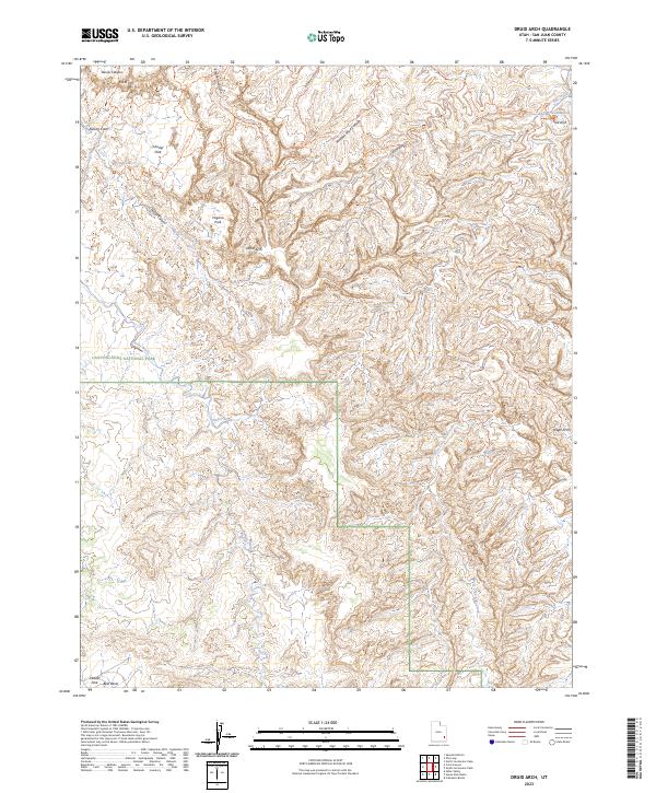
2023 Druid Arch
San Juan County, UT
2023 Eastland NW
San Juan County, UT
2023 Eastland
San Juan County, UT
2023 Eightmile Rock
San Juan County, UT
2023 Fable Valley
San Juan County, UT
2023 Fry Spring
San Juan County, UT

2023 Good Hope Bay
San Juan County, UT
2023 Goulding NE
San Juan County, UT
2023 Goulding NW
San Juan County, UT
2023 Goulding
San Juan County, UT
2023 Gray Spot Rock
San Juan County, UT
2023 Halls Crossing NE
San Juan County, UT
2023 Harts Point North
San Juan County, UT
2023 Harts Point South
San Juan County, UT
2023 Hatch Rock
San Juan County, UT
2023 Hatch Trading Post
San Juan County, UT
2023 Hite South
San Juan County, UT
2023 Hogan Mesa
San Juan County, UT
2023 Horsehead Point
San Juan County, UT
2023 Hotel Rock
San Juan County, UT
2023 House Park Butte
San Juan County, UT
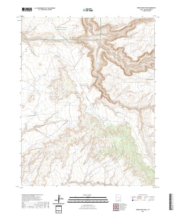
2023 Indian Head Pass
San Juan County, UT
2023 Jacobs Chair
San Juan County, UT
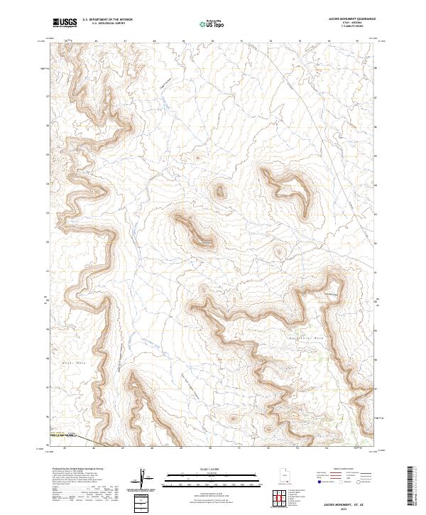
2023 Jacobs Monument
San Juan County, UT
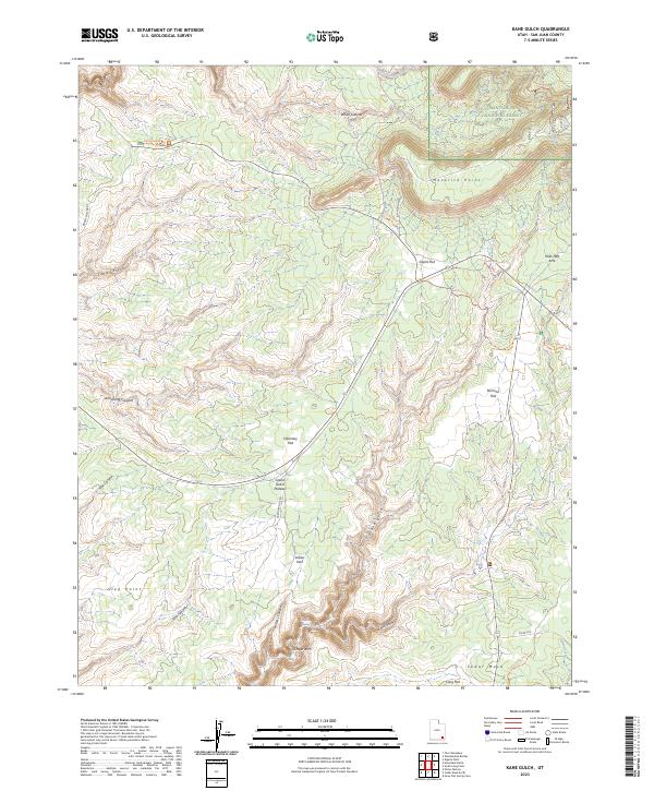
2023 Kane Gulch
San Juan County, UT
2023 Kane Springs
San Juan County, UT
2023 Kigalia Point
San Juan County, UT
2023 Knowles Canyon
San Juan County, UT
2023 La Sal East
San Juan County, UT
2023 La Sal Junction
San Juan County, UT
2023 La Sal West
San Juan County, UT
2023 Lisbon Gap
San Juan County, UT
2023 Lisbon Valley
San Juan County, UT
2023 Lockhart Basin
San Juan County, UT
2023 Mancos Jim Butte
San Juan County, UT
2023 Mancos Mesa NE
San Juan County, UT
2023 Mancos Mesa
San Juan County, UT
2023 McCracken Spring
San Juan County, UT
2023 Mexican Hat SE
San Juan County, UT
2023 Mexican Hat SW
San Juan County, UT
2023 Mikes Mesa
San Juan County, UT
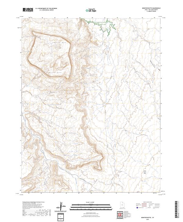
2023 Monitor Butte
San Juan County, UT
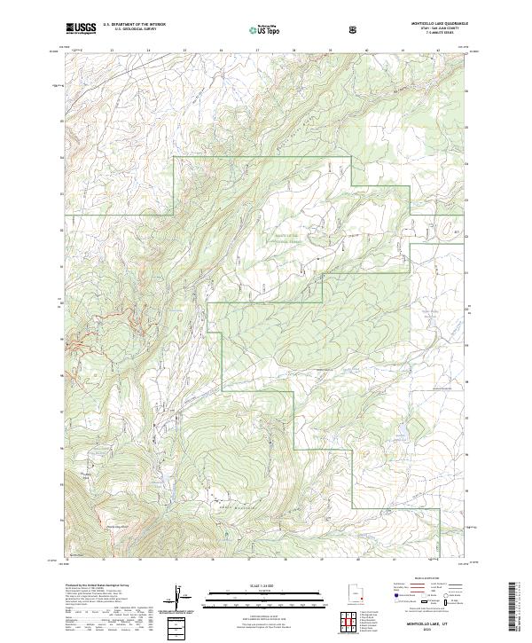
2023 Monticello Lake
San Juan County, UT
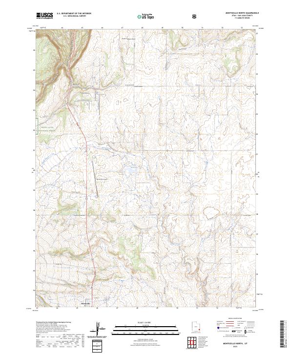
2023 Monticello North
San Juan County, UT
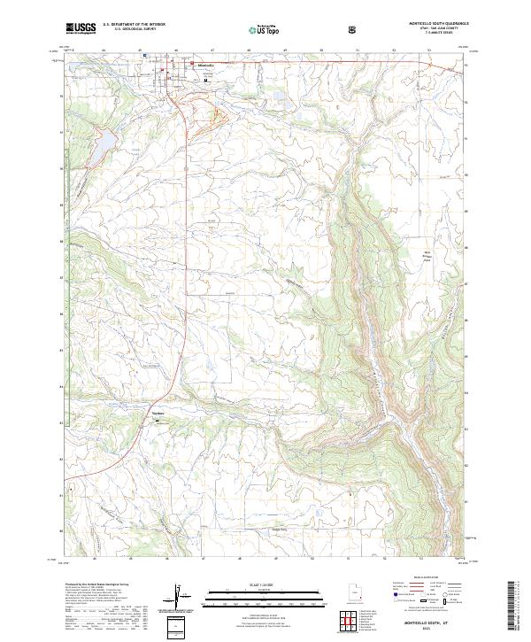
2023 Monticello South
San Juan County, UT
2023 Monument Basin
San Juan County, UT
2023 Monument Pass
San Juan County, UT
2023 Moses Rock
San Juan County, UT
2023 Moss Back Butte
San Juan County, UT
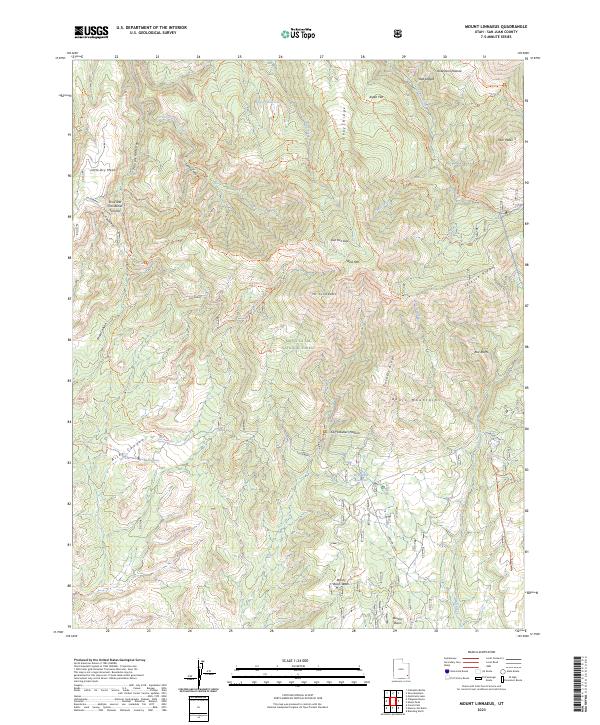
2023 Mount Linnaeus
San Juan County, UT
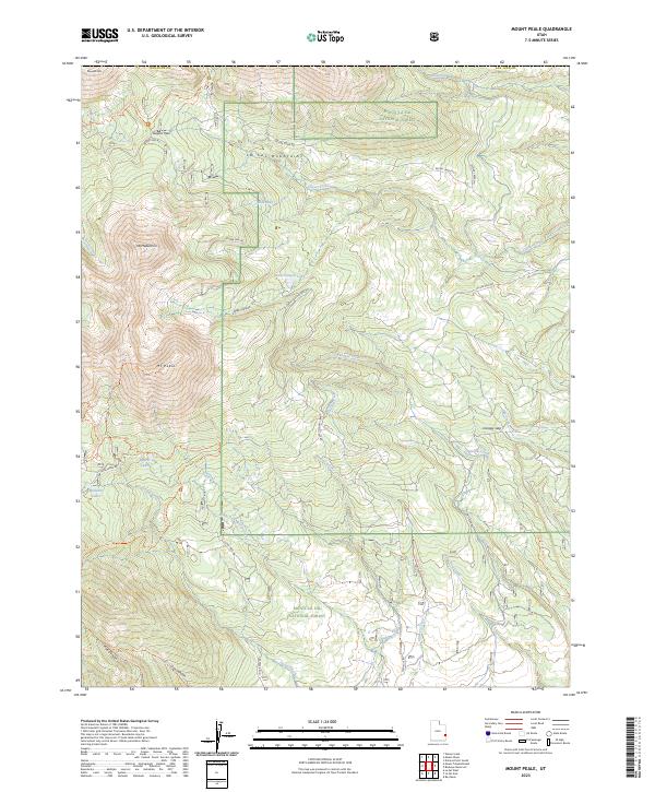
2023 Mount Peale
San Juan County, UT
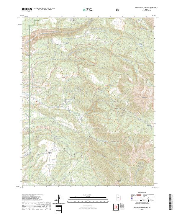
2023 Mount Tukuhnikivatz
San Juan County, UT
2023 Musselman Arch
San Juan County, UT
2023 Navajo Begay
San Juan County, UT
2023 Navajo Canyon
San Juan County, UT
2023 Nokai Dome
San Juan County, UT
2023 No-Mans Island
San Juan County, UT
2023 No Mans Mesa North
San Juan County, UT
2023 No Mans Mesa South
San Juan County, UT
2023 North Six-shooter Peak
San Juan County, UT
2023 Oljato NE
San Juan County, UT
2023 Oljato
San Juan County, UT
2023 Papoose Canyon
San Juan County, UT
2023 Peters Nipple
San Juan County, UT
2023 Photograph Gap
San Juan County, UT
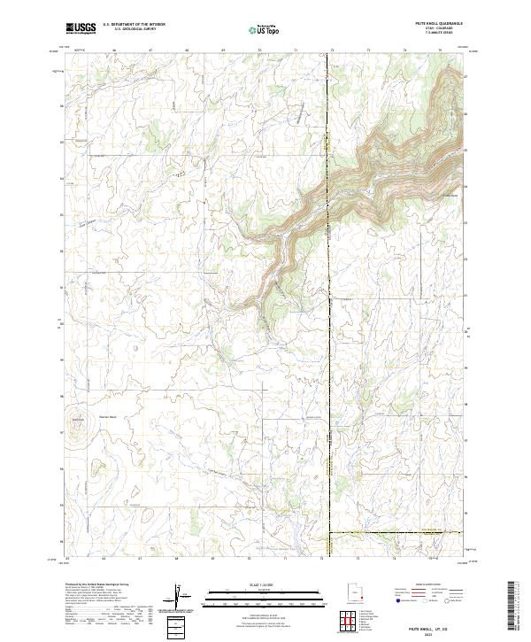
2023 Piute Knoll
San Juan County, UT
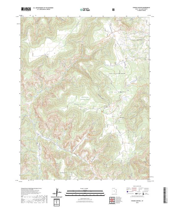
2023 Poison Canyon
San Juan County, UT
2023 Pollys Pasture
San Juan County, UT
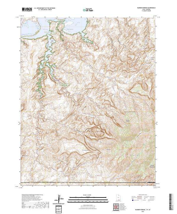
2023 Rainbow Bridge
San Juan County, UT
2023 Ray Mesa
San Juan County, UT
2023 Recapture Pocket
San Juan County, UT
2023 Red House Spring
San Juan County, UT
2023 Ruin Point
San Juan County, UT
2023 Sandstone Draw
San Juan County, UT
2023 San Juan Hill
San Juan County, UT
2023 Shafer Basin
San Juan County, UT
2023 Shay Mountain
San Juan County, UT
2023 Slickhorn Canyon East
San Juan County, UT
2023 Slickhorn Canyon West
San Juan County, UT
2023 Snow Flat Spring Cave
San Juan County, UT
2023 Sop Canyon
San Juan County, UT
2023 South Long Point
San Juan County, UT
2023 South Six-shooter Peak
San Juan County, UT
2023 Summit Point
San Juan County, UT
2023 The Cheesebox
San Juan County, UT
2023 The Goosenecks
San Juan County, UT
2023 The Loop
San Juan County, UT
2023 The Rincon
San Juan County, UT
2023 Trough Springs Canyon
San Juan County, UT
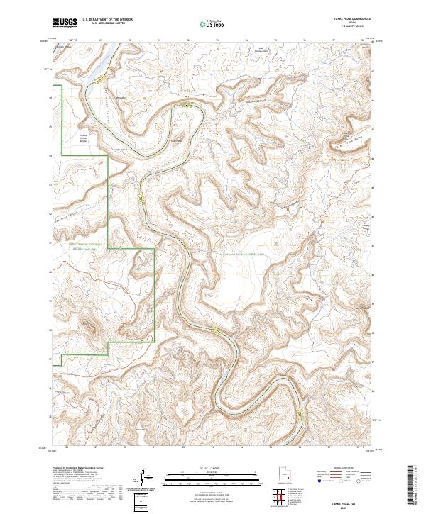
2023 Turks Head
San Juan County, UT
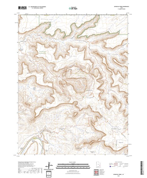
2023 Upheaval Dome
San Juan County, UT
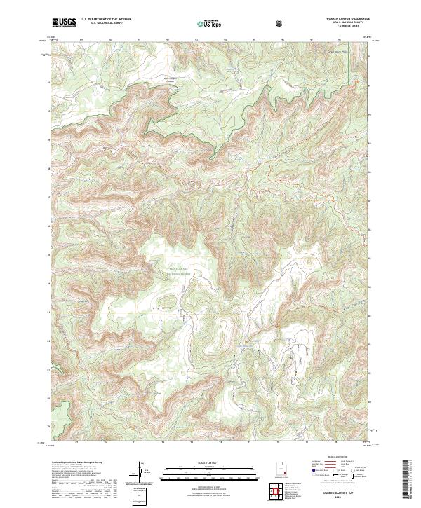
2023 Warren Canyon
San Juan County, UT
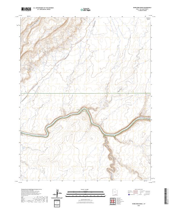
2023 Whirlwind Draw
San Juan County, UT
2023 White Mesa Village
San Juan County, UT
2023 White Mesa Village SE
San Juan County, UT
2023 White Rock Point
San Juan County, UT
2023 Wickiup Canyon
San Juan County, UT
2023 Wilson Creek
San Juan County, UT
2023 Woodenshoe Buttes
San Juan County, UT
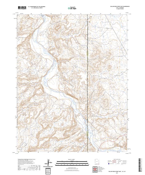
2023 Yellow Rock Point East
San Juan County, UT
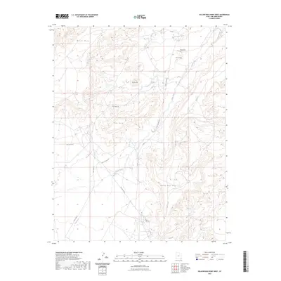
2023 Yellow Rock Point West
San Juan County, UT