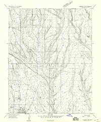
1959 Map of Verdure 3 NW
USGS Topo · Published 1959About this map
The community of Blanding anchors the southwestern corner of this survey, situated on the edge of White Mesa during a period of steady growth in San Juan County. The town grid includes the local High Sch and nearby Hogans, highlighting the area's rural social infrastructure in the late 1950s. Agriculture and water management are central to the landscape, evidenced by a Canal, various reservoirs, and the L-C Ranch located along the drainage of Recapture Creek.
Find a feature on this map
26 named features on this map. Tap any name to fly to it.
Don’t see what you’re looking for? This feature index may not catch every label — zoom into the map to look around manually.
Map Details
Editions of this 1959 Verdure 3 NW Map
This is the sole edition of this map. No revisions or reprints were ever made.
Other maps of this area

1886 · Abajo
USGS Topo · 1:250,000

1892 · Abajo
USGS Topo · 1:250,000

1893 · Abajo
USGS Topo · 1:250,000

1935 · Elk Ridge
USGS Topo · 1:96,000

1940 · Elk Ridge
USGS Topo · 1:125,000

1954 · Elk Ridge 1 SE
USGS Topo · 1:24,000
1954 · Mt Linnaeus
USGS Topo · 1:62,500

1955 · Verdure 2 SE
USGS Topo · 1:24,000

1955 · Verdure 3 SE
USGS Topo · 1:24,000

1955 · Verdure 3 NE
USGS Topo · 1:24,000