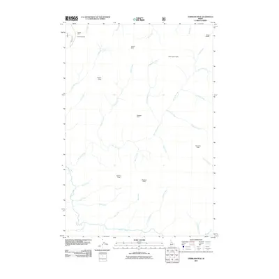
2011 Map of Vermilion Peak
USGS Topo · Published 2011About this map
Indian Hill Lookout stands as a primary landmark in this drainage-heavy landscape of Idaho County, marking a high point at the terminus of Indian Hill Rd. The terrain is defined by a dense network of high-elevation ridges and watercourses, including the notable Copper Ridge and prominent summits such as Vermilion Peak and Copper Butte. This 2011 survey documents a wilderness environment where numerous named creeks, such as No Business Creek, Disgrace Creek, and Buck Lake Creek, carve through the landscape between named vantage points like Prospect Point and Sparrow Point. The mapping shows the intricate relationship between high saddles, like Drake Saddle, and the headwaters of the regional stream system, providing a precise record of the area's complex topography before any modern infrastructure development beyond the single forest access road.
Find a feature on this map
34 named features on this map. Tap any name to fly to it.
Don’t see what you’re looking for? This feature index may not catch every label — zoom into the map to look around manually.
Map Details
Editions of this 2011 Vermilion Peak Map
This is the sole edition of this map. No revisions or reprints were ever made.
Other maps of this area

1911 · Lolo
USGS Topo · 1:250,000

1913 · Lolo
USGS Topo · 1:250,000

1956 · Elk City
USGS Topo · 1:250,000

1956 · Hamilton
USGS Topo · 1:250,000

1959 · Hamilton
USGS Topo · 1:250,000

1960 · Elk City
USGS Topo · 1:250,000

1960 · Hamilton
USGS Topo · 1:250,000

1964 · Hamilton
USGS Topo · 1:250,000

1966 · Selway Falls
USGS Topo · 1:24,000

1966 · Green Mtn.
USGS Topo · 1:24,000