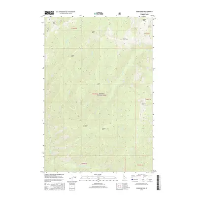
2017 Map of Vermilion Peak
USGS Topo · Published 2017About this map
Nez Perce National Forest dominates this interior Idaho landscape, defined by a series of prominent peaks and high ridges that separate various drainage basins. The area is anchored by Vermilion Peak in the east and Copper Butte in the north, with Prospect Point rising centrally between the winding courses of Copper Cr and Little Copper Cr. Access to these remote elevations is marked primarily by Indian Hill Rd in the northwest corner near Indian Hill.
Find a feature on this map
41 named features on this map. Tap any name to fly to it.
Don’t see what you’re looking for? This feature index may not catch every label — zoom into the map to look around manually.
Map Details
Editions of this 2017 Vermilion Peak Map
This is the sole edition of this map. No revisions or reprints were ever made.
Other maps of this area

1911 · Lolo
USGS Topo · 1:250,000

1913 · Lolo
USGS Topo · 1:250,000

1956 · Elk City
USGS Topo · 1:250,000

1956 · Hamilton
USGS Topo · 1:250,000

1959 · Hamilton
USGS Topo · 1:250,000

1960 · Elk City
USGS Topo · 1:250,000

1960 · Hamilton
USGS Topo · 1:250,000

1964 · Hamilton
USGS Topo · 1:250,000

1966 · Selway Falls
USGS Topo · 1:24,000

1966 · Green Mtn.
USGS Topo · 1:24,000