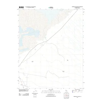
2012 Map of Vermillion Canyon
USGS Topo · Published 2012About this map
Olancha Dunes and the dramatic geological depression of Vermillion Canyon define this arid landscape in Inyo County. Located along the southwestern edge of a vast dry lake bed, the area features the distinctive Dirty Socks Spring, a notable water source in a region otherwise dominated by seasonal washes and desert sands. Settlement is sparse, anchored by the small community of Grant in the southwest corner near Cactus Flats Rd. This 2012 survey illustrates the relationship between the few persistent water sources and the shifting terrain of the Eastern Sierra foothills, where the elevated heights of Red Ridge transition into the expansive flats of the basin floor.
Find a feature on this map
6 named features on this map. Tap any name to fly to it.
Don’t see what you’re looking for? This feature index may not catch every label — zoom into the map to look around manually.
Map Details
Editions of this 2012 Vermillion Canyon Map
This is the sole edition of this map. No revisions or reprints were ever made.
Other maps of this area

1905 · Olancha
USGS Topo · 1:125,000

1907 · Olancha
USGS Topo · 1:125,000

1908 · Ballarat
USGS Topo · 1:250,000

1913 · Ballarat
USGS Topo · 1:250,000

1948 · Death Valley
USGS Topo · 1:250,000

1948 · Fresno
USGS Topo · 1:250,000

1951 · Keeler
USGS Topo · 1:62,500

1951 · Haiwee Reservoir
USGS Topo · 1:62,500

1954 · Death Valley
USGS Topo · 1:250,000

1955 · Fresno
USGS Topo · 1:250,000