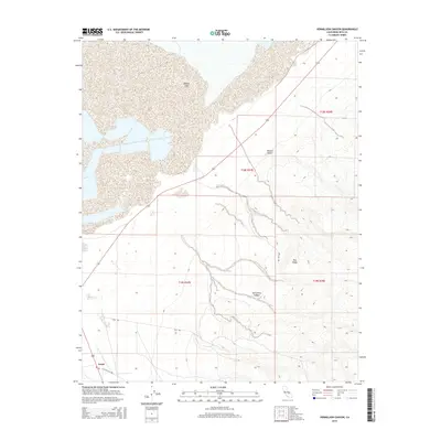
2015 Map of Vermillion Canyon
USGS Topo · Published 2015About this map
Owens Lake and the northern reaches of the Mojave Desert define this arid landscape near the eastern Sierras. The map illustrates the hydrological complexity of the region, featuring the mineral-rich waters of Dirty Socks Spring and the drainage patterns leading into the lake bed. Local topography is sharply defined by Red Ridge and the winding course of Vermillion Canyon, providing a clear record of the area's geological relief. Human activity is concentrated along the western edge, where the settlement of Grant sits near a network of desert routes including Fall Rd and Cactus Flats Rd. This survey serves as a vital record for understanding the environmental shifts and sparse infrastructure of the Owens Valley corridor in the early 21st century.
Find a feature on this map
13 named features on this map. Tap any name to fly to it.
Don’t see what you’re looking for? This feature index may not catch every label — zoom into the map to look around manually.
Map Details
Editions of this 2015 Vermillion Canyon Map
This is the sole edition of this map. No revisions or reprints were ever made.
Other maps of this area

1905 · Olancha
USGS Topo · 1:125,000

1907 · Olancha
USGS Topo · 1:125,000

1908 · Ballarat
USGS Topo · 1:250,000

1913 · Ballarat
USGS Topo · 1:250,000

1948 · Death Valley
USGS Topo · 1:250,000

1948 · Fresno
USGS Topo · 1:250,000

1951 · Keeler
USGS Topo · 1:62,500

1951 · Haiwee Reservoir
USGS Topo · 1:62,500

1954 · Death Valley
USGS Topo · 1:250,000

1955 · Fresno
USGS Topo · 1:250,000